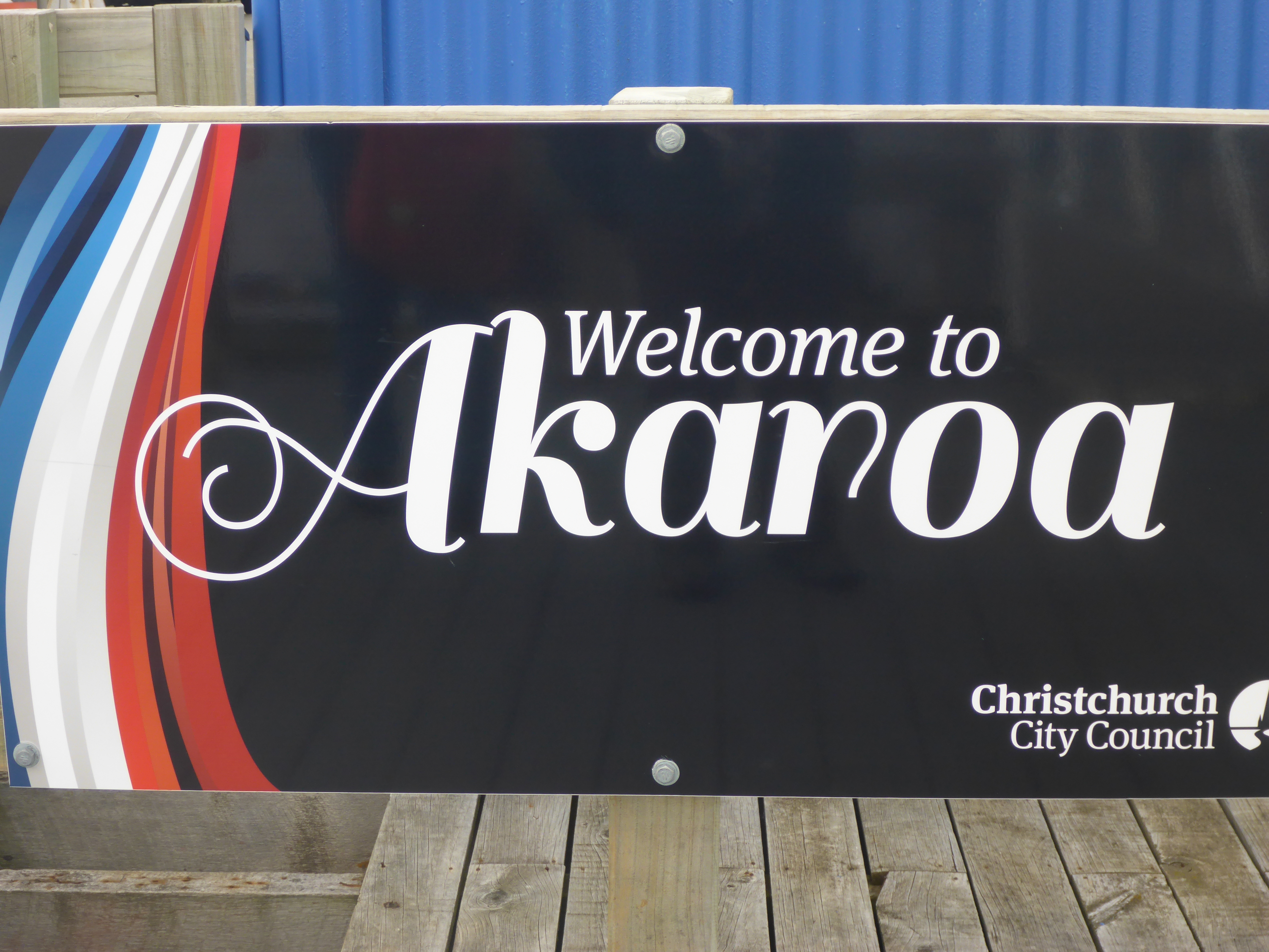
We left Mount Cooke on March 16 for the four and a half hour drive to Akaroa which stands on Banks Peninsula about 80km from Christchurch. The peninsula was formed by two giant volcanic eruptions eight million years ago. Its full of lots of bays and the drive along what is known as the Summit Road is quite spectacular.
The area around Banks Peninsula is home to a rare species of dolphin, called Hector’s dolphin, found only around New Zealand and of course boat trips are available to spot these, penguins, whales and orcas.
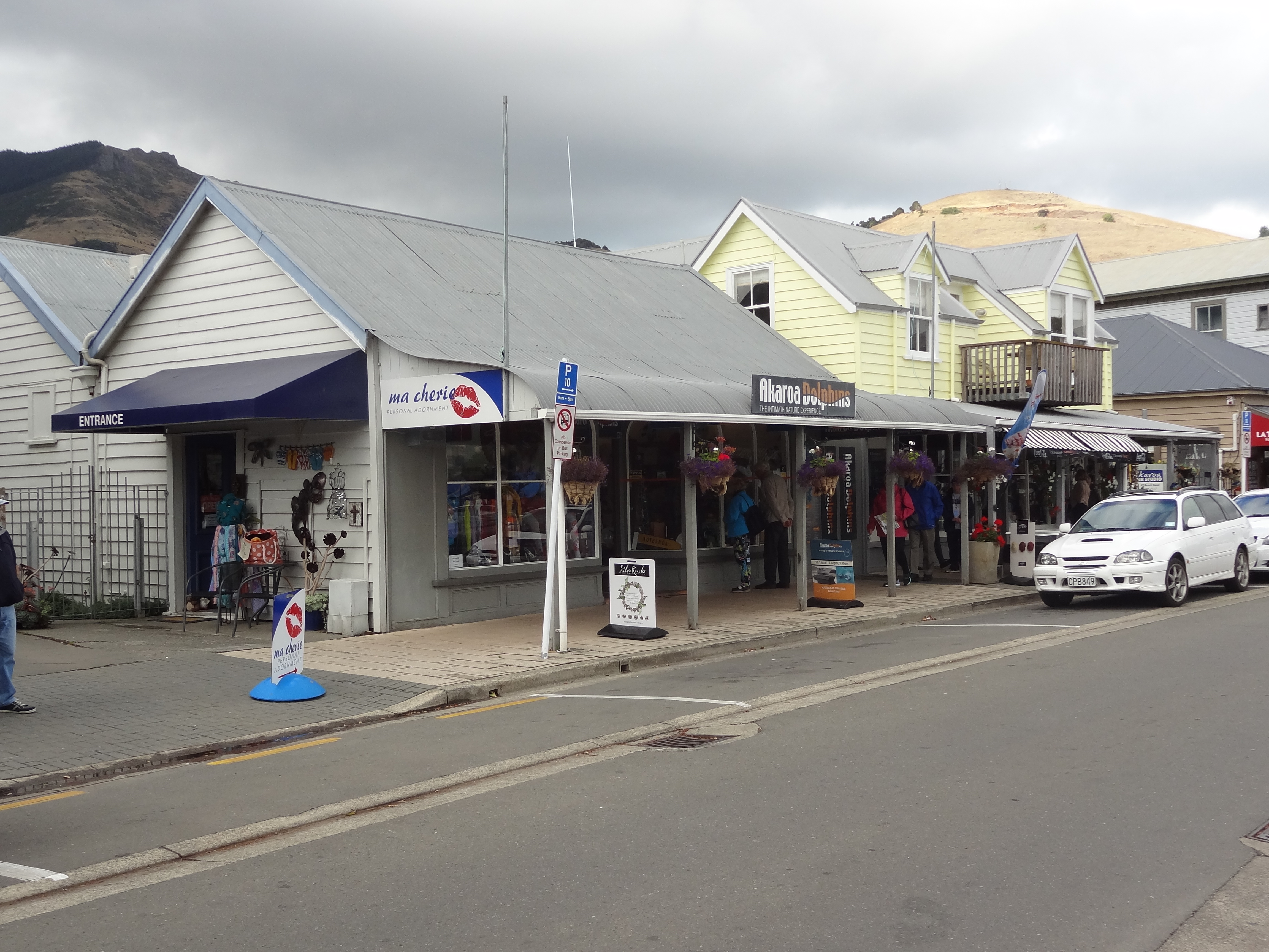
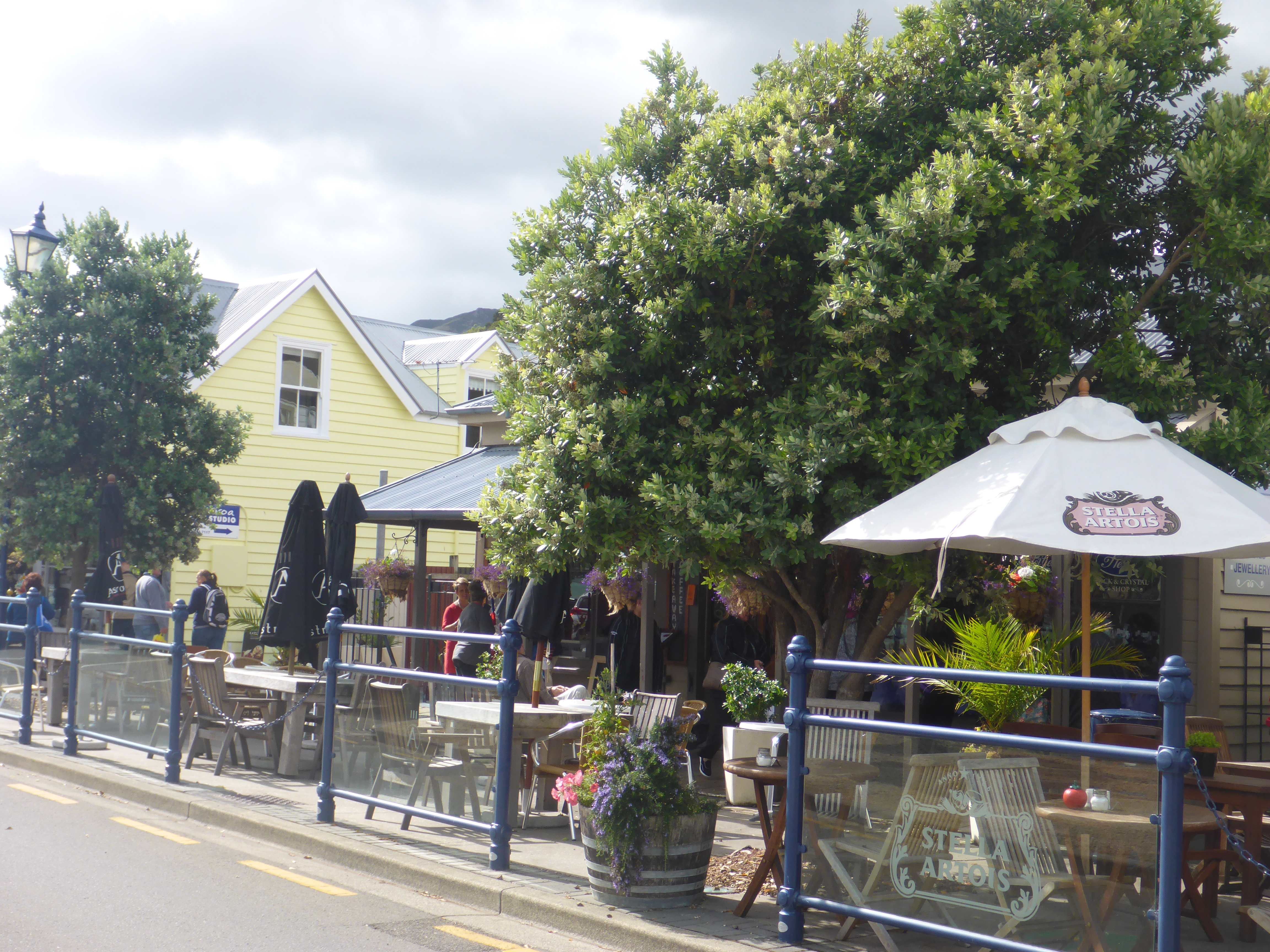
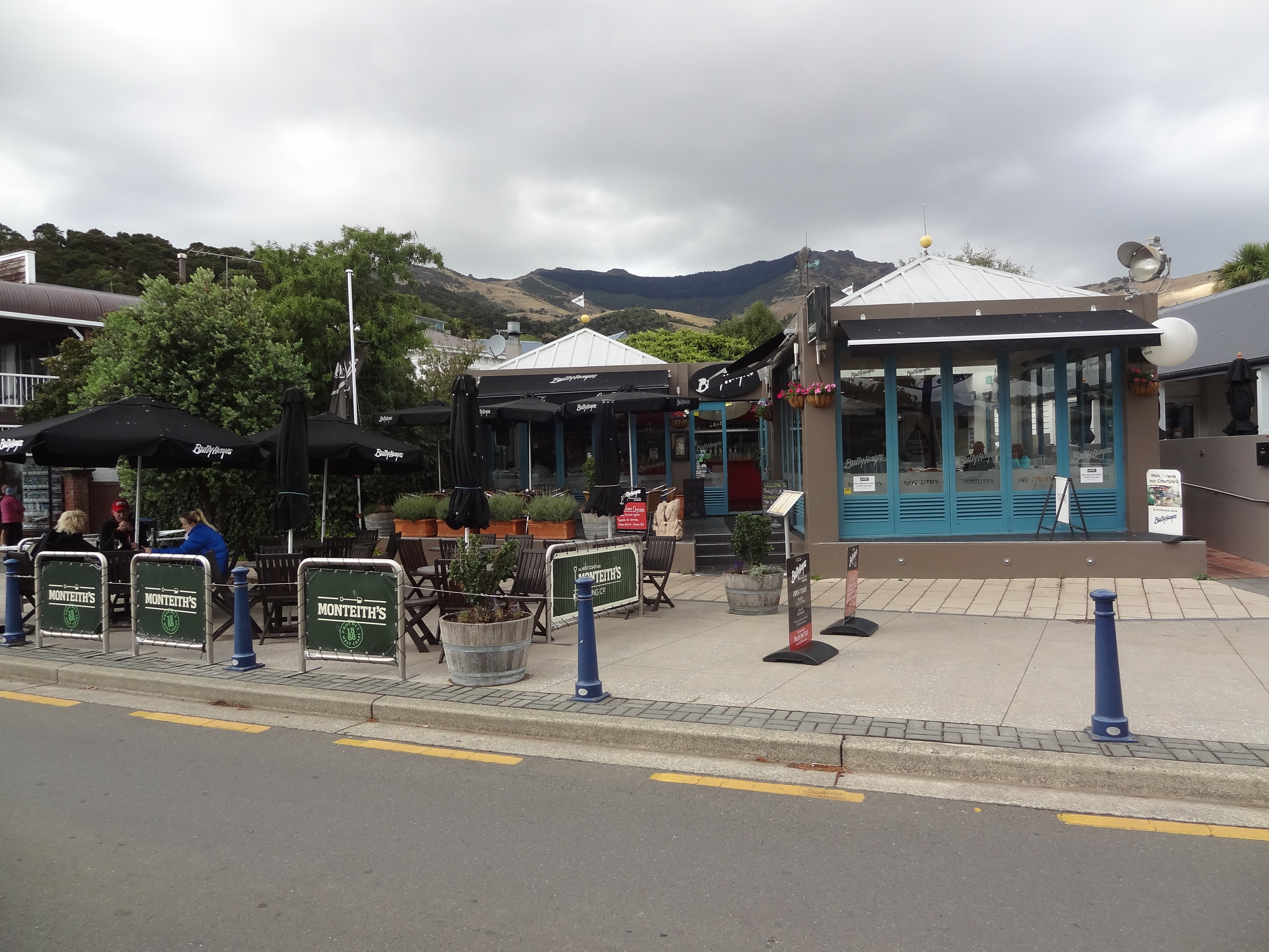
Ma cherie, one of many shops with a French nameWaterfront watering hole at Akaroa
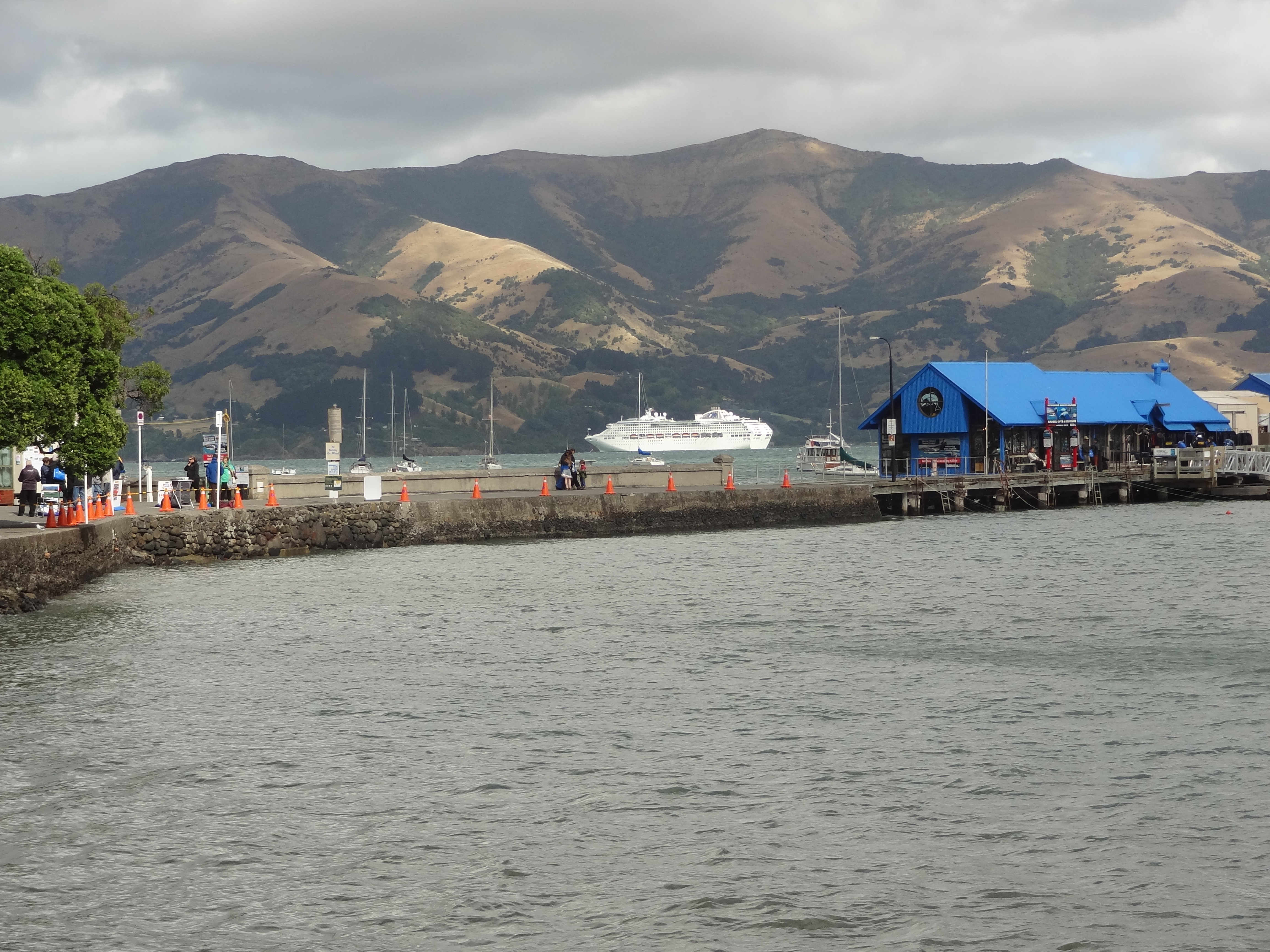
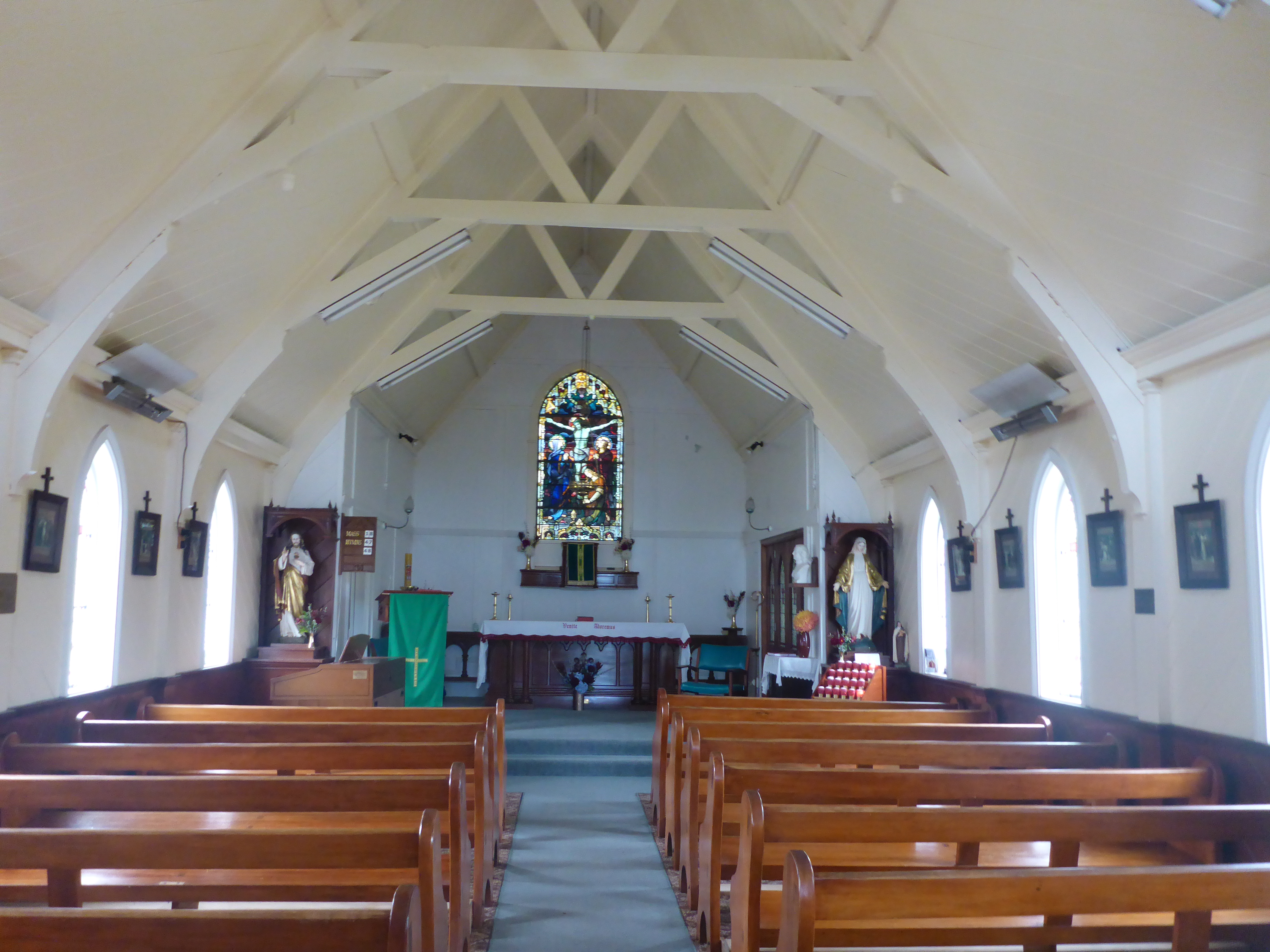
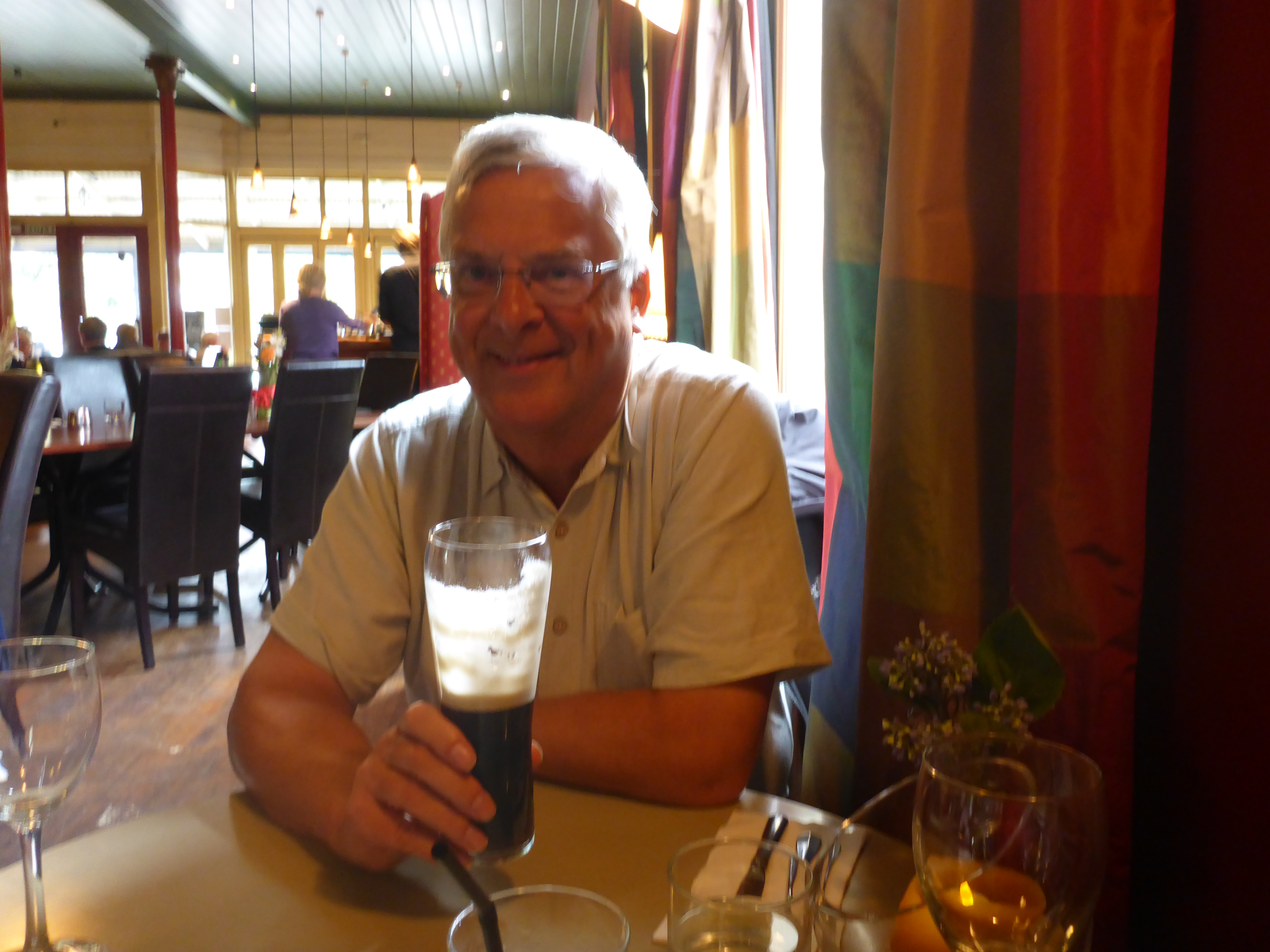
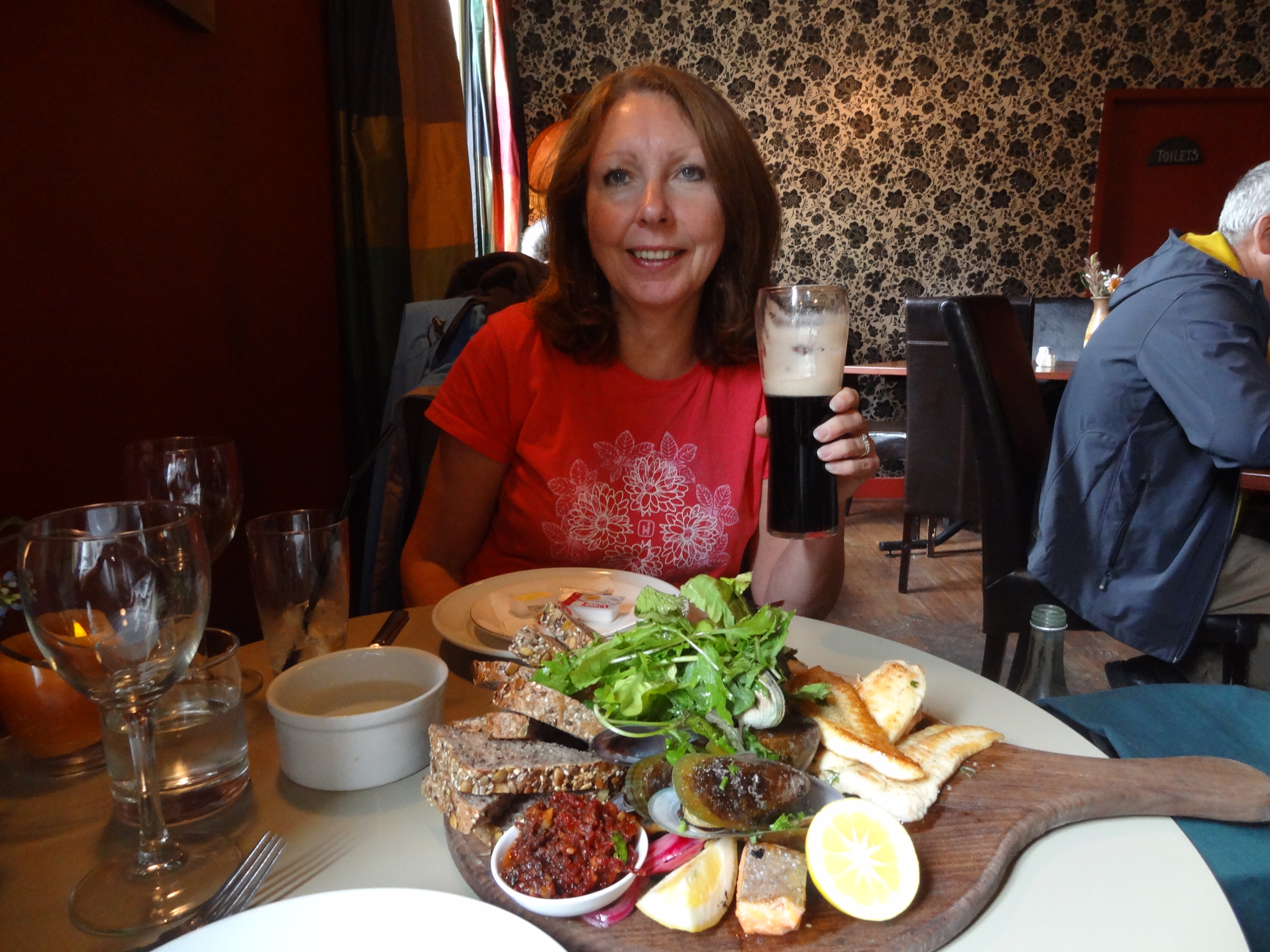
Waterfront watering hole at AkaroaAkaroa Harbour with the cruise ship Dawn Princess docked under angry skiesSt Patrick’s Church on St Patrick’s DaWe missed Mass but did get a peek insideAnd since it was Paddy’s Day, it would have been rude not to try the Guinessand a fish platter..One of Akaroa’s many nice restaurants
We left our Omarama motel room sometime after 9.00 to drive the ninety or so kilometres to Aoraki Mt Cook. The next couple of days was all walking and we really needed decent weather but the morning was dull with rain threatening and we feared the worst.
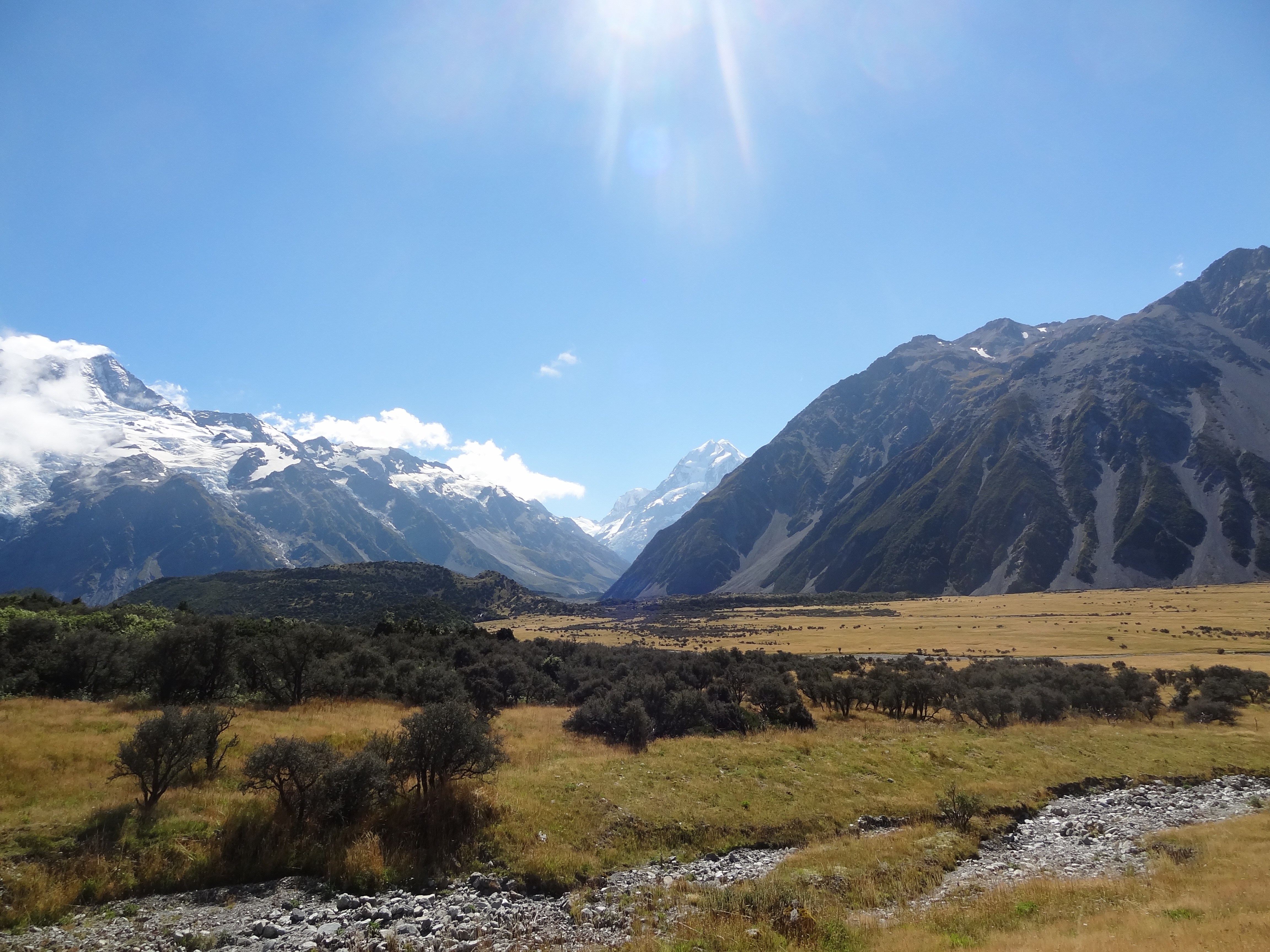
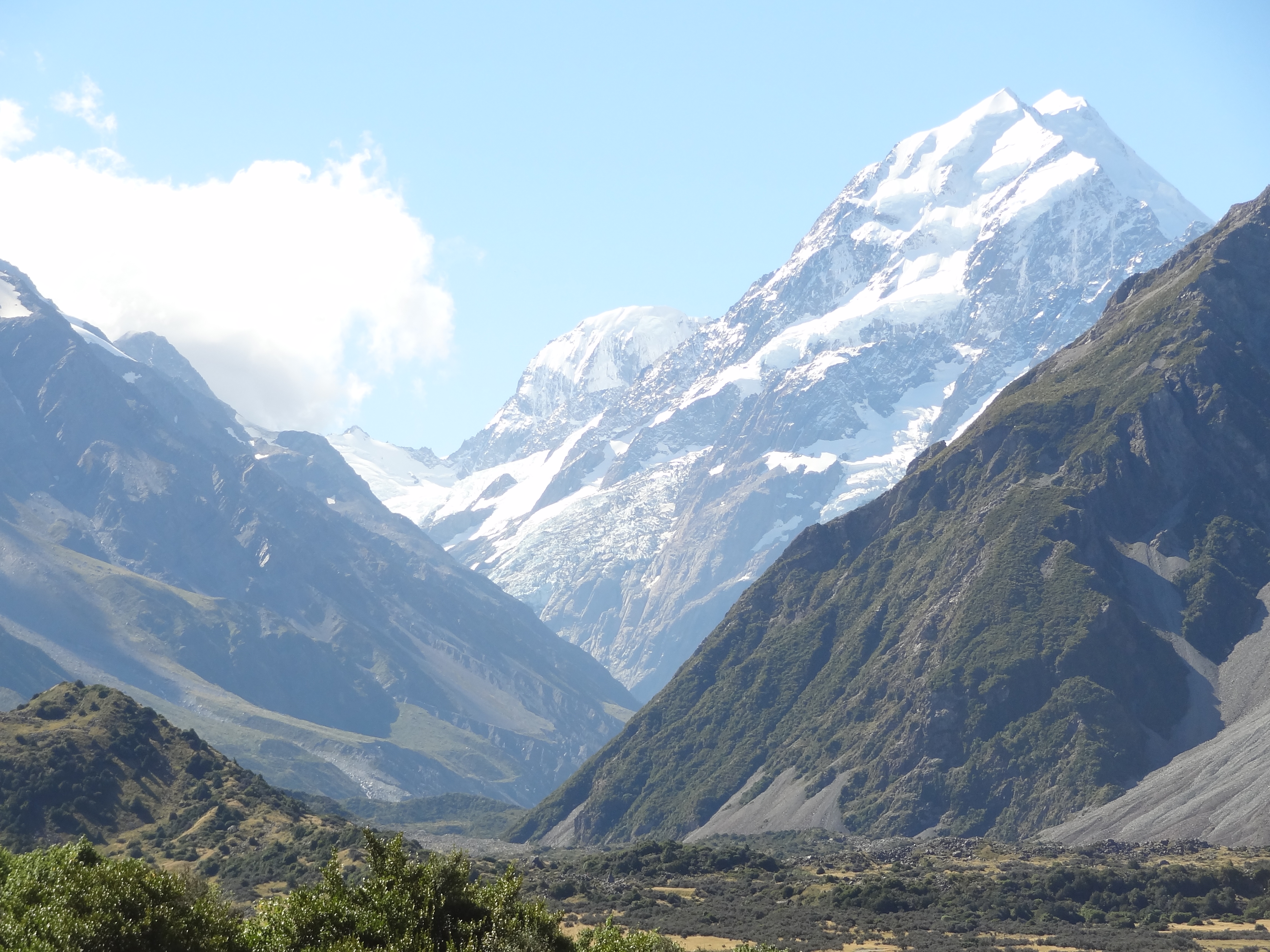
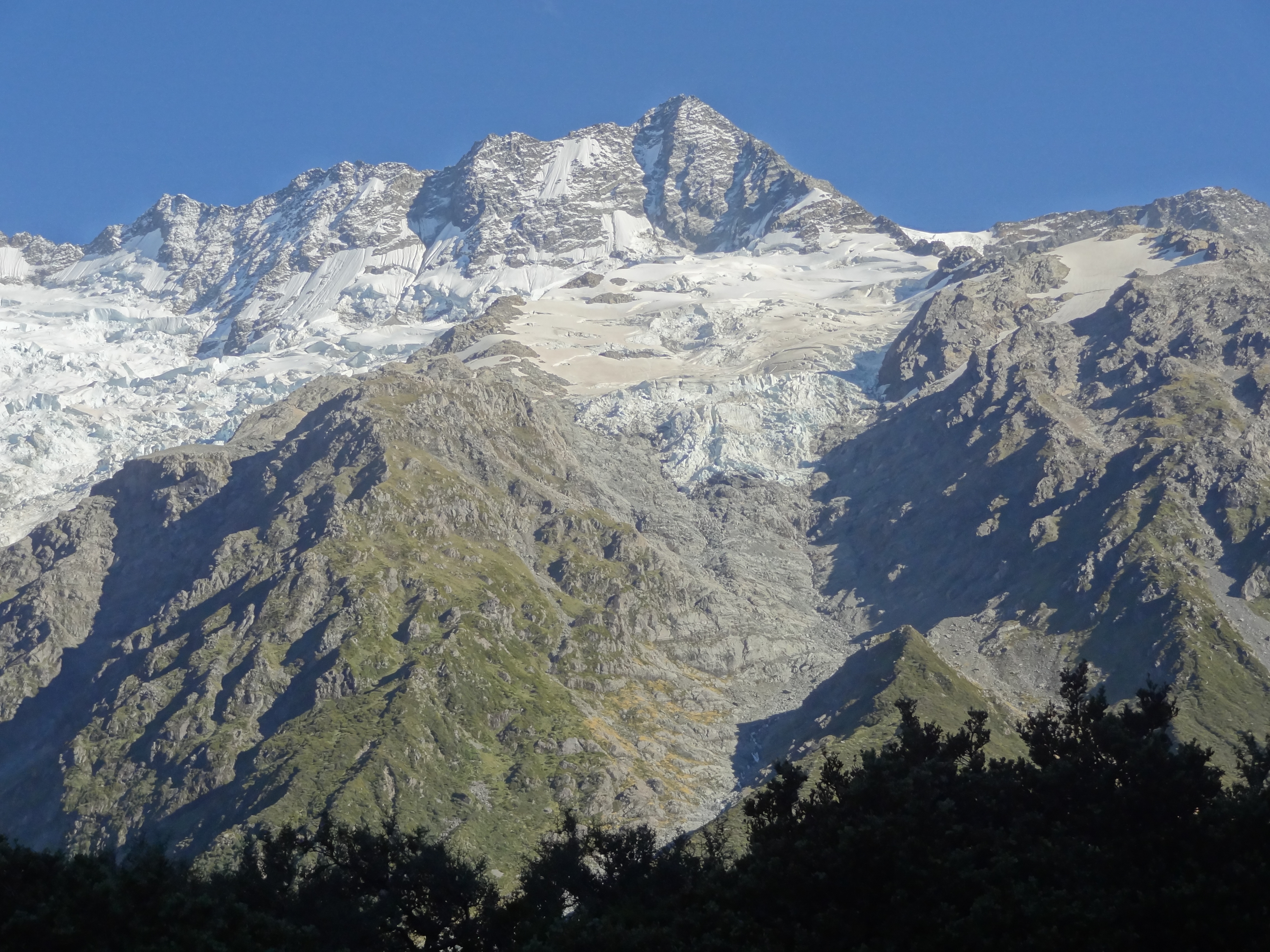
Aoraki Mount Cook is the highest mountain in New Zealand lying in the Southern Alps which is the mountain range which runs the length of South Island. It consists of three peaks known as Low Peak, Middle Peak and High Peak with the Tasman Glacier to the east and the Hooker Glacier to the west.
The Mountain is obviously steeped in climbing history having been first conquered by a group of New Zealand Mountaineers Fyfe, Graham and Clark in 1894 when they made the ascent at fairly short notice once they learned that an English climber, Edward Fitzgerald was on his way to claim the prize. Fitzgerald was piqued to learn he had been beaten to it and refused to make an attempt. Instead he climbed other nearby peaks with his swiss Guide Matthias Zurbriggen who himself went on to make the first solo climb of Aoraki Mount Cook in 1895.
Aoraki Mt Cook came to be known by this name in 1998 when the Maori name Aoraki was added to the name given by the Europeans. All very politically correct but its a bit of a mouthful and from here on I shall refer to it as AMC!
The roads were quiet as always in New Zealand and making good time, we made a small diversion off the main highway to take a look at Twizel about half way en route. In our research about this trip, Twizel didn’t strike us as being a must see place; rather one of those places that it might be necessary to call into for provisions or overnight accommodation en route to somewhere else, but we were in time so decided to have a shufty.
Twizel is a new town built in 1968 to house construction workers who were building the Upper Waitaki Hydroelectric Scheme. This massive scheme consists of 50km of canals, two dams and four powerhouses and at the peak of the project in the 1970’s the town had a population of around 6,000.
As the intention had been that the town would be “de-constructed” and revert to farmland on completion of the Scheme, many of the buildings and much of the infra-structure was and still is built on a “temporary ” basis. For example, many of the buildings are prefabricated and all power services, cables etc are overhead rather than buried. In the event many of the families who had settled here during the Project decided to settle there and there is now a resident population of around 1200 which grows significantly in the tourist season. The town itself isn’t particularly attractive given its temporary nature but the surroundings comprise wonderful mountain, lake and river landscapes.
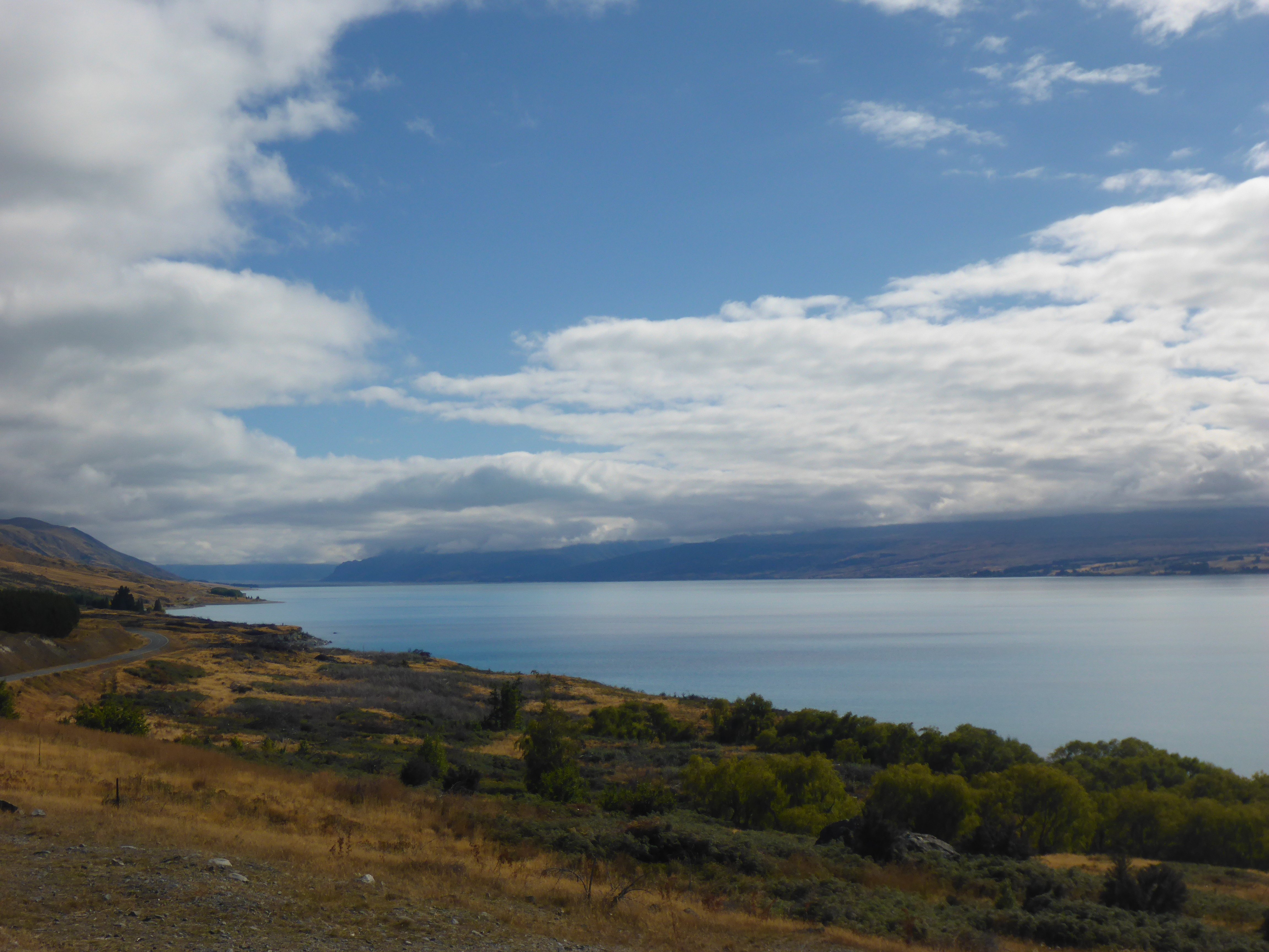
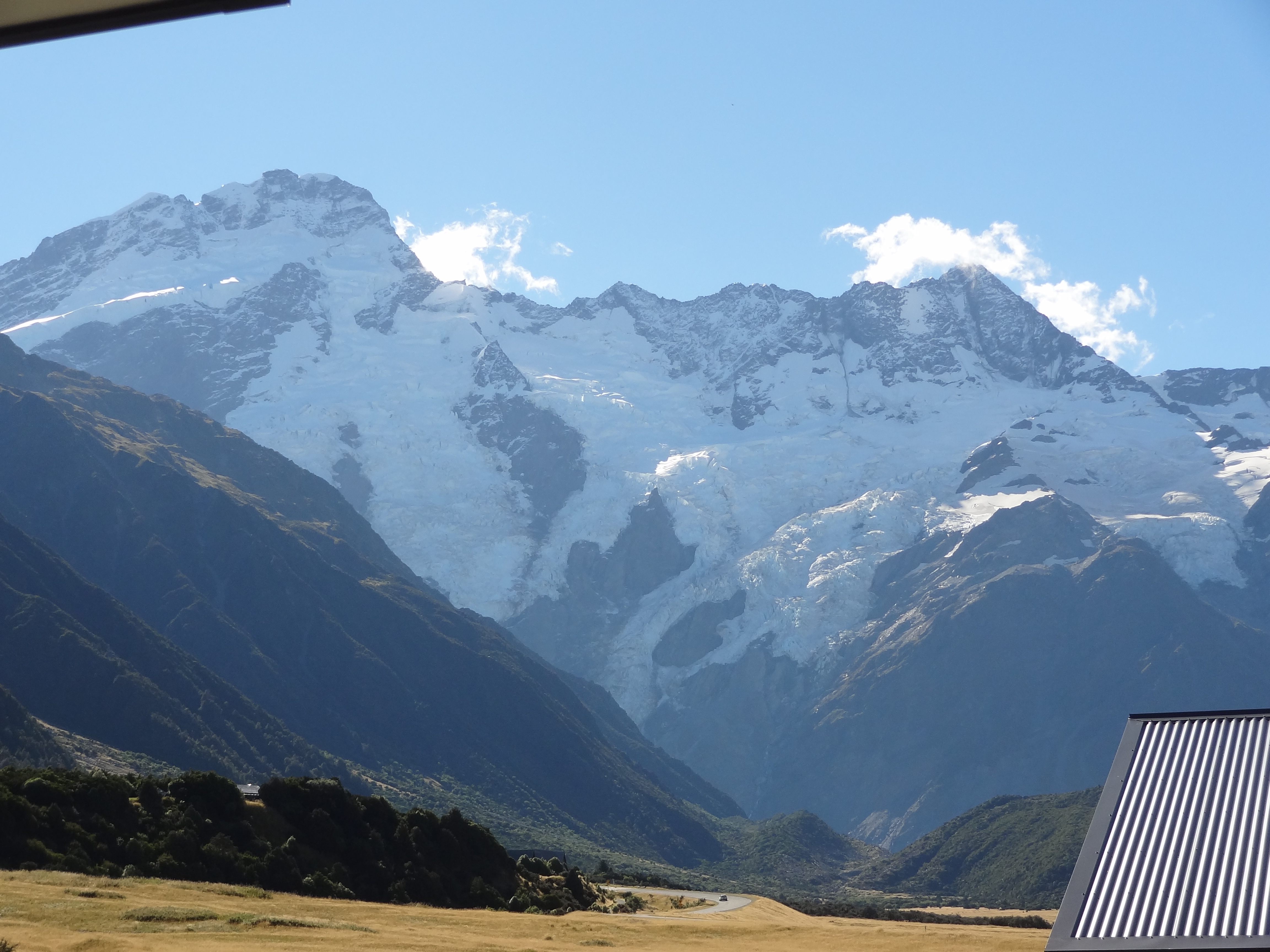
As we neared AMC, we stopped briefly at Peter’s Lookout on the shore line of Lake Pukaki to get a better view of the Mountain and happily we found that the weather ahead appeared to be clearing although the Mountain itself ws still shrouded in cloud.
Lake Pukaki from Peter’s Lookout, approaching Aoraki Mt Cook.The weather appeared to be clearing up, thankfully
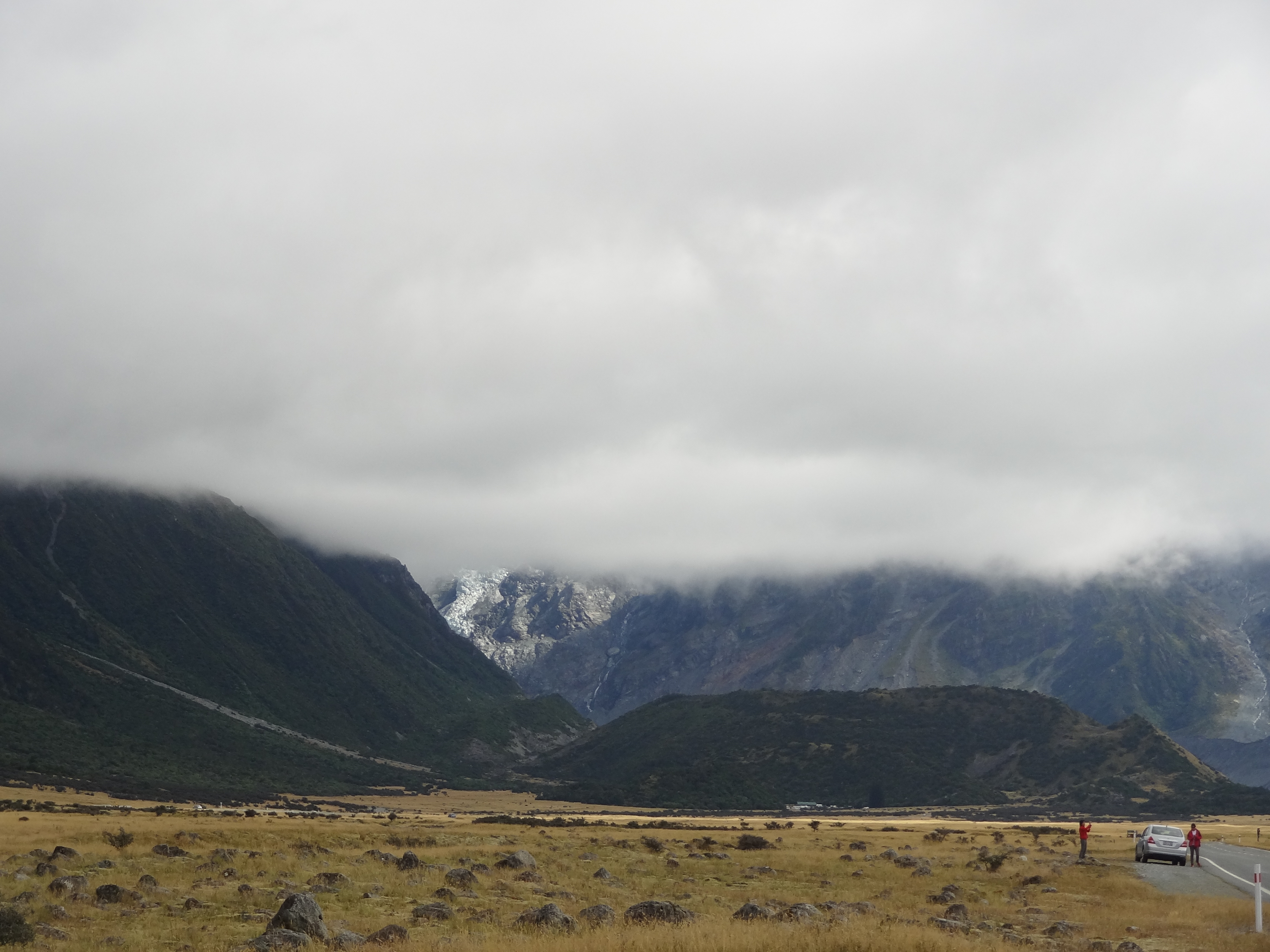
However, the view below was our first view of the Mountain itself as we approached the village. Not exactly promising but miraculously most of this cloud cleared as the day went by.
Our first view of Mt Cook – it didn’t look promising !
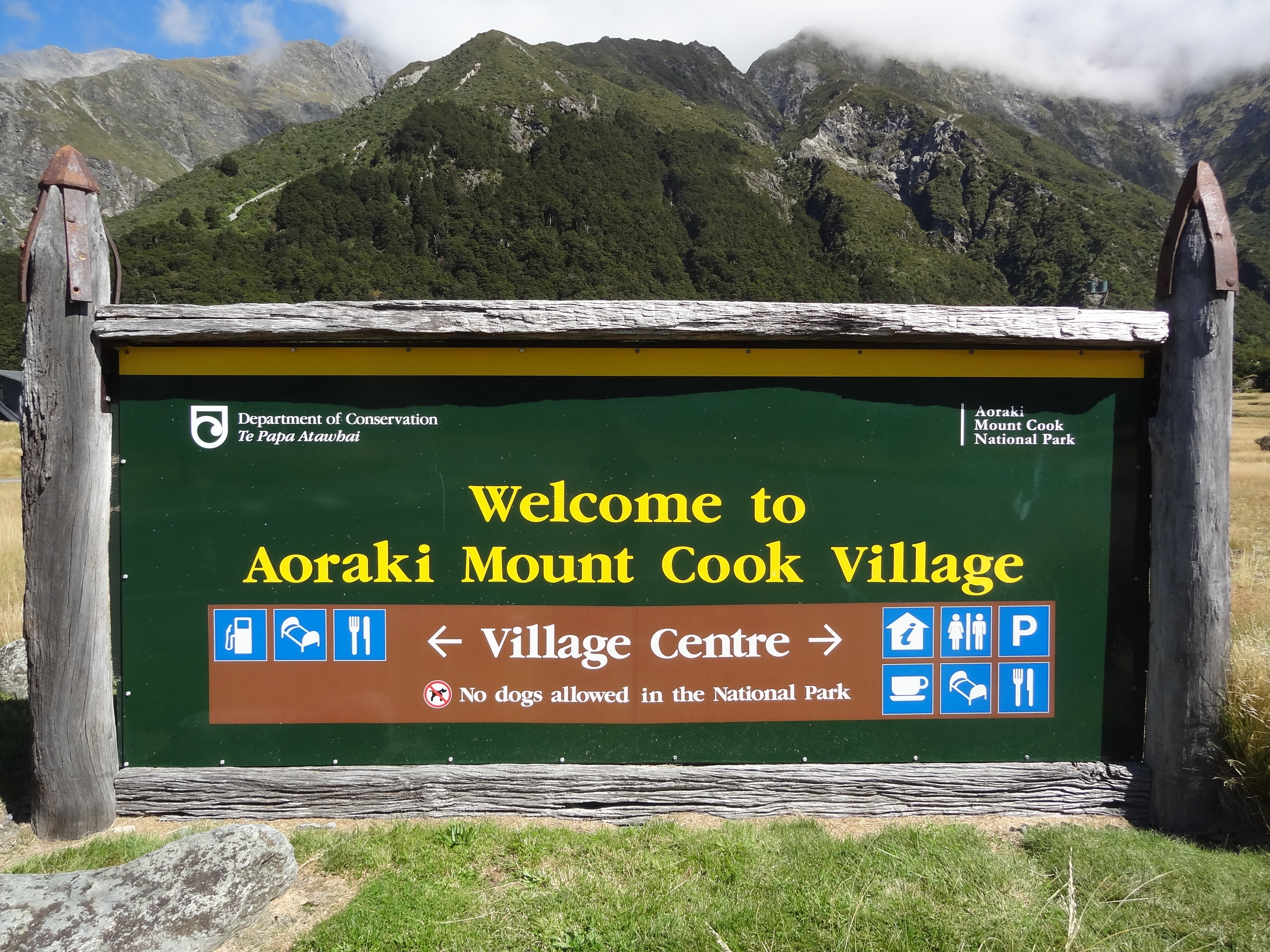
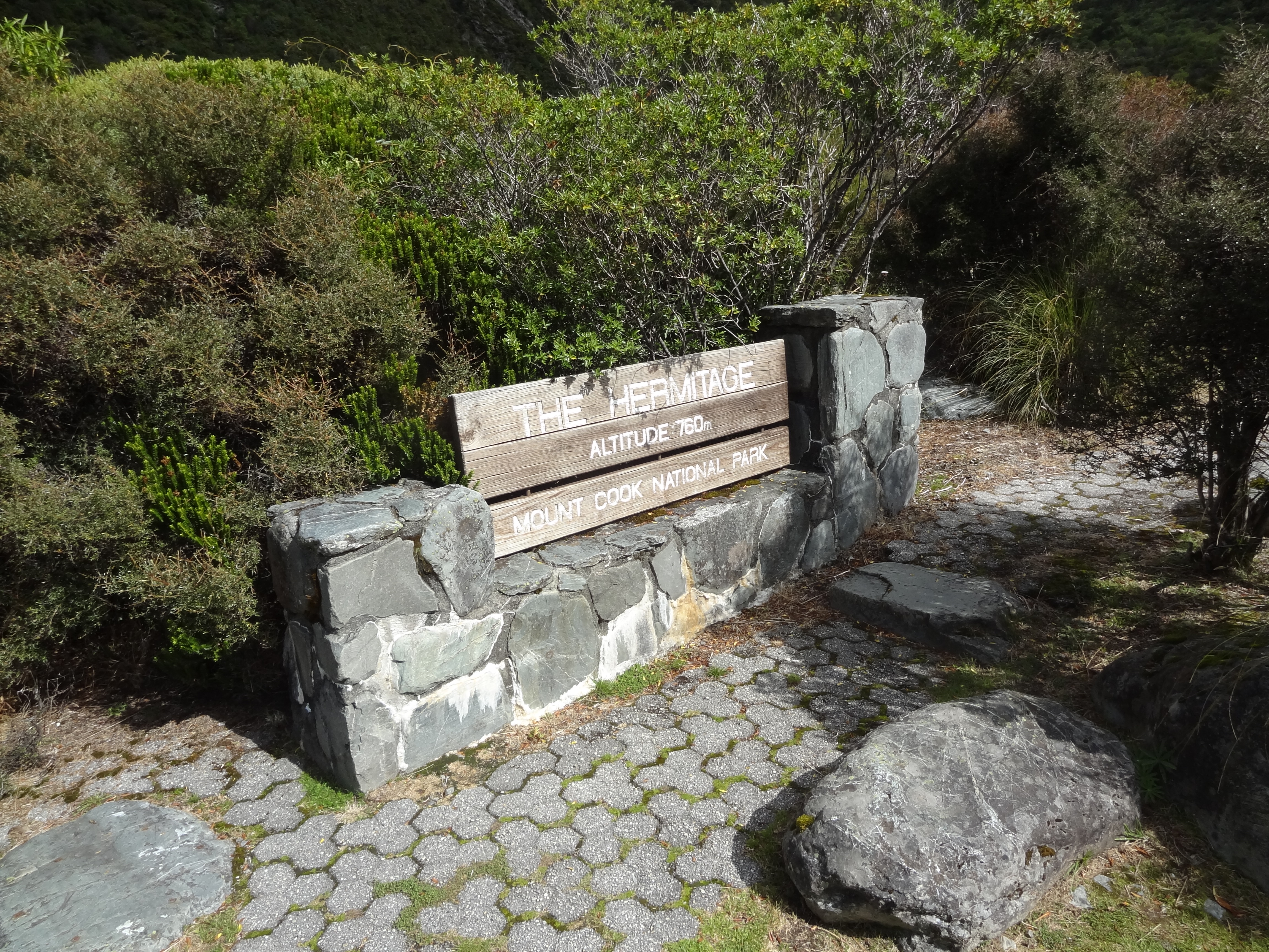
We finally arrived at AMC Village around 11.00 am. The sign below pointing out facilities in the village centre is perhaps a tad mis-leading as it might suggest a village somewhat larger than the reality. Apart from the Hermitage Hotel and a handful of other accommodation providers, including a large modern backpackers hostel with bar and restaurant, there is very little in the village, not even a supermarket.
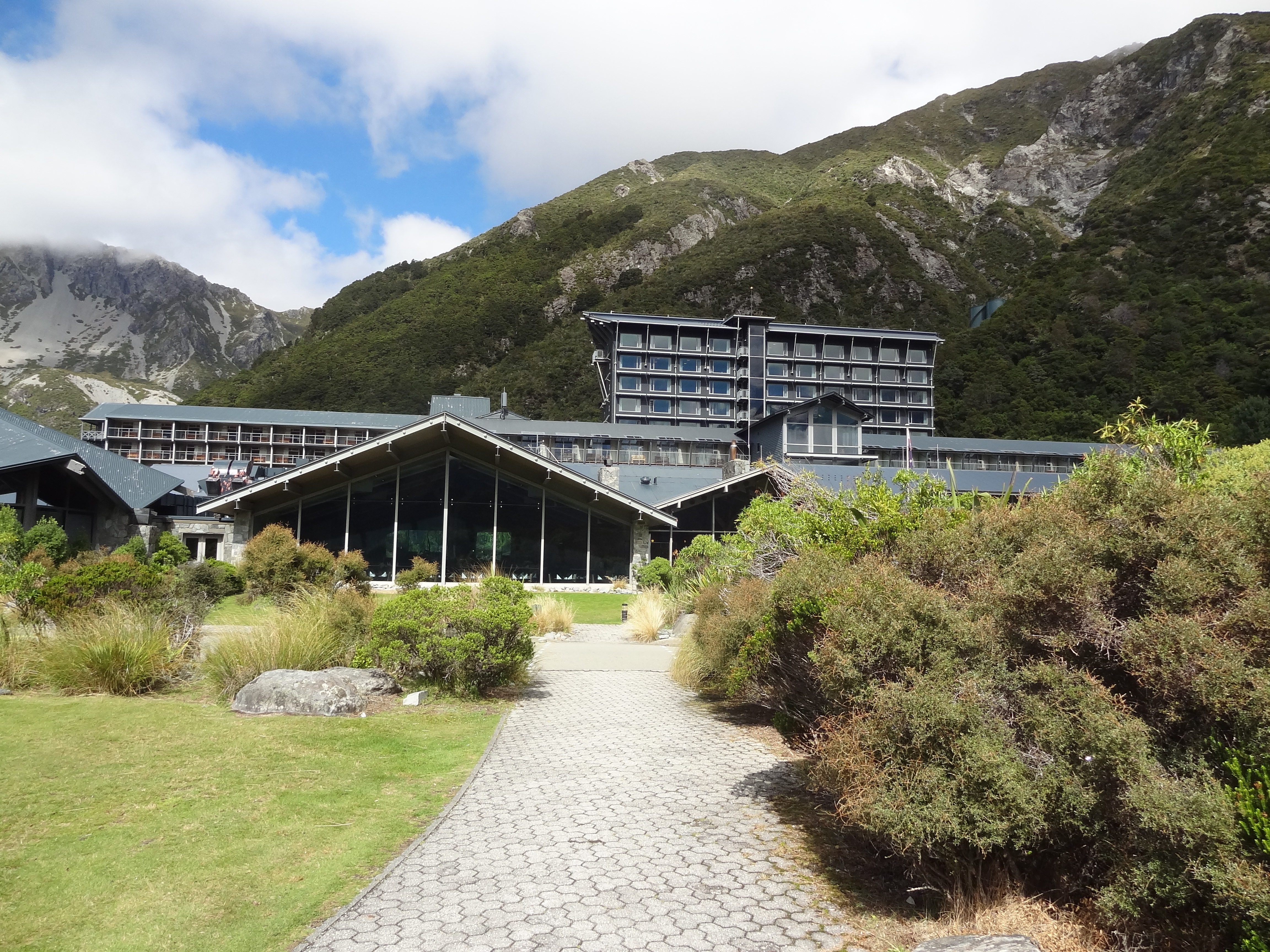
The Hermitage itself is quite a grand affair.
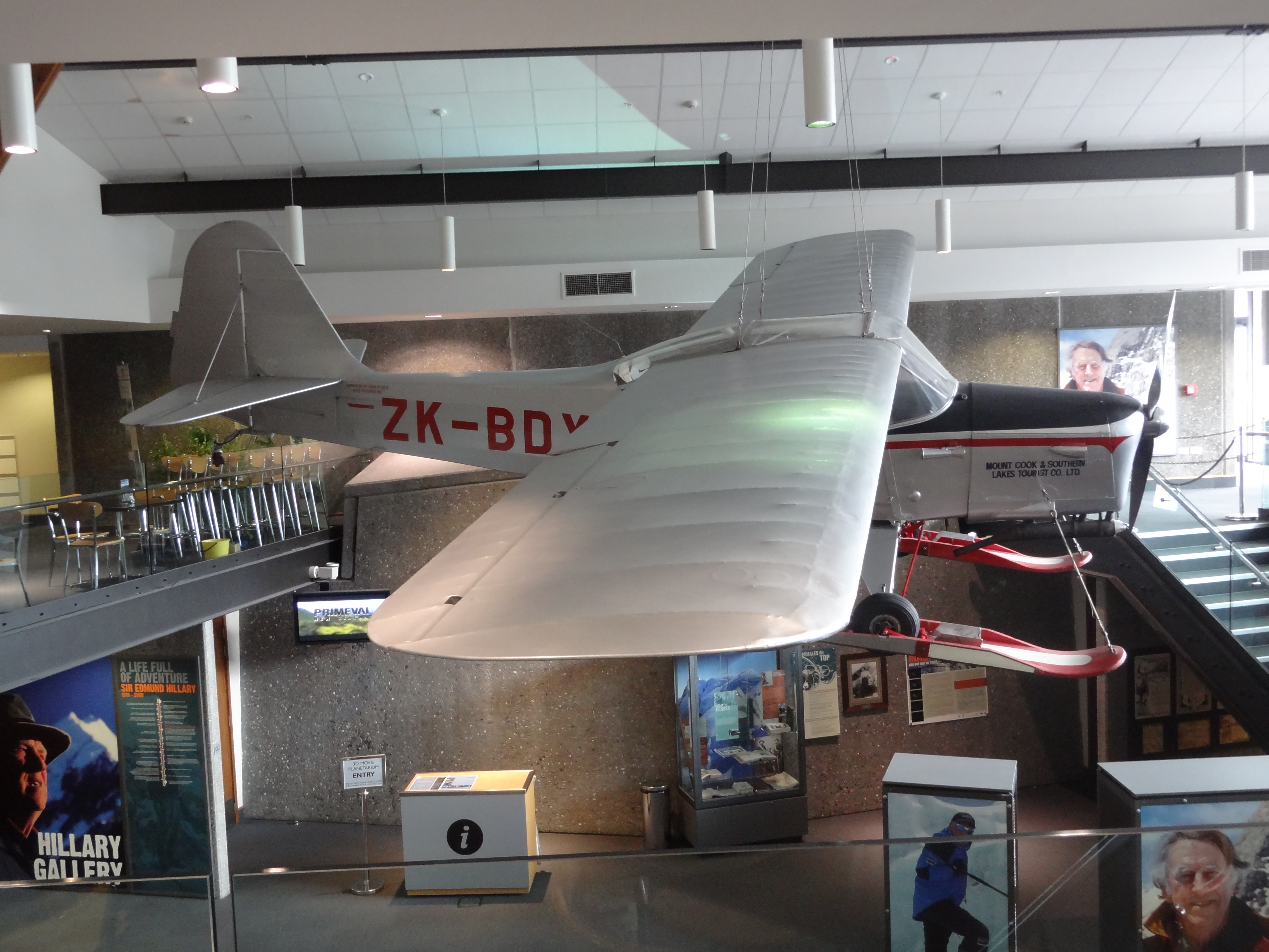
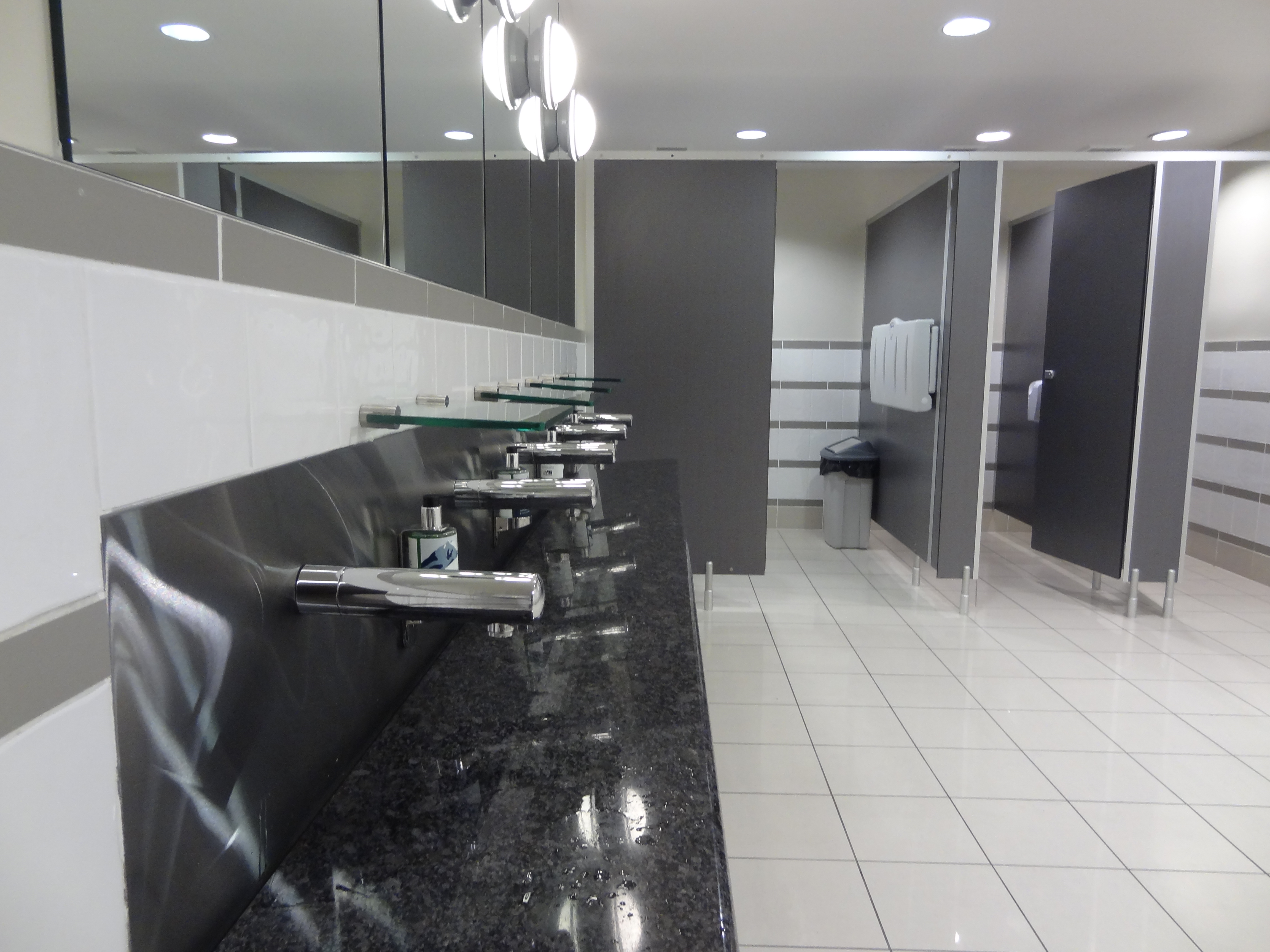
The Hermitage Hotel – centre of everything Mt CookAn impressive mobile hanging from the ceiling in the Sir Edmund Hillary Alpine CentreEven the loos are impressive at the Hermitage – handwash with no sink….
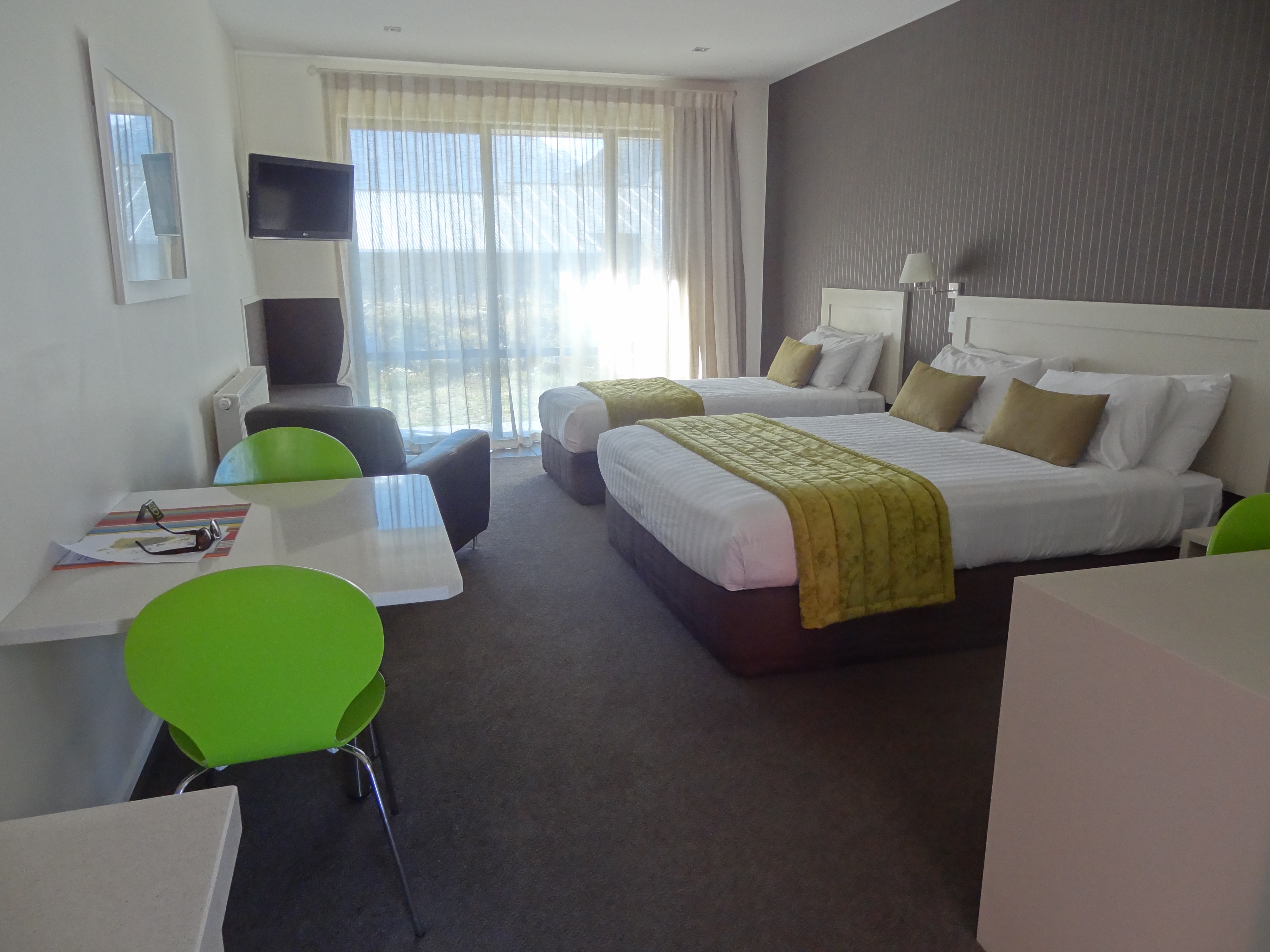
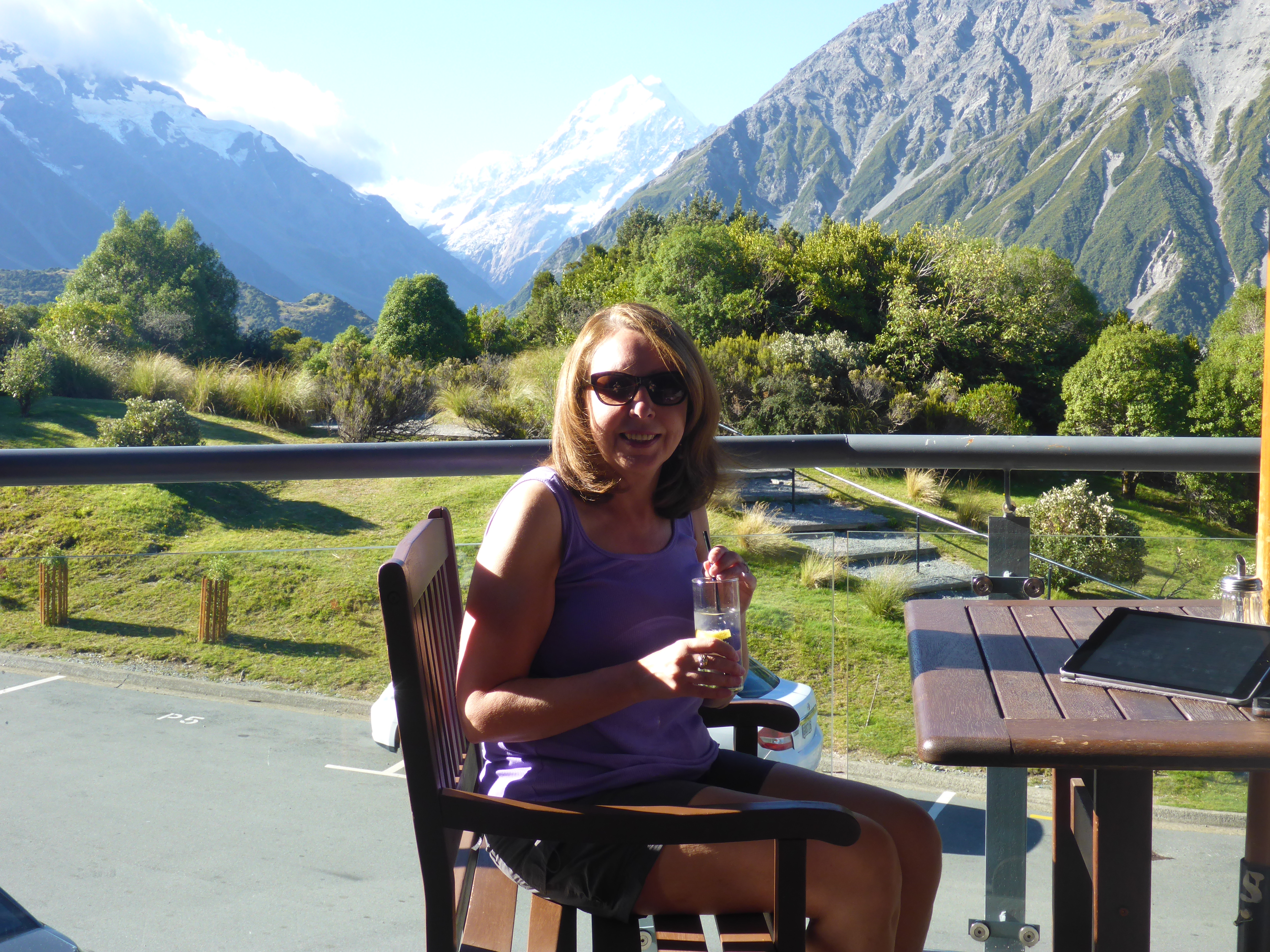
After a look around the Hermitage we booked into our accommodation at Mount Cook Alpine Lodge. A nice room, albeit a tad small but with a good view of the mountains.
Not big but nice roomnot a bad view to wake up to…..
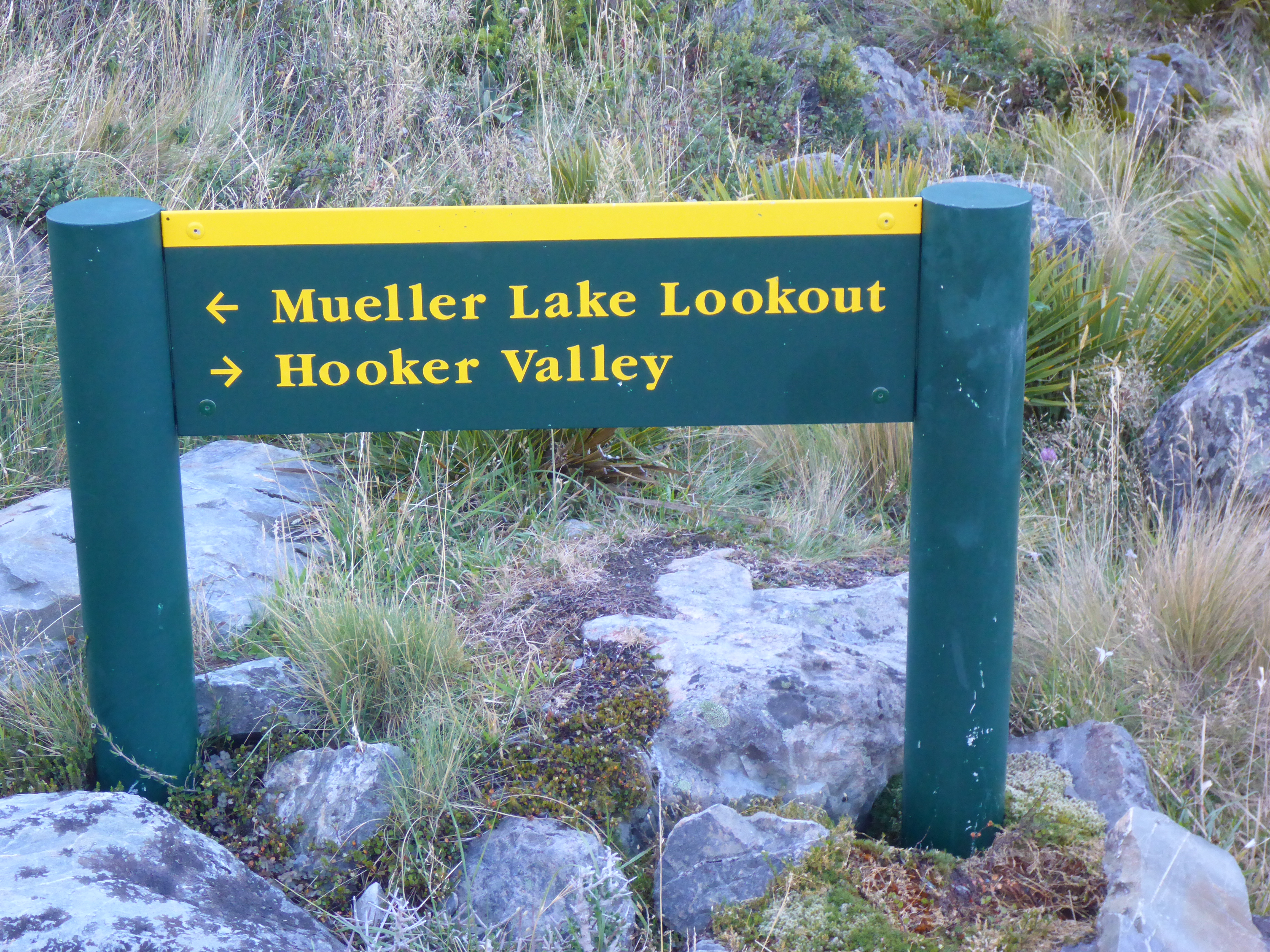
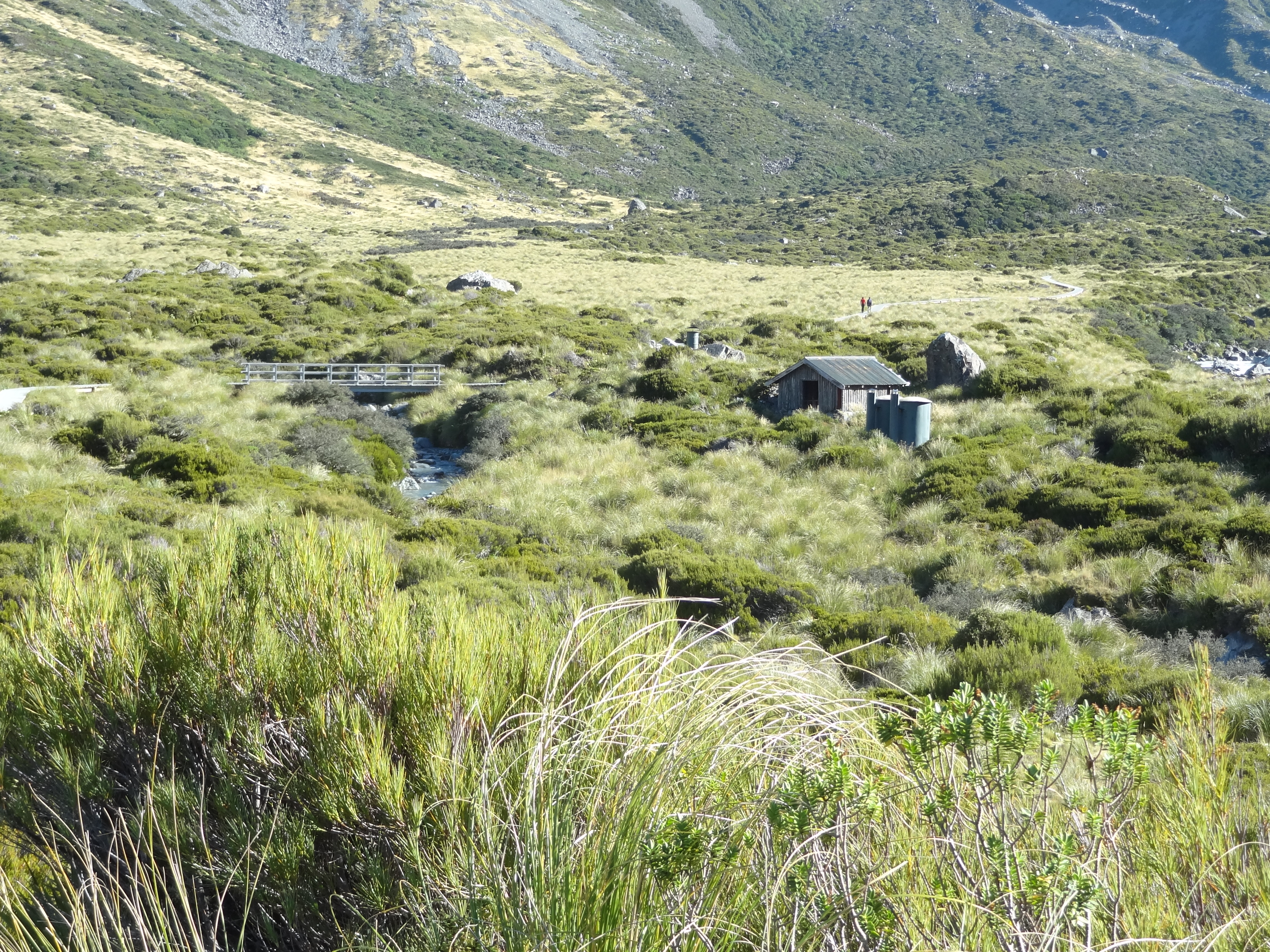
Kea Point
Our first walk to Kea Point
After a quick lunch we went off to find the start point of the Kea Point track which would take us to the Mueller Glacier moraine wall. This is an easy walk of around three hours from our motel. It’s a fairly flat walk through grassland and scrub but nevertheless there are stunning mountain views wherever you look. It would be a great introduction to the area.
scenery on the short walk to Kea Point
Ann pictured at Kea Point with Mueller Glacier Lake and the moraine wall behind with the backdrop of Aoraki Mount Cook
We finished this first walk with a few drinks at the backpackers motel which was well priced and with a decent menu before retiring for the night well and truly knackered.
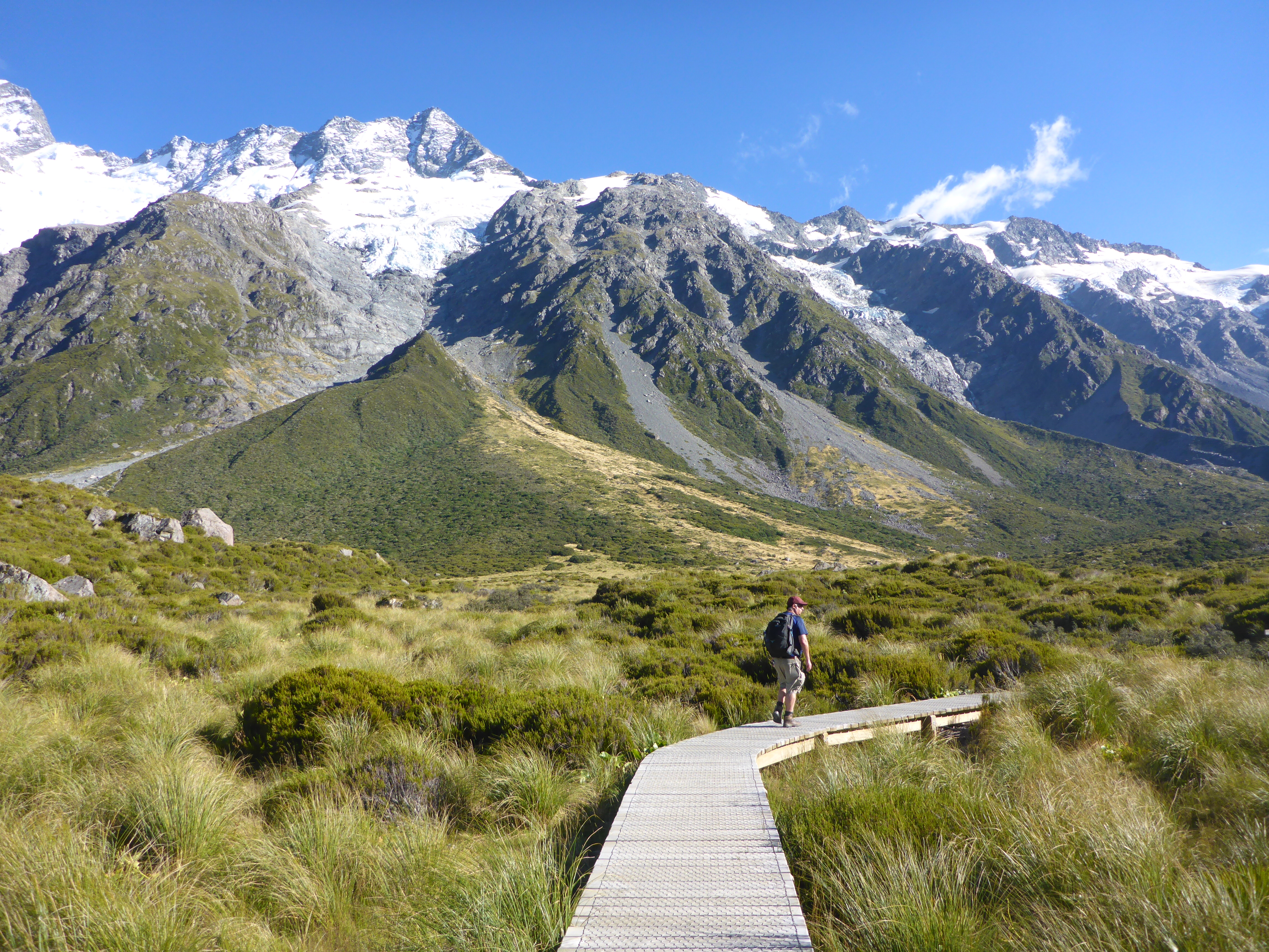
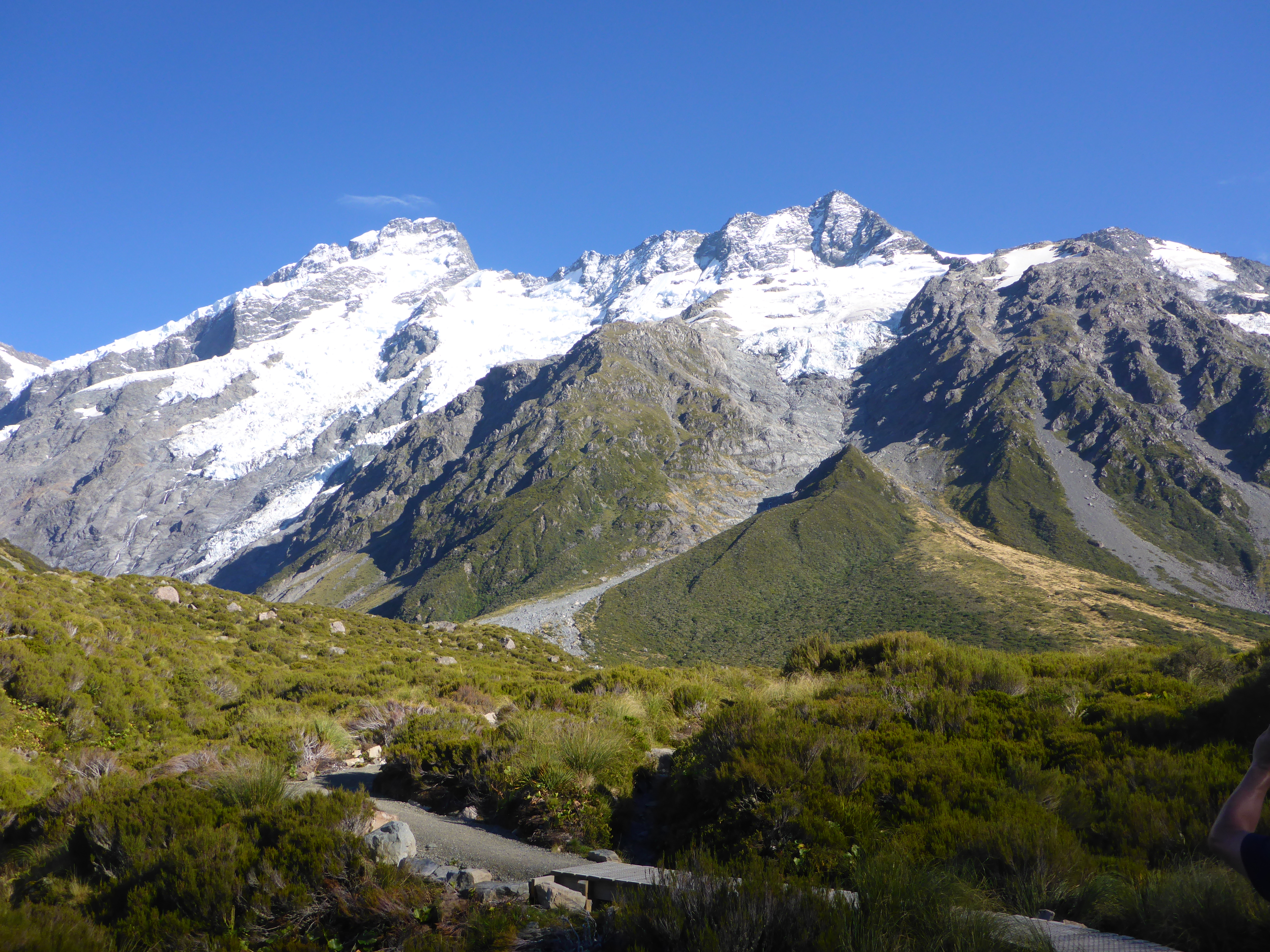
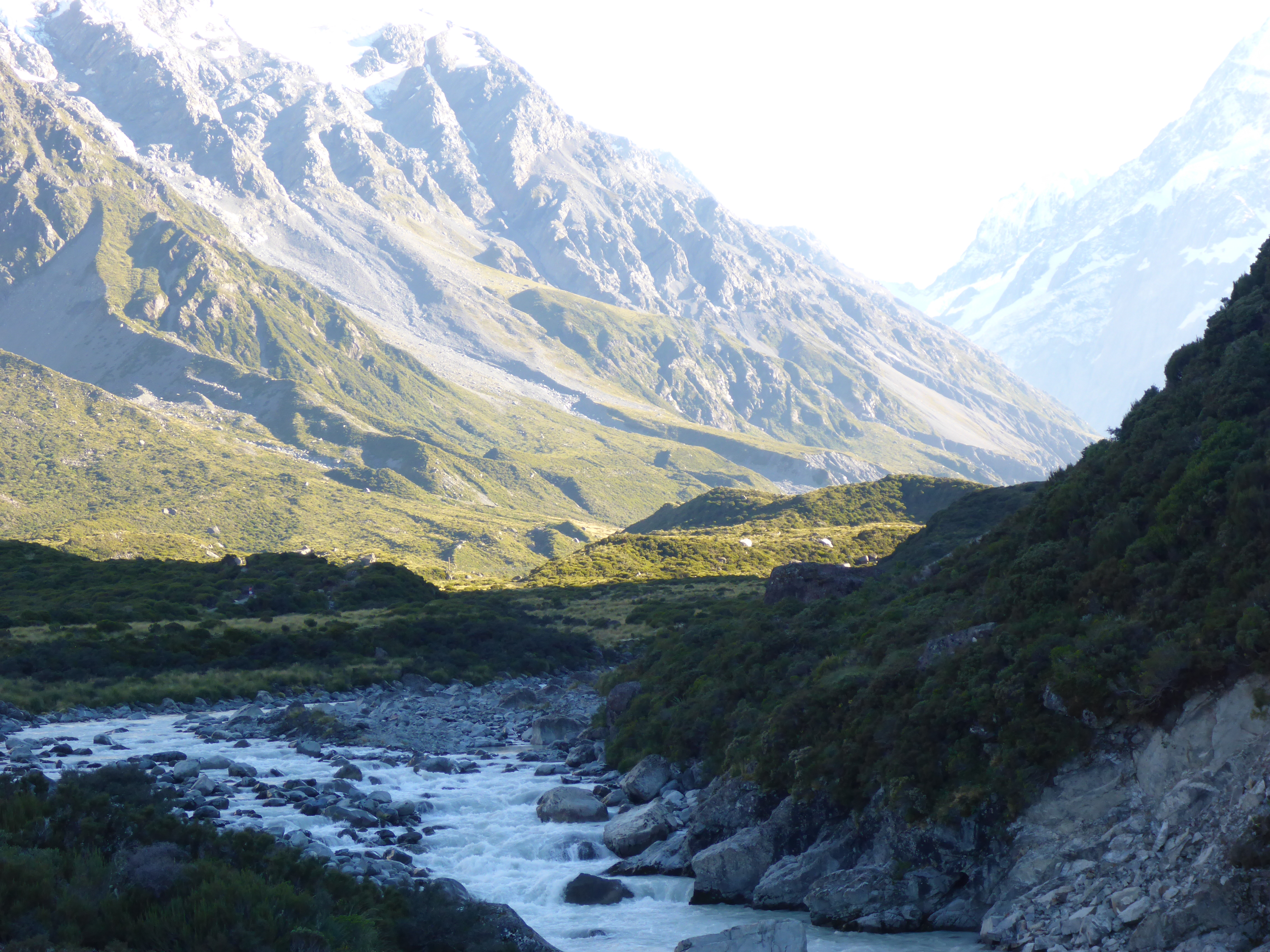
Hooker Valley Walk
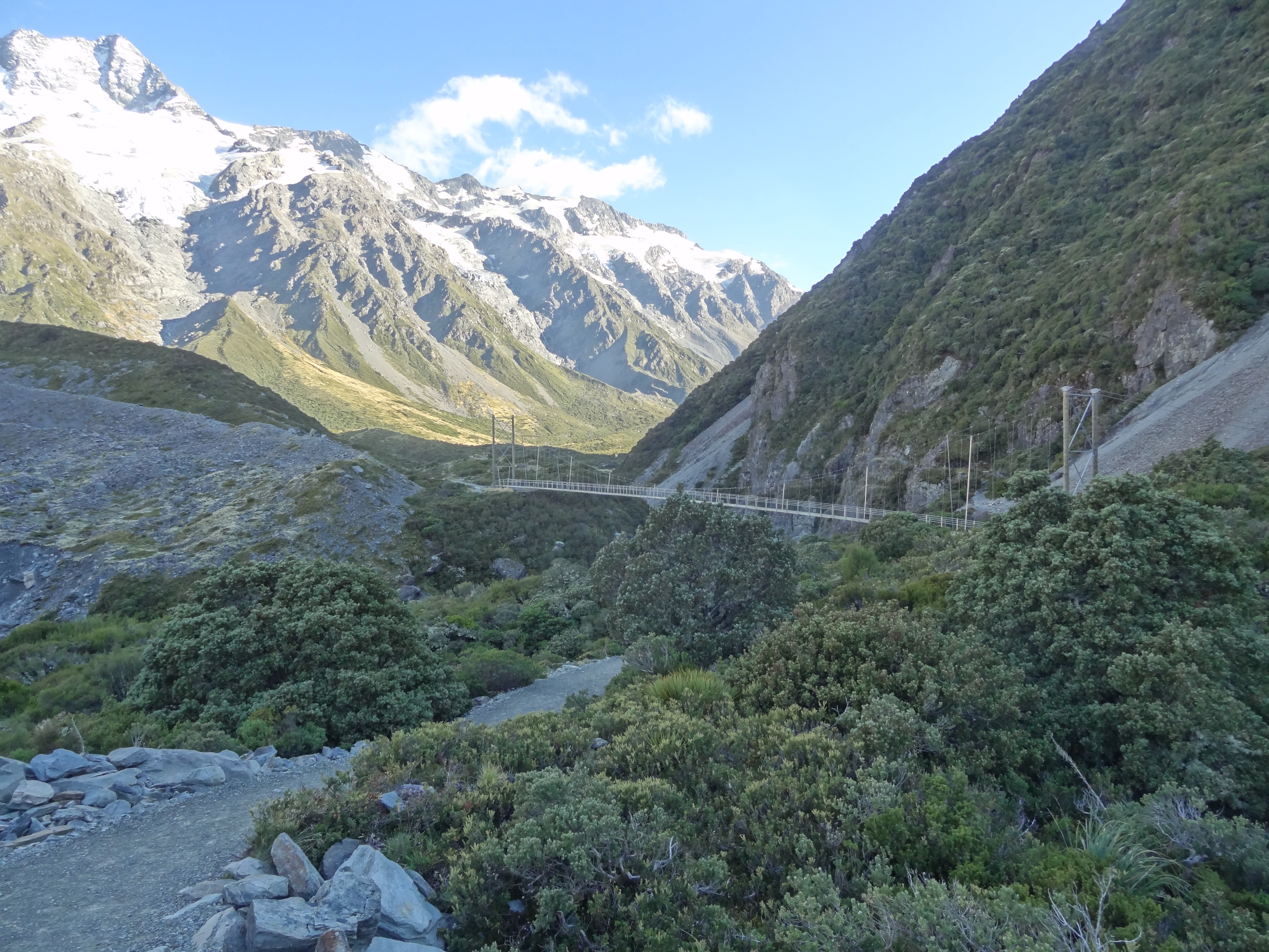
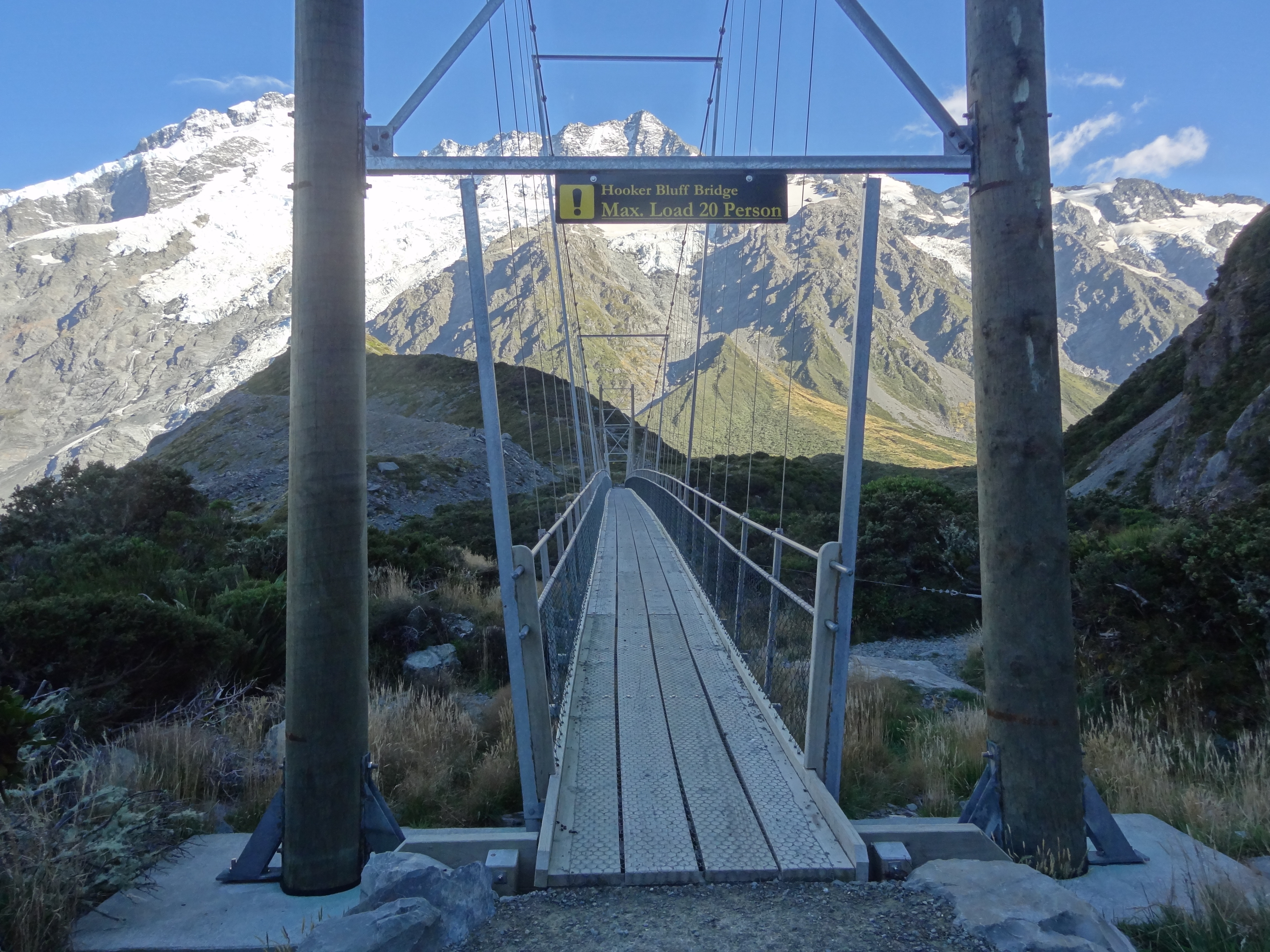
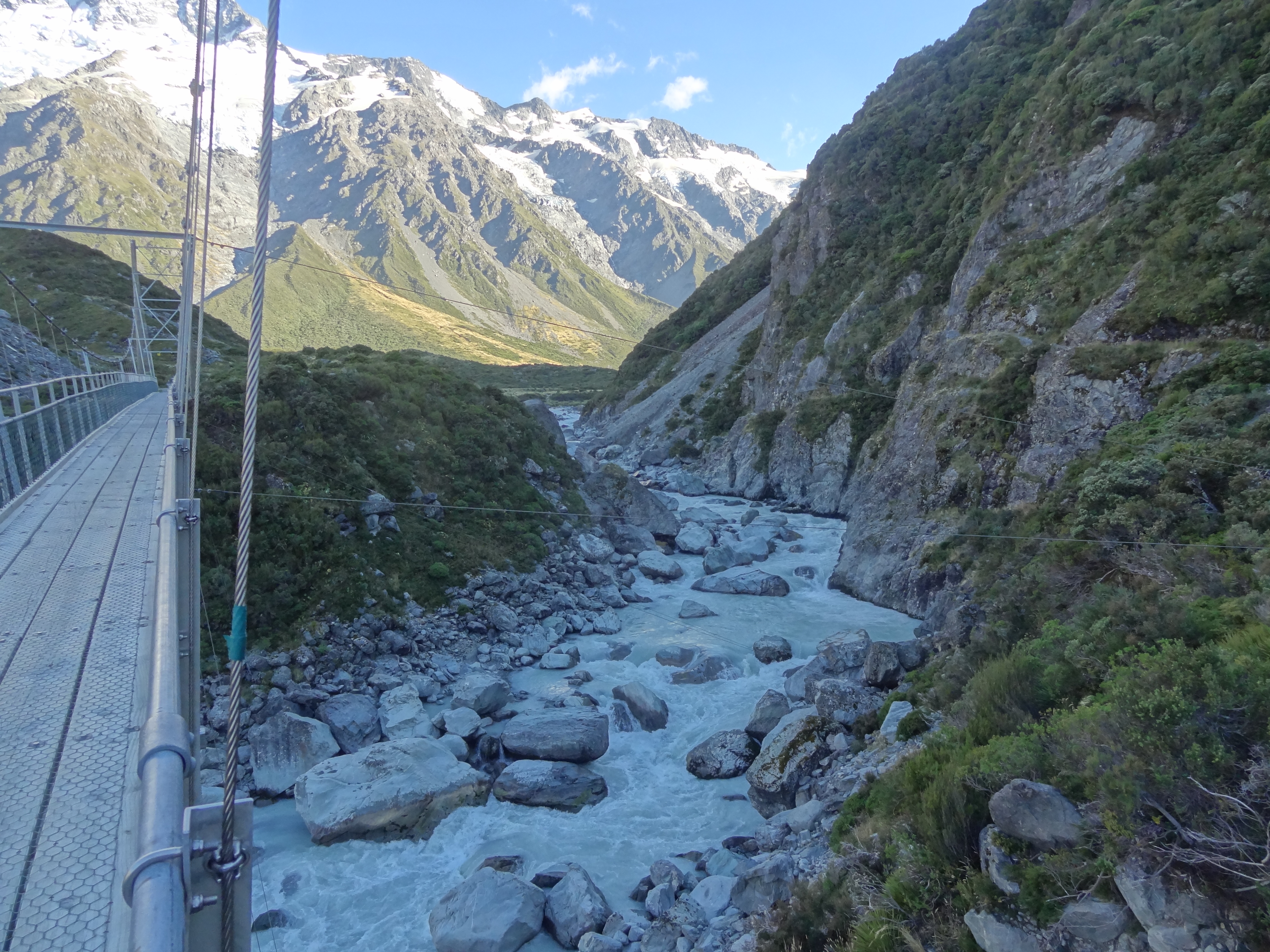
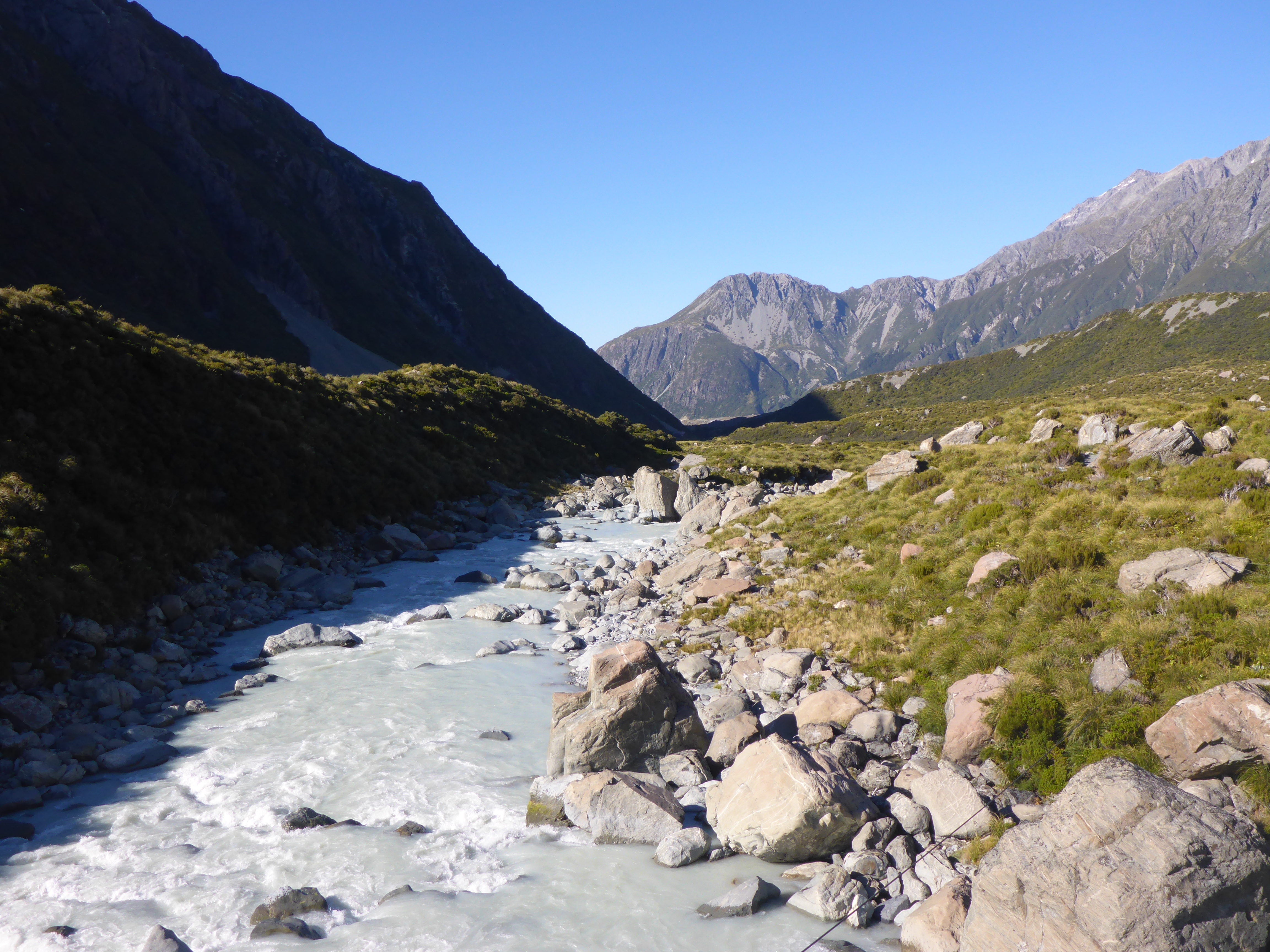
On Day 2 we would complete the longer (about 5 hours return from our digs with stops for photos) and more challenging but still easy walk along the Hooker Valley Track to the source of the Hooker River. This is an amazingly beautiful walk and one of the most popular walks in New Zealand and we set off early – for us – in the hope we would miss most of the crowds. It worked; we had the outward walk to ourselves for most of the way and didn’t hit the crowds until our return walk.
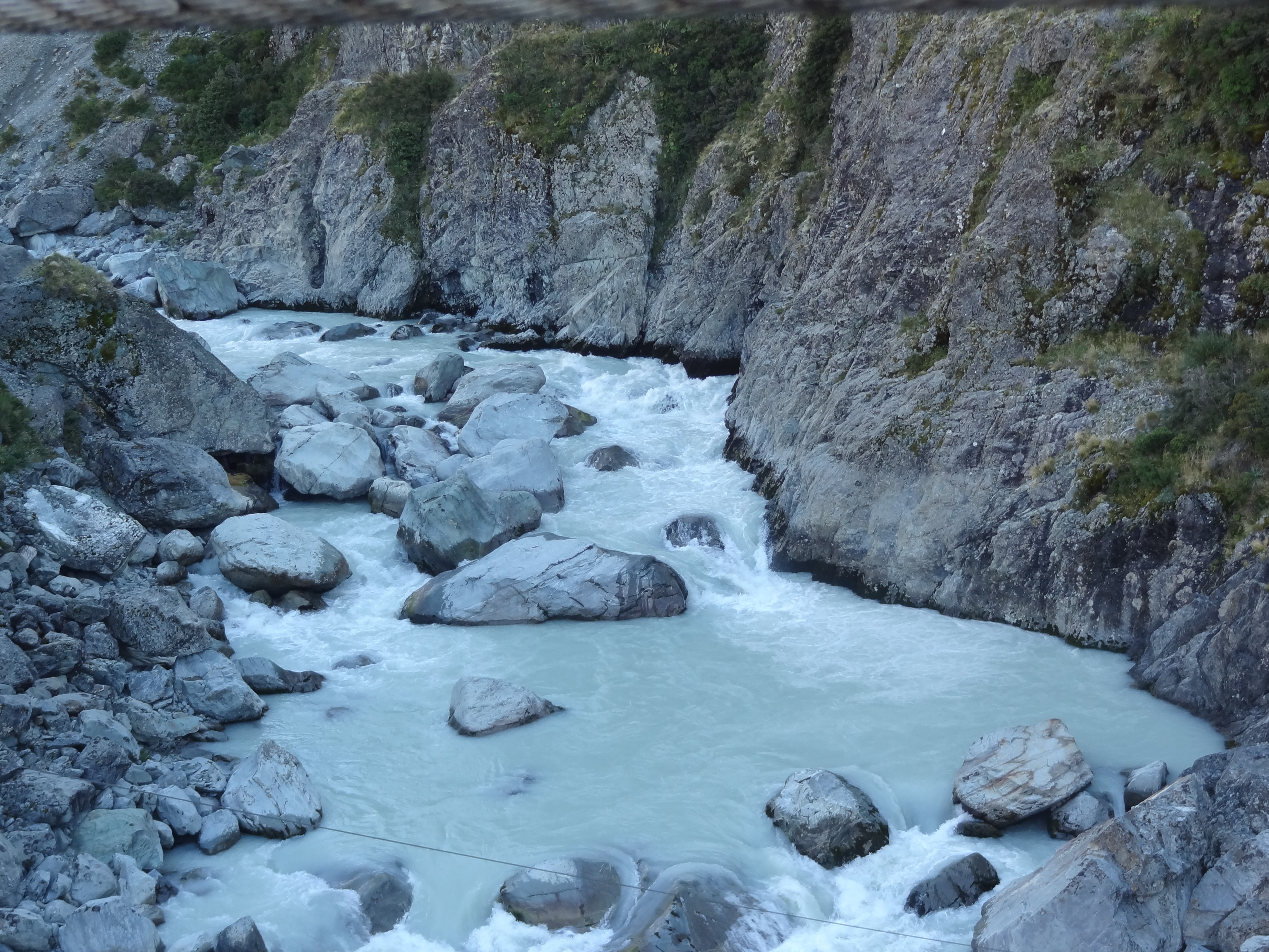
This walk is through much more varied landscapes but still mostly flat on good tracks with some boardwalk through marshy bits and steps in other parts where there is a bit of up and down. There are 3 long suspension bridges en route crossing the beautiful glacial river rushing below and the scenery is just awesome! There always seemed to be a view on the other side of the bridge – the pictures below will show you what I mean….
We did the Hooker Valley walk on our second day hereAn early start meant we had most of the outgoing walk to ourselves…
one of several suspension bridges en route
A loo with a view….
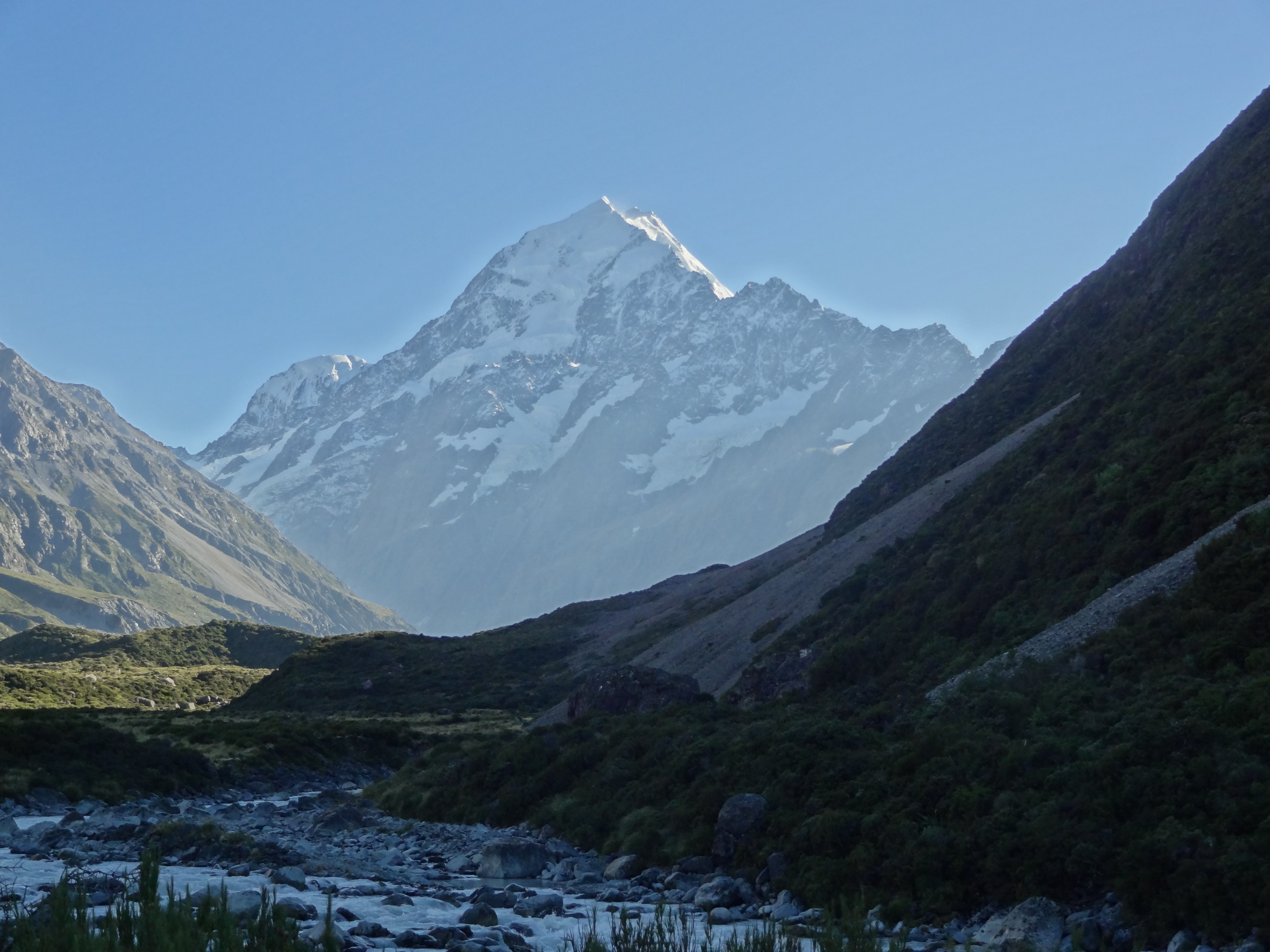
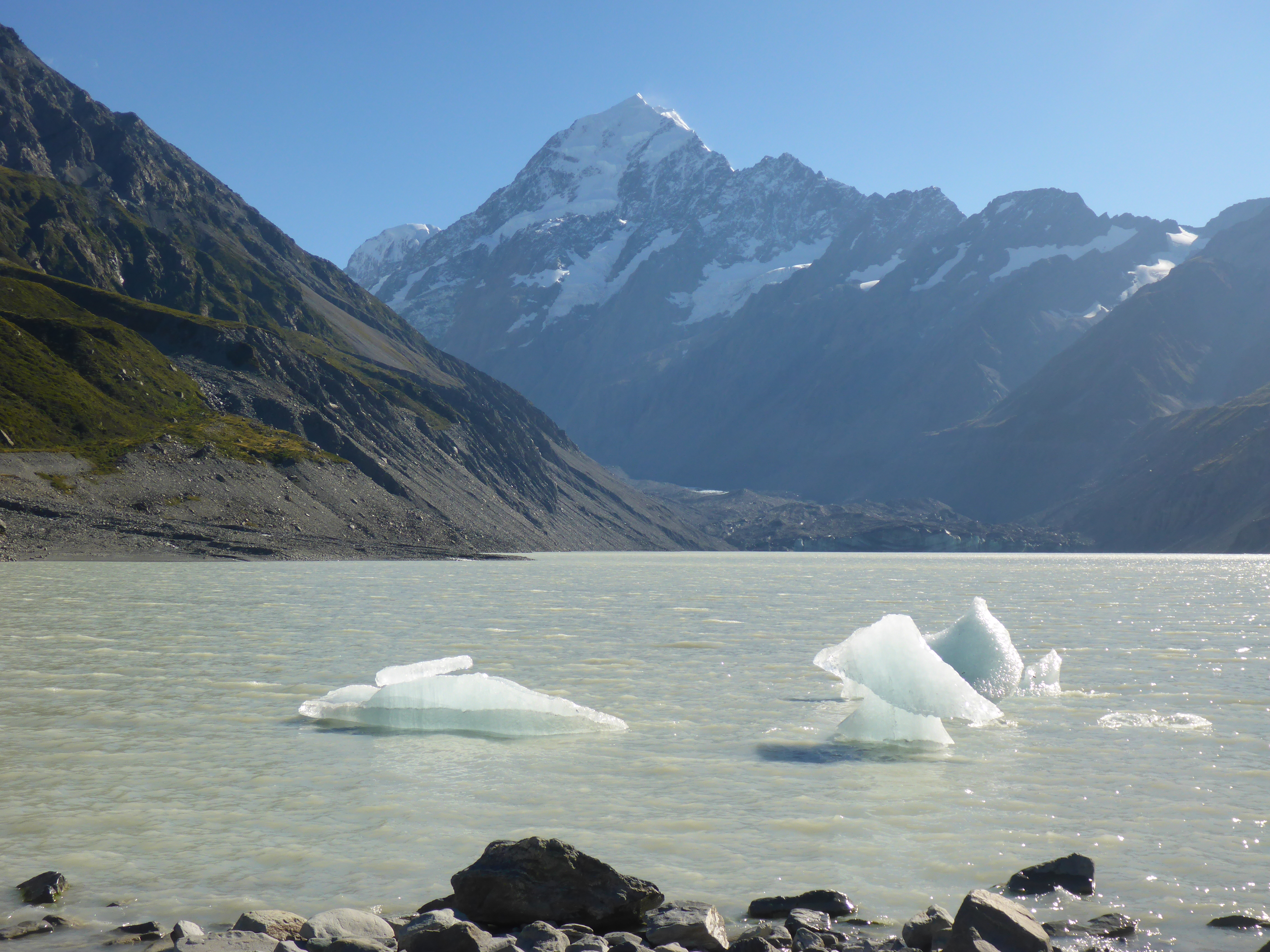
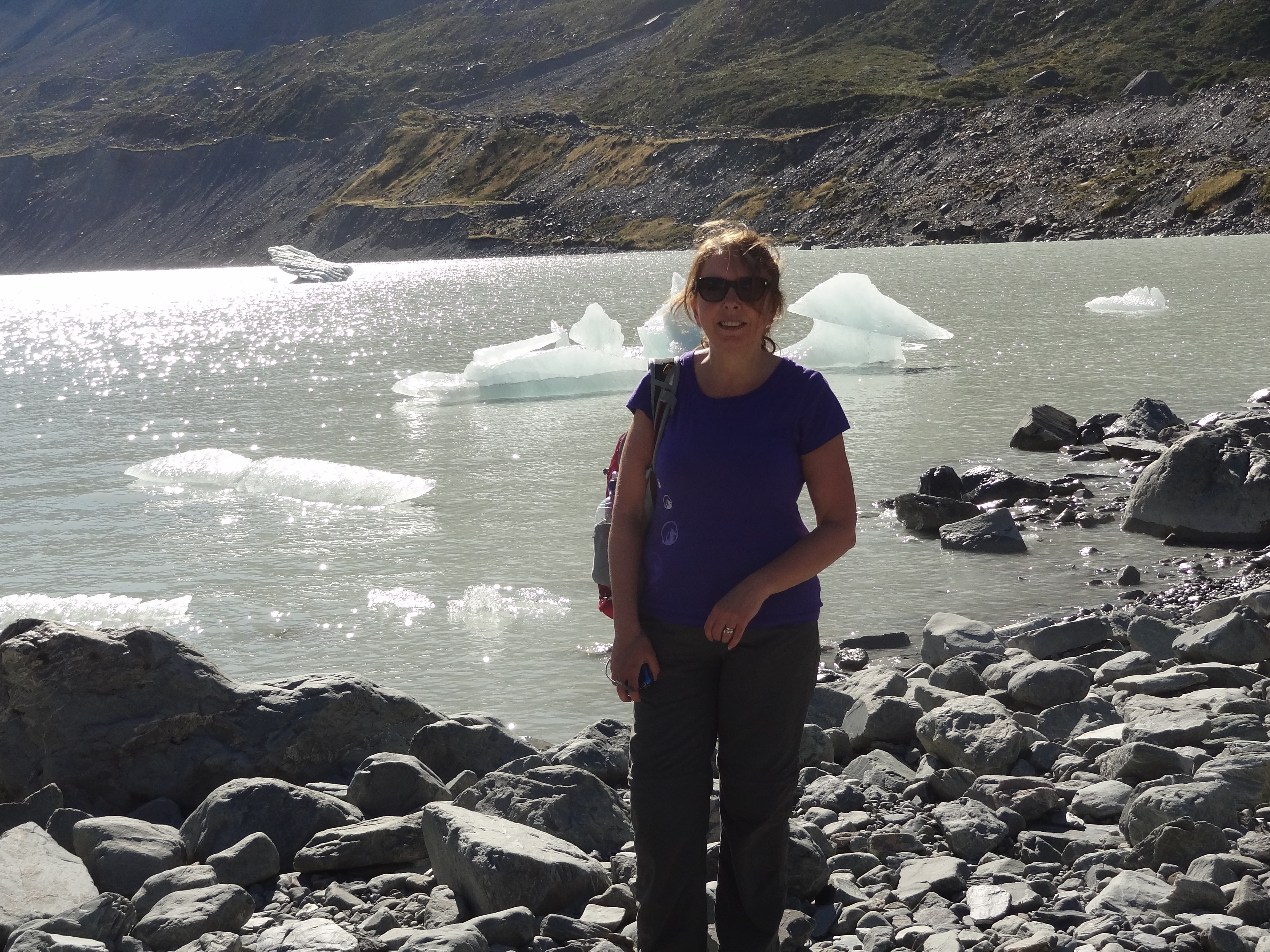
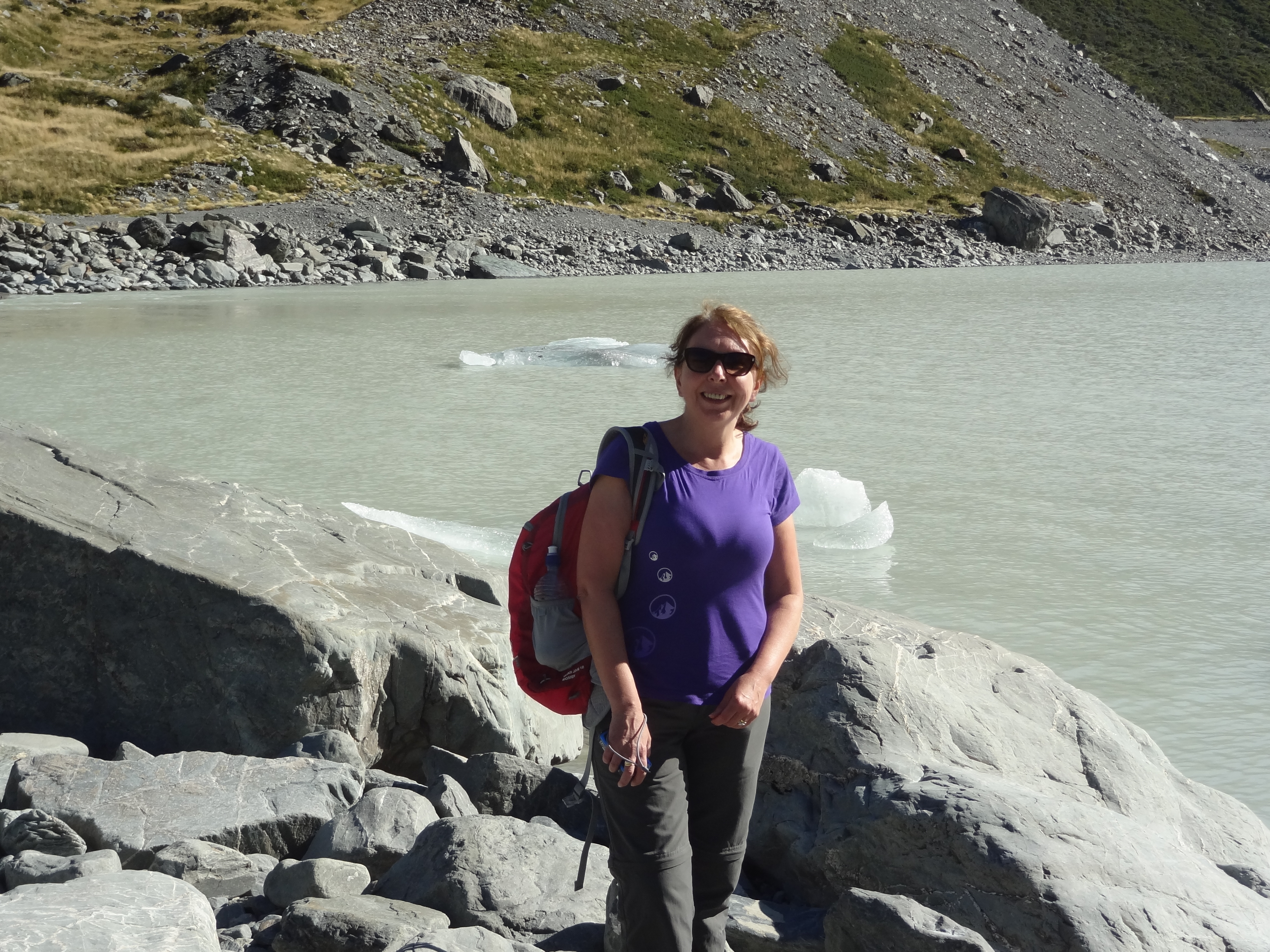
Aoraki/Mount Cook seen from the end of the Hooker Valley – this the morain lake of the Hooker Glacier complete with ice bergs.
Back at the Hermitage, a well deserved cold drink before dinner.
We left Dunedin on 12th March. The direct route to Mt Cooke from Dunedin is a drive of only three and a half hours but it didn’t look a particularly interesting drive and we had decided to take a very circuitous route over a couple of days via Hyde and Ranfurley and then South West to Alexandra, before turning North again, skating by Cromwell to Omarama and on through Twizzle and Tekapo to Aoraki Mt. Cook. None of these towns are of any size but we had read many a travel blog and Tripadvisor thread recommending the areas as places to visit due to their history.
The road from from Dunedin to Hyde passes initially through suburban Mosgiel but swiftly hits open countryside, and within an hour or so the small town of Middlemarch, population circa 300, a country railway town which is the end of the Taieri Gorge railway line from Dunedin.
We wouldn’t have chance to travel the railway line on this visit but it is apparently well worth a trip for its spectacular scenery and for travellers without cars this could be part of a rail/bus trip from Dunedin west to Wanaka or Queenstown which I reckon would be a lovely way to make such a journey.
Otherwise Middlemarch, which sits at the foot of the Rock and Pillar Range of hills is the start point of the Otago Central Rail Trail, a 150 km walking, cycling and horse riding trail which runs from Middlemarch to Clyde following the old railway route of that name.
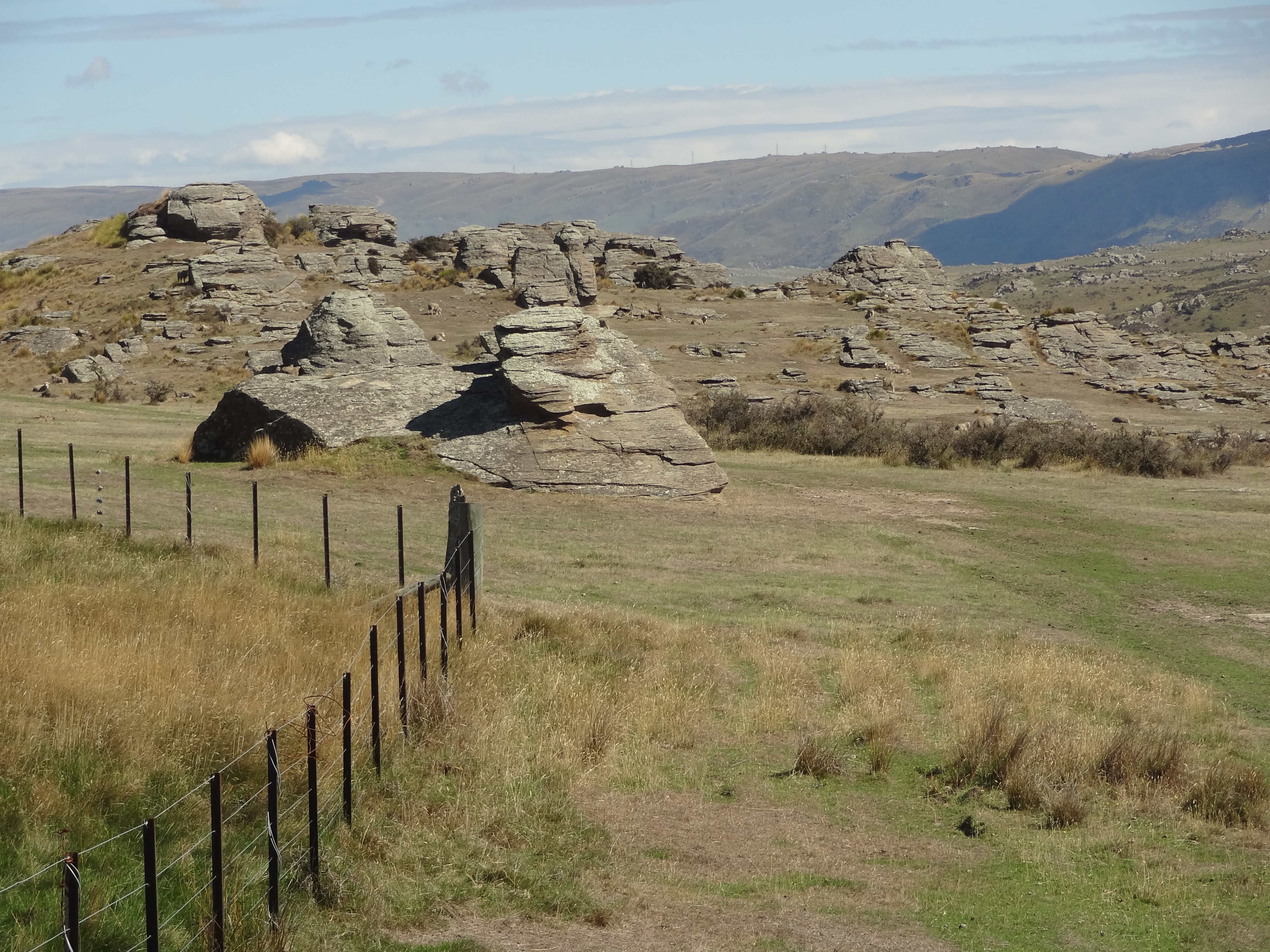
From Middlemarch the road passes through the Rock and Pillar Range with its strange rock formations until it reaches Hyde.
Approaching the Rock and Pillar RangeStrange rock formations resulting from the movement of two parallel faults uplifting the area in between.
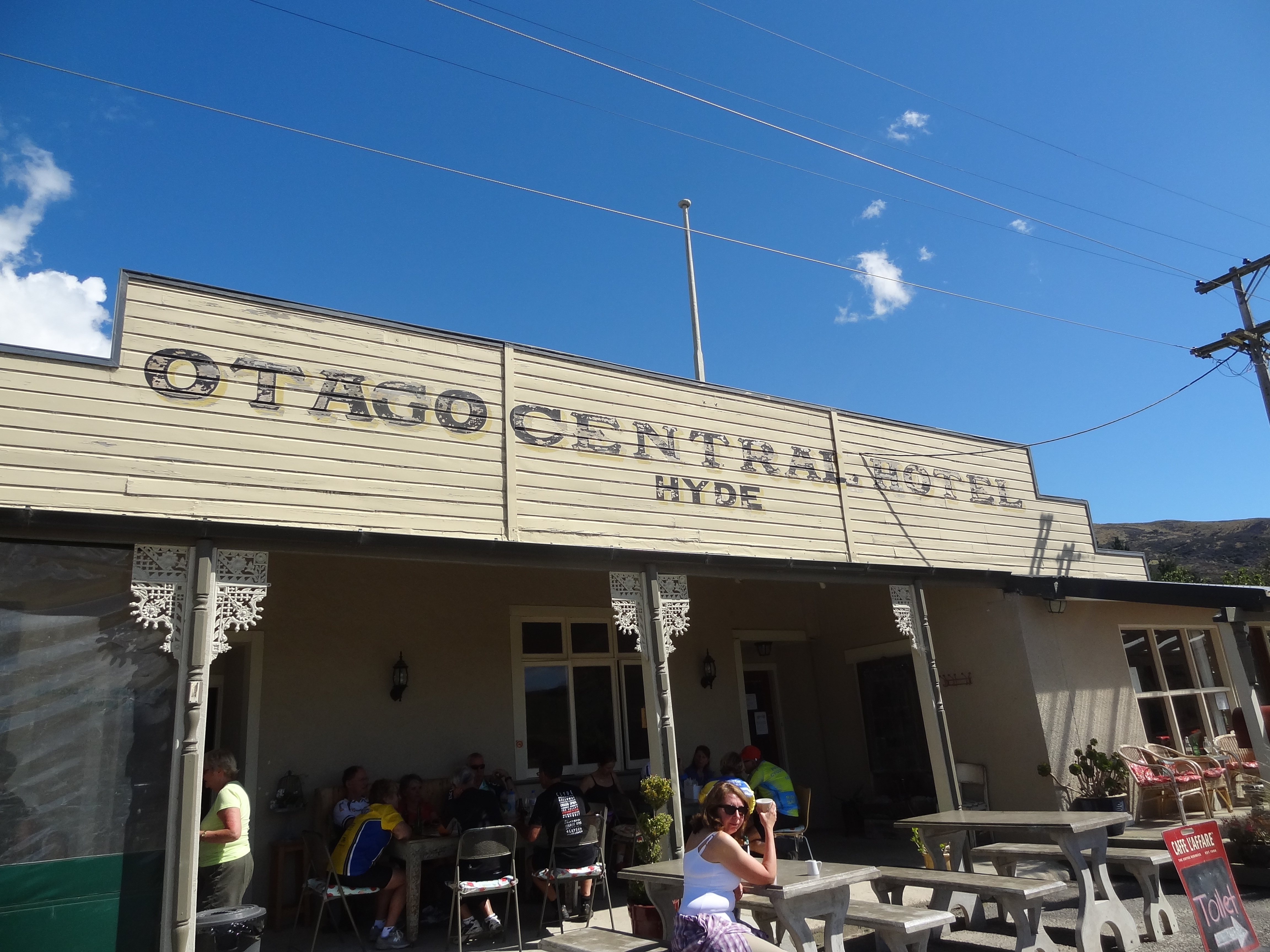
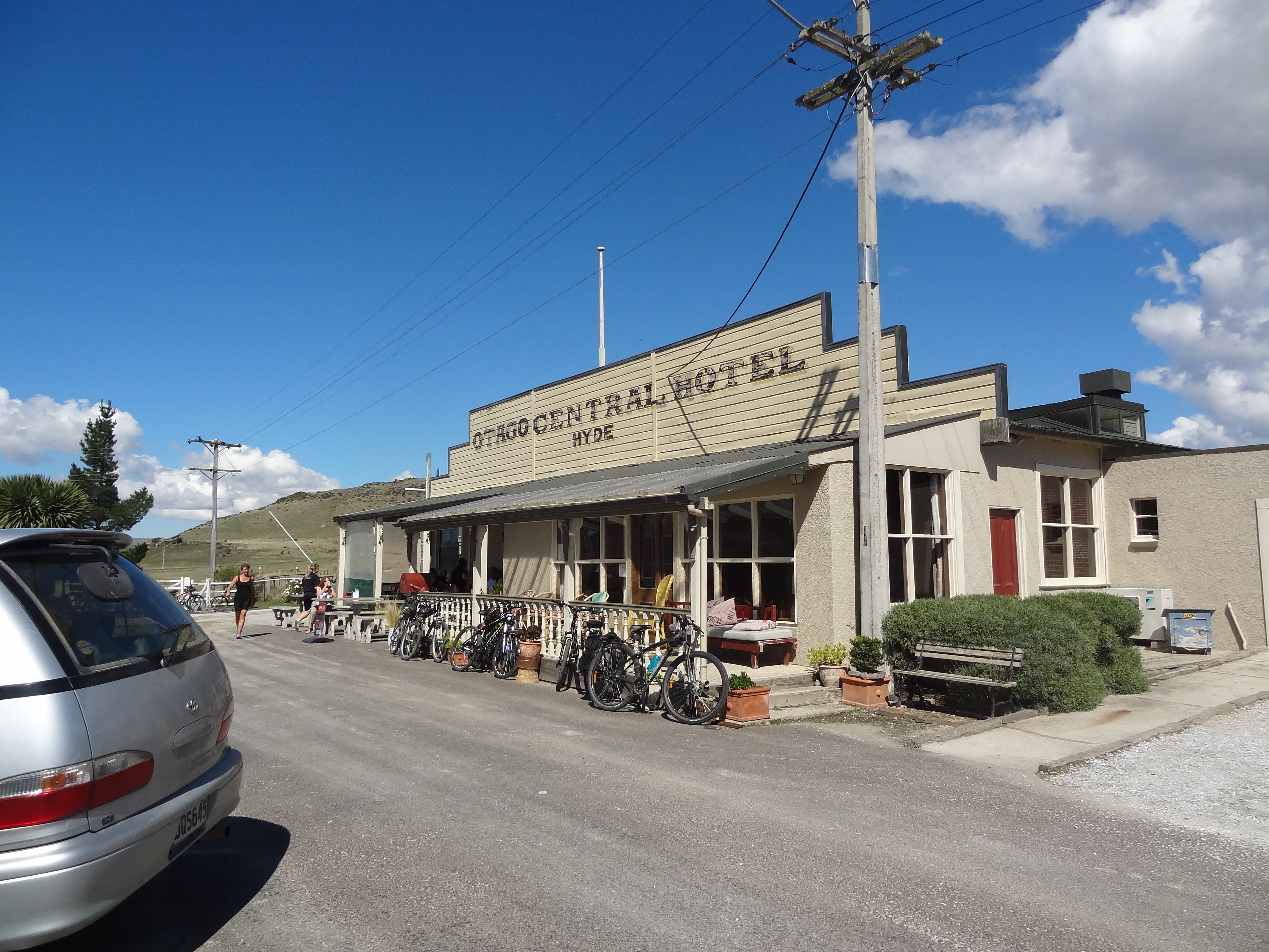
Hyde is a small settlement established in the 1860’s gold rush period and is most famous as the scene of a railway disaster in 1943 in which 21 people were killed when a train came off the rails at high speed in a cutting near the town. This remains New Zealand’s second worst rail disaster.
Otago Central Hotel, Hyde on the Otago Rail TrailA well earned rest for cyclists and walkers
The place is now enjoying a re-birth as a stop on the Central Otago Cycling Trail where cyclists and others can stop for refreshments or even an overnight stay at the Otago Central Hotel and we stopped ourselves for coffee and cake…
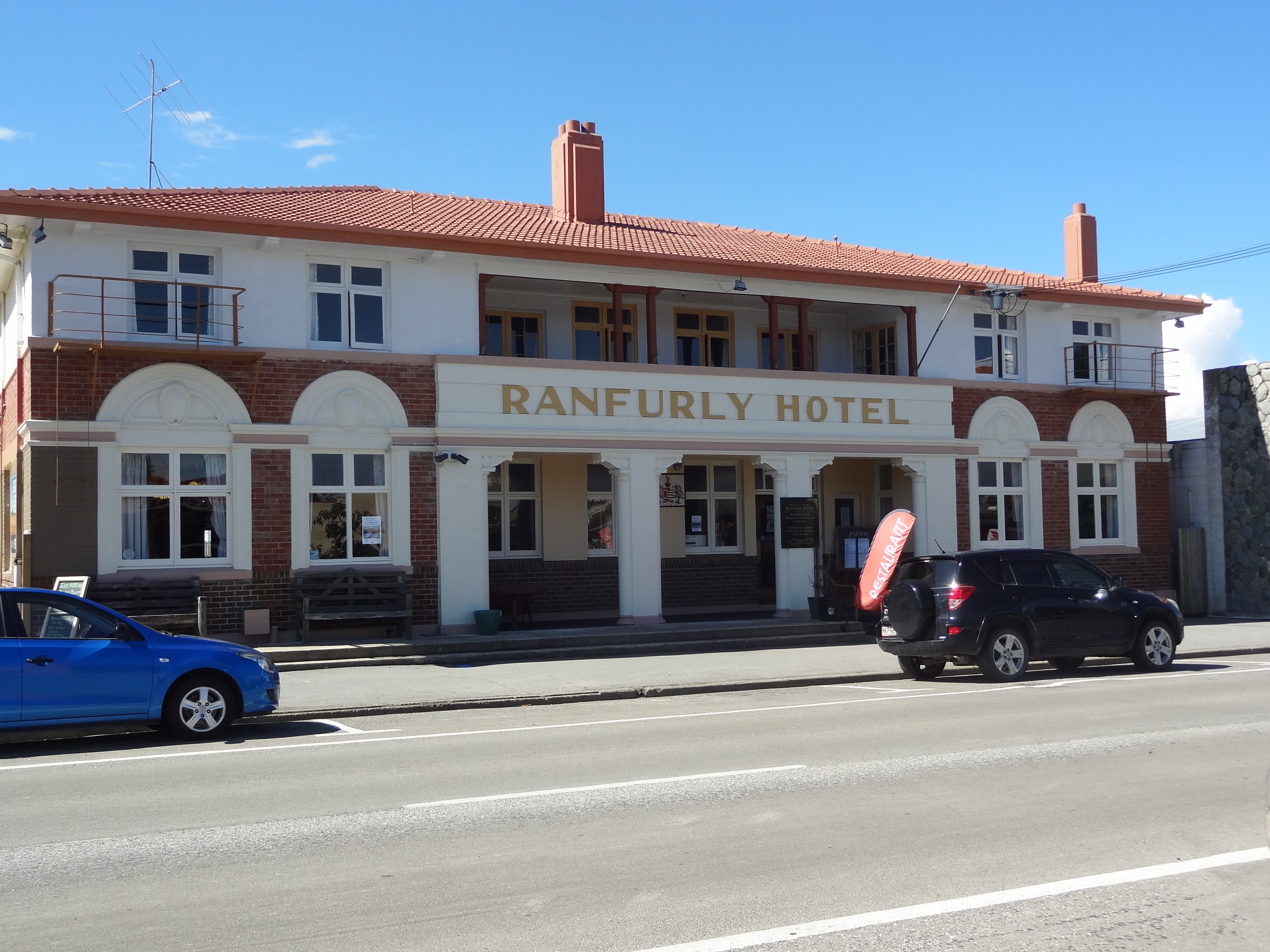
After Hyde, we stopped at Ranfurly. Established as a town proper in 1898 following the gold rush period, the town was built here as it was at the end of the railway line to Dunedin which had been built to transport people and produce from this isolated area to the port city of Dunedin. Thus Ranfurly became the hub and service centre for the small farming communities of the region which is known as Maniototo.
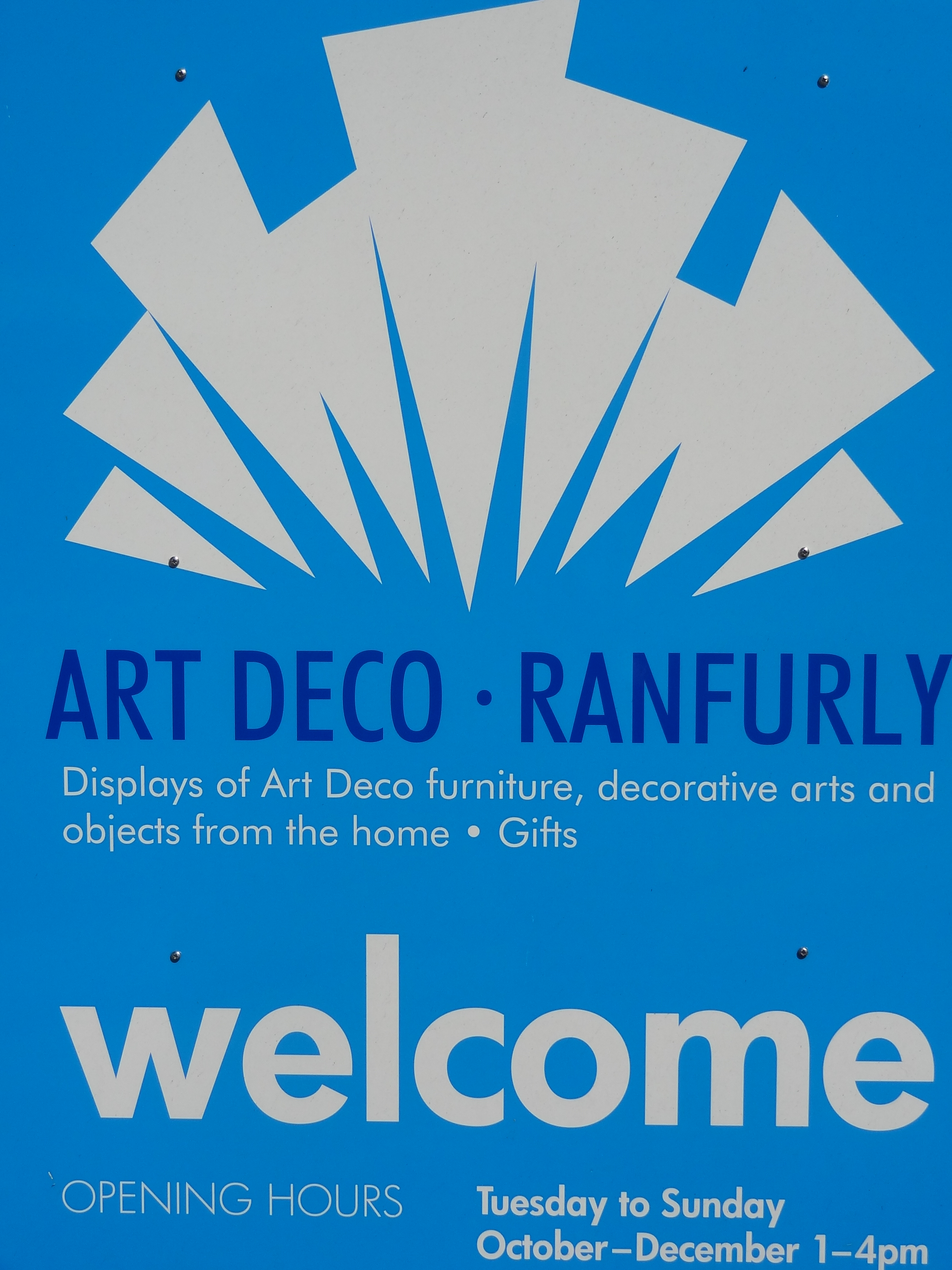
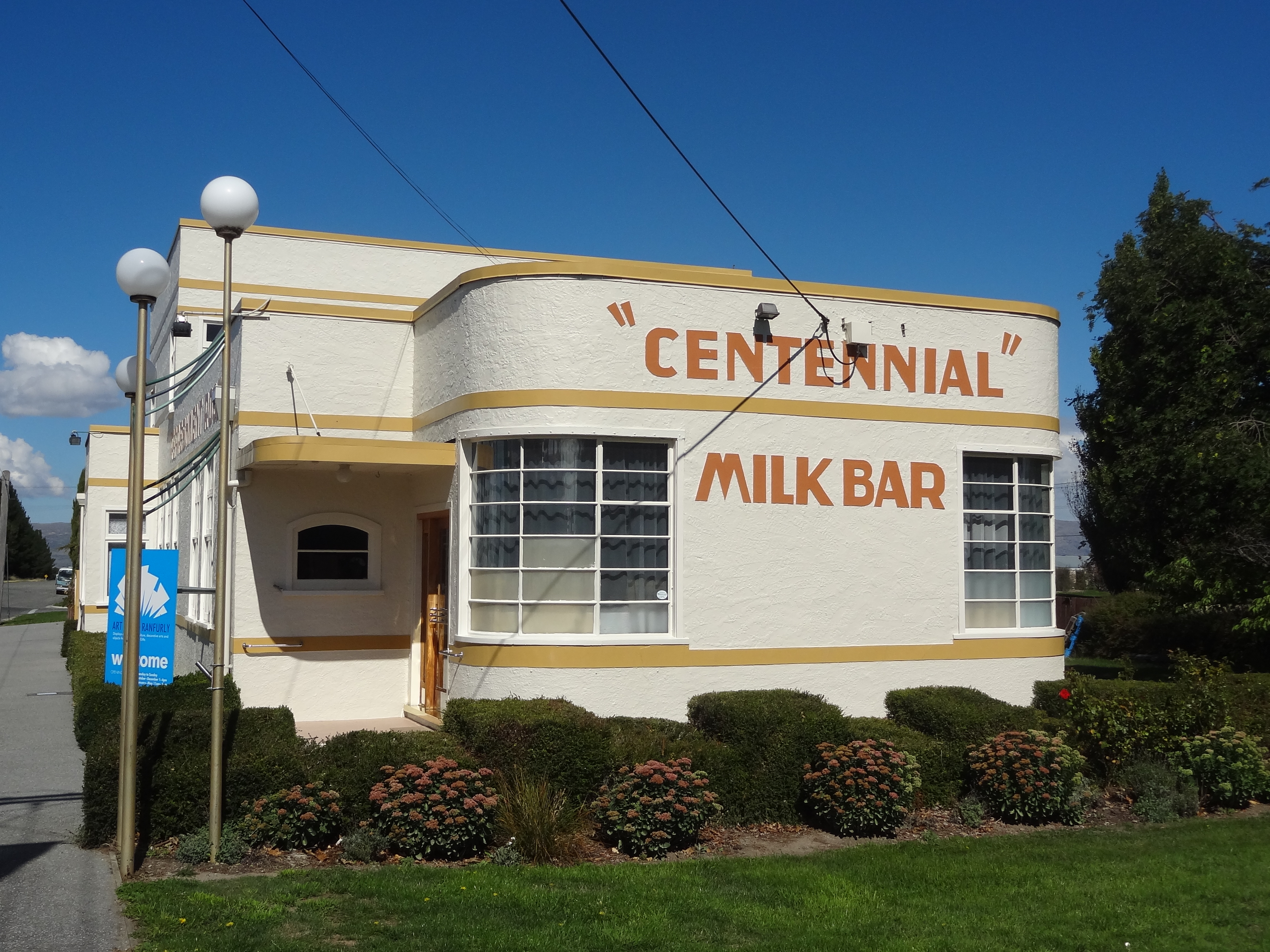
The town experienced a building boom in the 1930s, some of which apparently resulted from suspicious fires. This was the period of Art Deco and the town is is well known for the many Art Deco buildings which remain from that time. The buildings have been retained and well preserved and are celebrated each year with a festival. There is a small Art Deco museum amongst other attractions and being once connected to the rail line with various accommodation options for travellers, the town is another stopping place for travellers including those on the Otago Central Rail Trail. We thought it a very attractive place to stop off
Whilst the town was established and grew on the back of the rail connection built in 1898,the line was closed in 1990 following de-regulation which opened the door to freight being moved by road transport.
Art Deco at Ranfurly, Central Otago
Ranfurly is celebrated for its Art Deco buildingsRanfurly
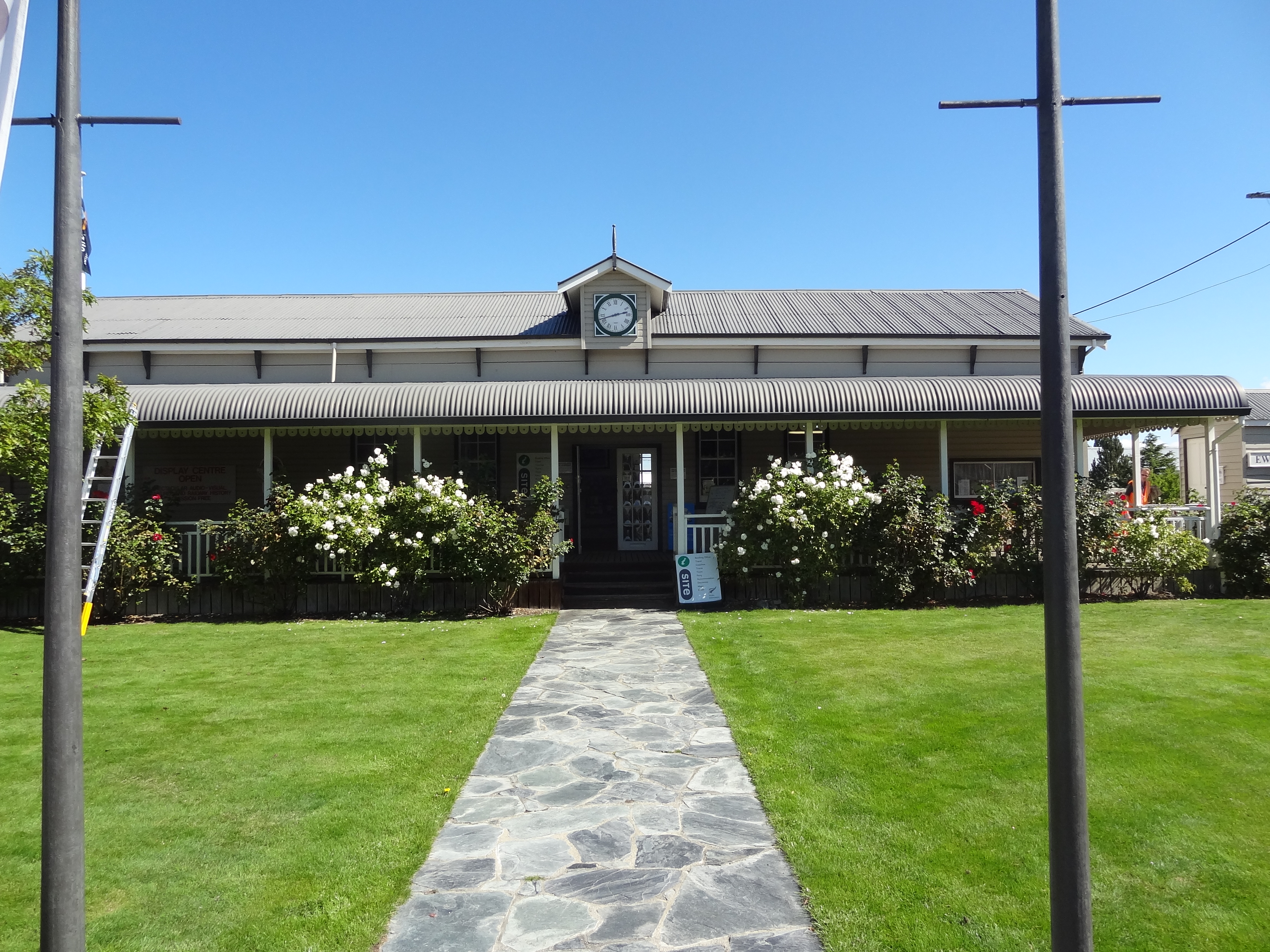
The prettiest iCentre seen so far
Alexandra
Next stop, this time with an overnight stay at the excellent but oddly named Nangari Studio Unit was in Alexandra, yet another small town founded during the Otago gold rush period of the 1860’s.
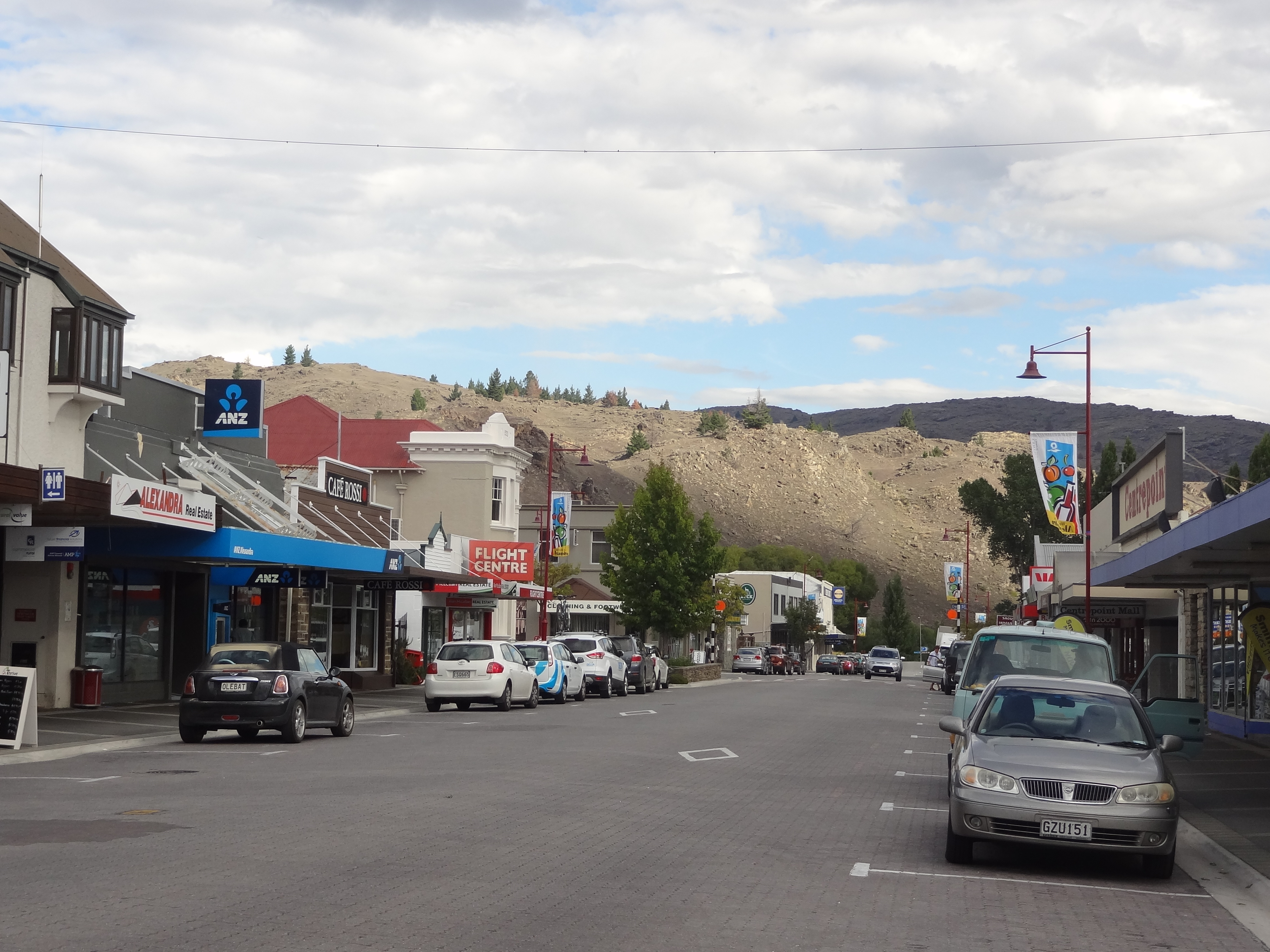
Alexandra is known as the hottest, driest and coldest place in New Zealand and with four distinct seasons is a popular tourist town with tourism based on outdoor activities such as walking, climbing, cycling or water based activities with the town sat on the mighty Clutha River
In truth, the town was not as we imagined given its write up. The hills overlooking it appeared strangely barren to us and we thought unattractive. We thought them reminiscent of spent wasteland left behind by the mining activities but I guess they are yet another part of New Zealand’s rich tapestry.
The town is otherwise quite non descript though not unattractive but whilst the tourist blurb describes it as having many eateries, we arrived late afternoon to find only a handful still open. It’s true that our visit wasn’t in the peak tourism period but nevertheless we were surprised to find only the iCentre (actually a very nice iCentre) and a couple of shops still open by 5pm. With most of the eateries closed or about to close, we struggled to find anywhere nice to eat that wasn’t a take away but eventually, with the help of Google, found an excellent burger restaurant which was ironically about to close that evening – for good! We had excellent $10 dollar burgers (a special price on their last night) and a couple of beers before retiring to our “Unit” which formed part of the owners residence just outside the town centre.
Happily it was no hardship to return early to our excellent accommodation with good wifi here but I’m afraid we found this town to be a very dull place and hard to believe its something of a holiday resort!
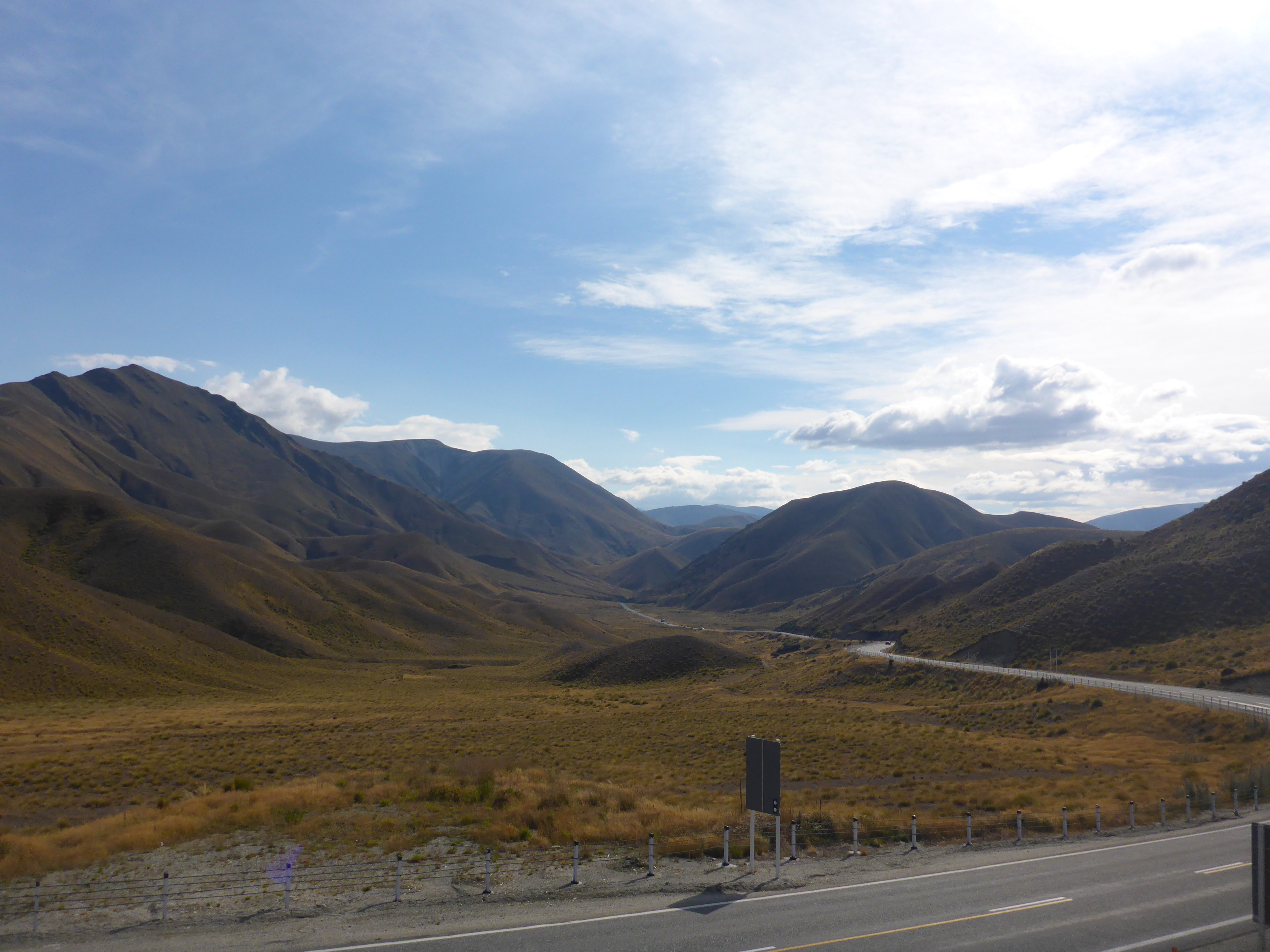
Alexandra – get there early before it closesScenery en route to Omarama
Omarama
Omarama is a small town with a population of only a few hundred serving the farming community and tourism at the head of the Waitaki Valley en route from Christchurch to Queenstown. Its attractions, as ever, are the great outdoors with lovely mountain scenery, lakes and the river system which makes this a big place for trout fishing. It is also a place known f0r its spas with hot tubs supplied from pure mountain water!
Apart from hunting and fishing, cycling, trecking, 4X4 driving et al, the town is also a popular place for gliders and scenic flights being so close as it is to Aoraki Mount Cook but I think many of the visitors travelling hither and thither from around central Otago, Wanaka, Queenstown and all points north east and south,use Omarama, as we did, as a convenient stopping point before Mt Cook.
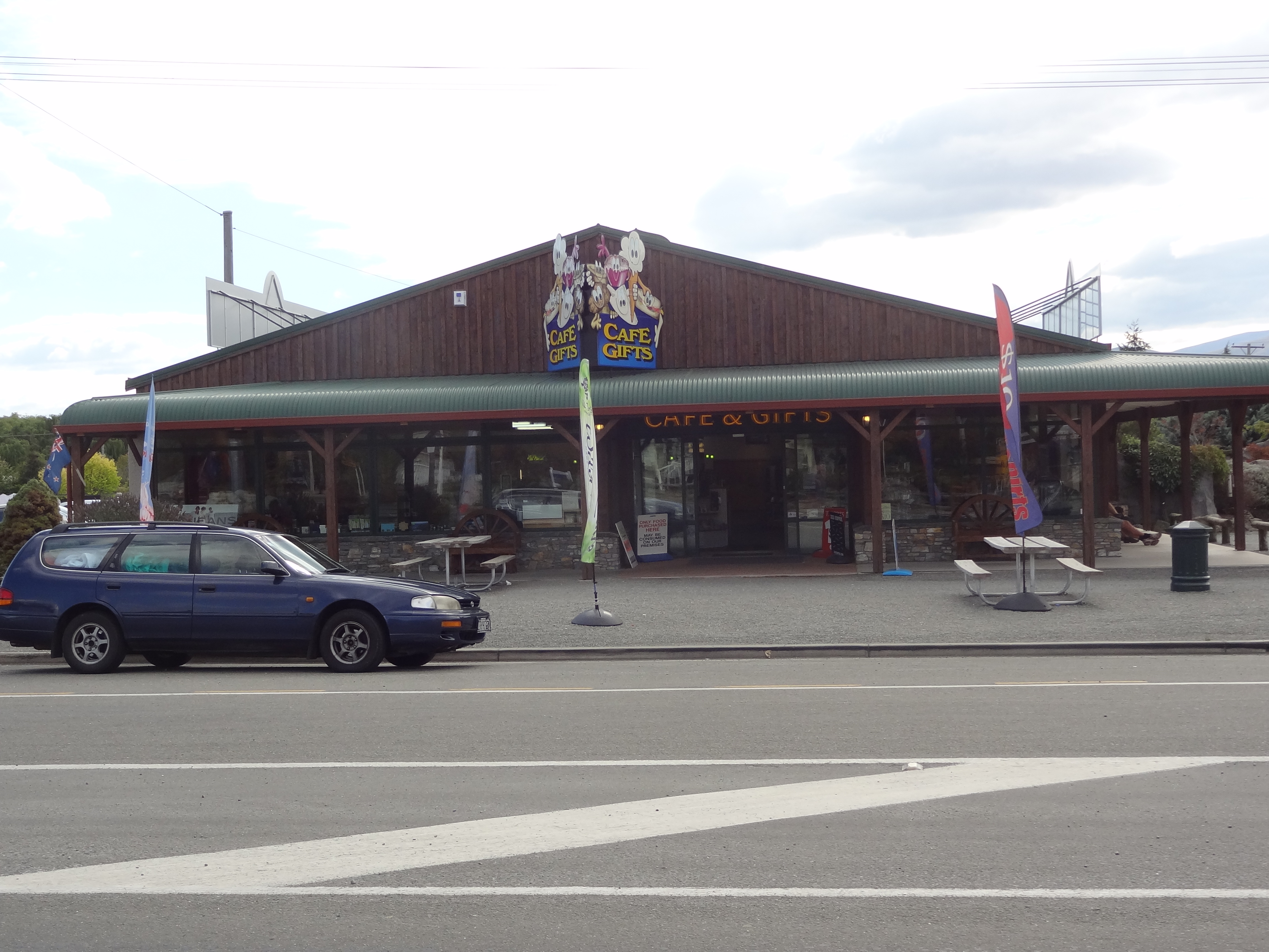
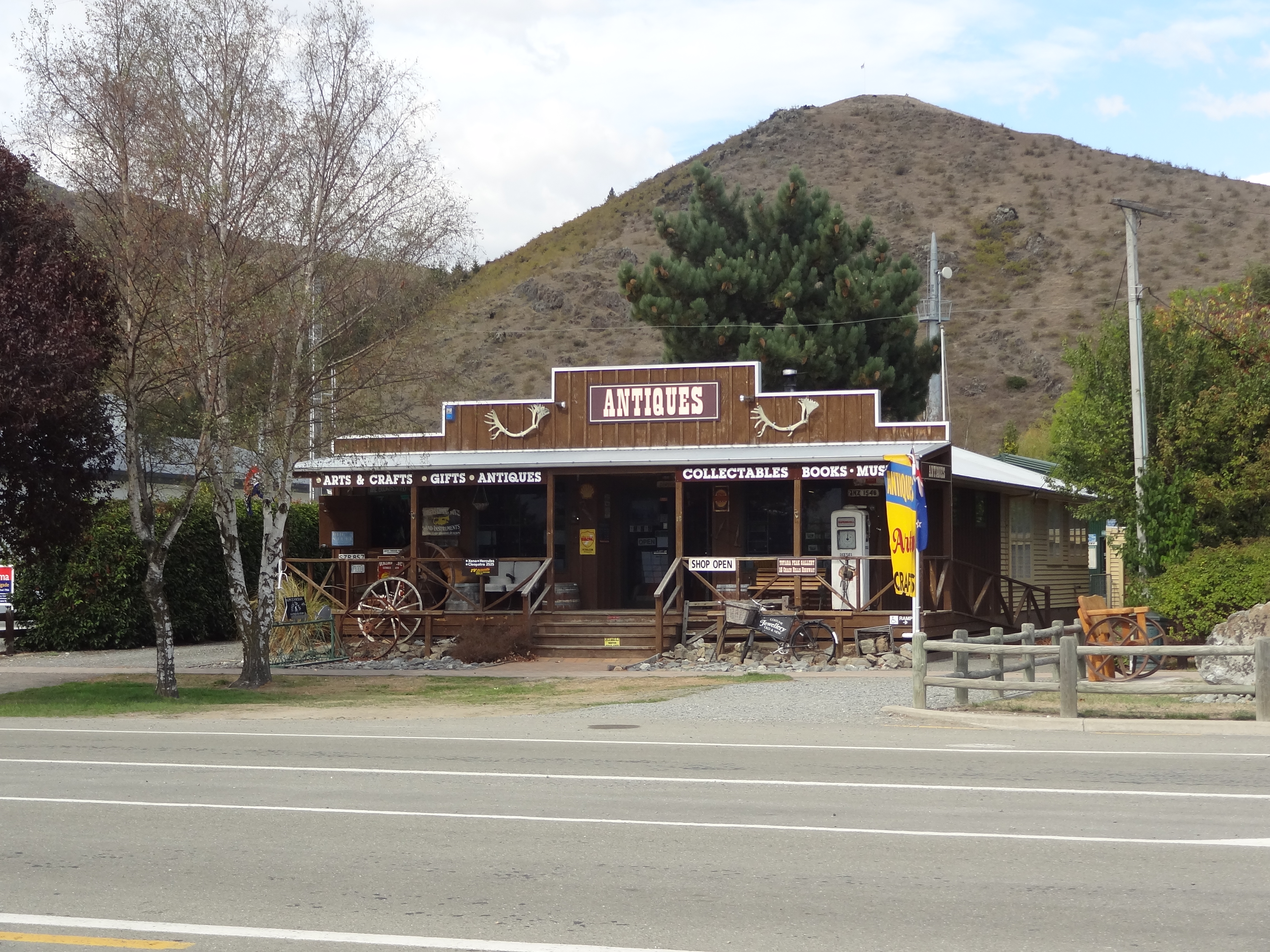
Now this is a small place with a population of only a few hundred souls. Apart from a couple of hotels and motels (we stayed at the the Asure Sierra which was very acceptable) there is a
Four Square Supermarket, a gas station, 2 or 3 shops selling outdoor clothing, merino and possum products, a couple of eateries and an antiques/junk shop!
We arrived around lunchtime and had a very pleasant lunch at the Rinkly Ram restaurant which isn’t just a restaurant and wine bar but a centre for all things lamb merino and other products and featuring a daily sheep shearing exhibition in addition to its retail opportunities. Sadly we missed the sheep shearing.
After a leisurely tour of the few shops and a short walk along the river, rain began to fall and we took shelter with a few beers at the Omarama Hotel until retiring to our motel for an early night. Next morning we would drive on to Aoraki Mount Cook.
Merino Country Cafe and GiftsOmarama Antiques & Collectables
Dunedin, or at least the area, is really deserving of its own post but lack of time meant that we didn’t really do justice to this place and so it’s one place in New Zealand we would like to return to.
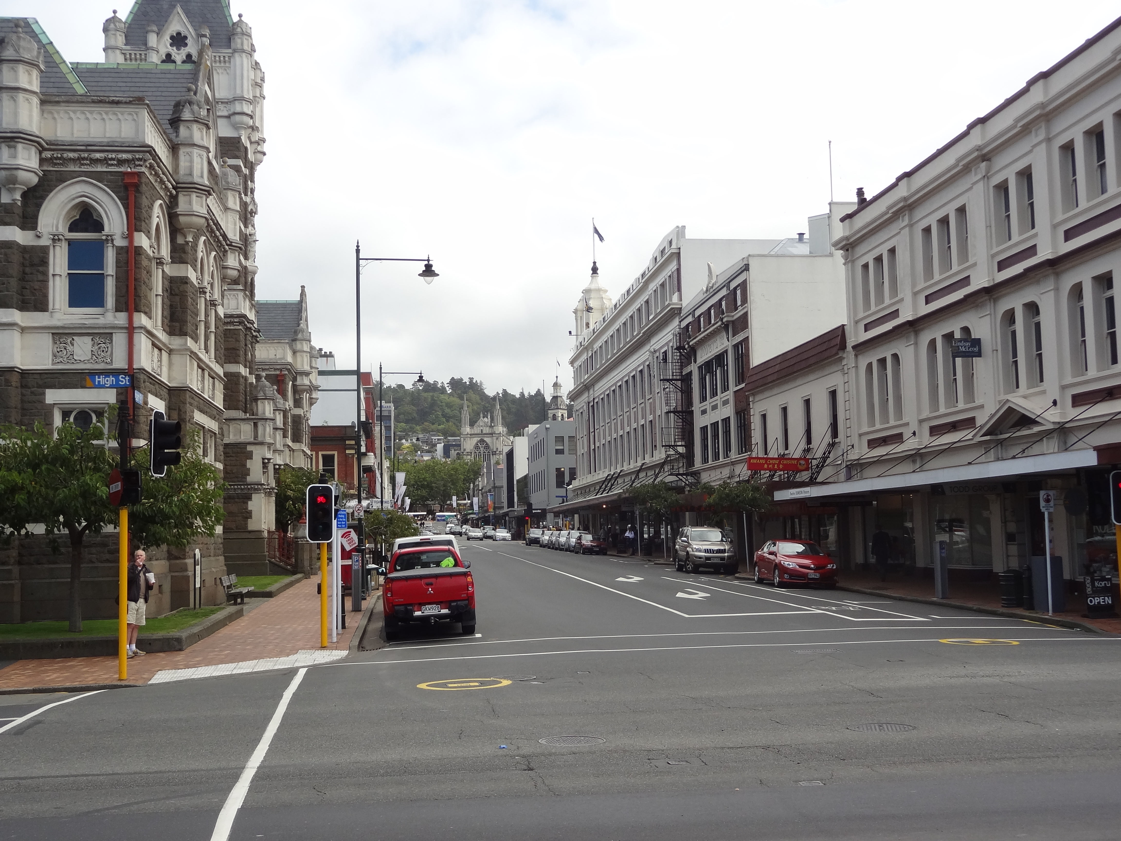
This is a University city known as the Edinburgh of New Zealand with Edwardian and Victorian architecture and a young person vibe to it – i.e. lots of students around ! Whilst it is Otago’s commercial hub and its second largest city, it is quite small and so we didn’t plan to spend too long here; the attraction as always in New Zealand, is not in the city itself but its environs.
Dunedin Municipal Buildings with St Pauls Cathedral left
Dunedin is the gateway to the Otago Peninsular a rugged finger of land with steep hills left behind by a volcano.The place is famed for its beauty and wildlife and especially its bird life, notably yellow eyed penguins and Royal Albatross – there is a Royal Albatross Centre Close to Larnach Castle which is the only real man made attraction on the peninsula and the only castle in Australasia. The peninsula is an area often overlooked by tourists because it’s rather out of the way although it’s fair to say that as it’s quite small, a driving tour of most of it can be done in only a few hours.
We had left Kaka Point on 11th March on a sunny morning, quite sad to be leaving such a lovely place so soon. We had tried to extend our stay but unfortunately the unit was booked up for the next few days.
The drive North from the Catlins was as lovely as ever and we arrived in the city centre around noon. We spent three hours seeing as many of the ” must sees” as possible ( there really are very few ) including an hour or so in the definite must see Museum of Settlers which was very interesting. By 2.30 we were more than a little peckish and grabbed a quick Chinese lunch which was our first Chinese meal in New Zealand – pretty good it was too.
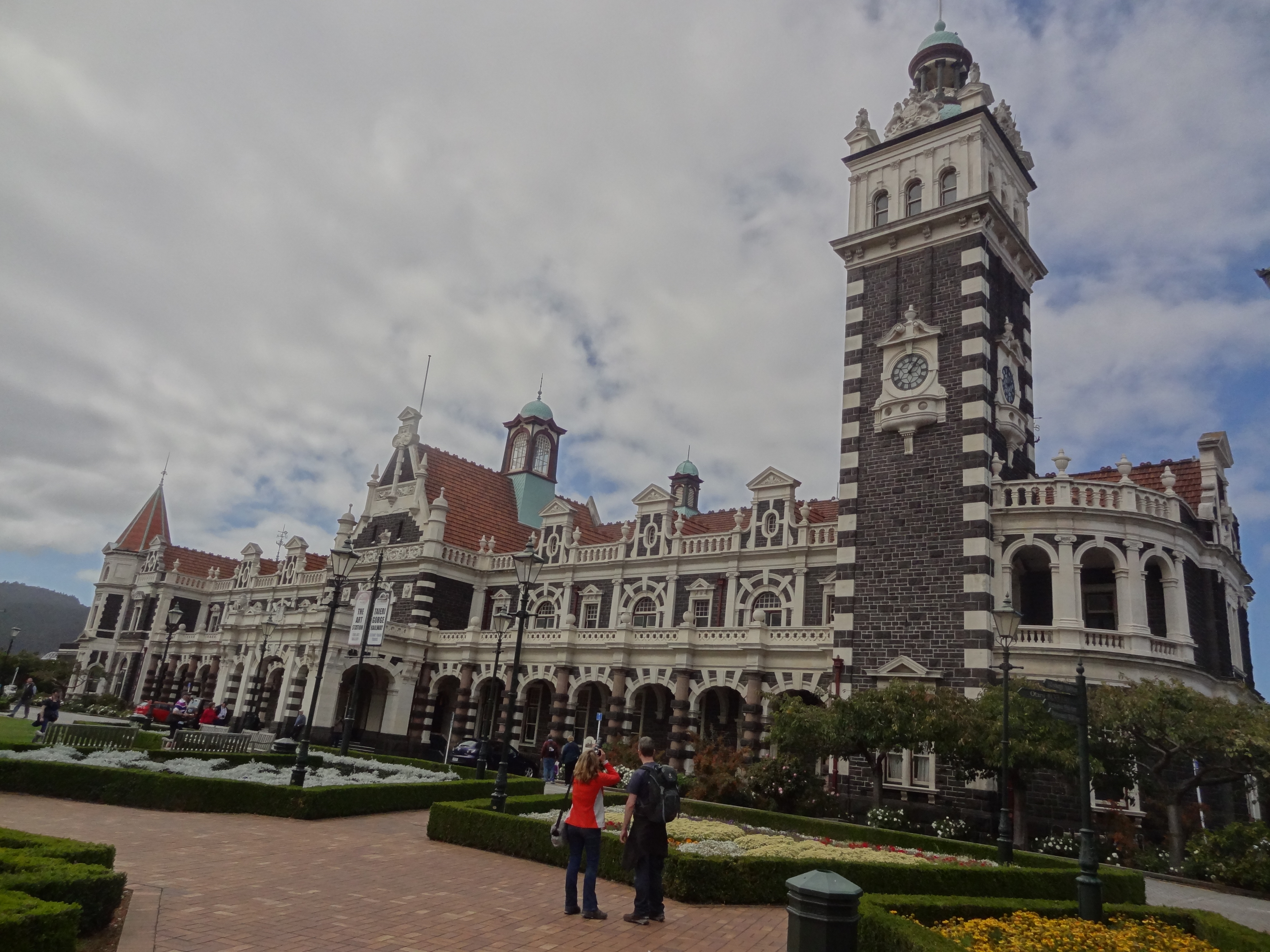
Dunedin Street Scene – a typical city centre with nice bits and scruffy bits but also a few fine old buildingsDunedin Railway Station – probably the most memorable of the city centre buildingsDunedin Station
Dunedin Municipal Buildings with St Pauls Cathedral left
St Pauls Cathedral
After our late lunch, we decided we should book into our accommodation before driving to the peninsula. We had originally booked 2 nights in a Motel near the city centre but had re-thought this, cancelled the booking and booked a suburban house instead. I figured the house would be nicer accommodation (it was a Victorian villa) and handier for the Peninsula and for a quick getaway from the city when we left on the next leg of the journey.
This change of plan turned out to be a poor decision by me as the “substantial and well fitted holiday home” described in the marketing blurb ob-line turned out to be a backpackers kip miles north of the city. I had totally mis-read the map !
We got to the house about 4.30pm and what a find it was – a beautiful timber building painted pastel blue, albeit in need of repainting, with verandas and balconies and a very pretty english garden complete with sleepout. The owner had left the keys under the mat as promised and so we showed ourselves around. She, the owner, had mentioned in an email that the house had just been sold and we could see why someone would want to buy the place – but we could also see why someone would want to sell it! The place could be absolutely stunning and must have been in years gone by but now it needed a total renovation with probably dodgy wiring, ancient and backpacker battered furniture, a not terribly clean kitchen, suspect bed linen and an absence of the advertised wifi, it was definitely not for us!
I phoned the owner but with no reply despite a few attempts. After 20 minutes or so of waiting I sent a text explaining why we wouldn’t be staying in the house and eventually a couple of hours later I received a reply which suggested the owner wasn’t too surprised at our decision!
The only saving grace in this episode was that the owner had asked me to pay by cash on the day and so we hadn’t lost out in cash terms. However, we had lost a few hours and by now it had turned 5pm and we had nowhere to sleep! A quick surf of the net told us there was little accommodation available in town that night and nothing which would give us the two consecutive nights we needed.
We ended up booking the very same motel we had first cancelled – but only for one night.Our decision was to take the one night only and do a quick tour of the peninsula in the morning and then set off for Mt Cook, the next highlight of our journey. This left us with a night to fill and so we reviewed our journey plan and decided to take a more scenic and circuitous route via Central Otago rather than the quicker more direct route via Omarou as per our original plan.
After a long and messy drive back through Duned city centre we eventually landed at the Beach Lodge Motel. Not the prettiest motel we had seen but it was clean and everything worked and it was very handy for the Peninsula. We spent the evening in the motel dining on cheese and wine and caught up with some paperwork and blogging.
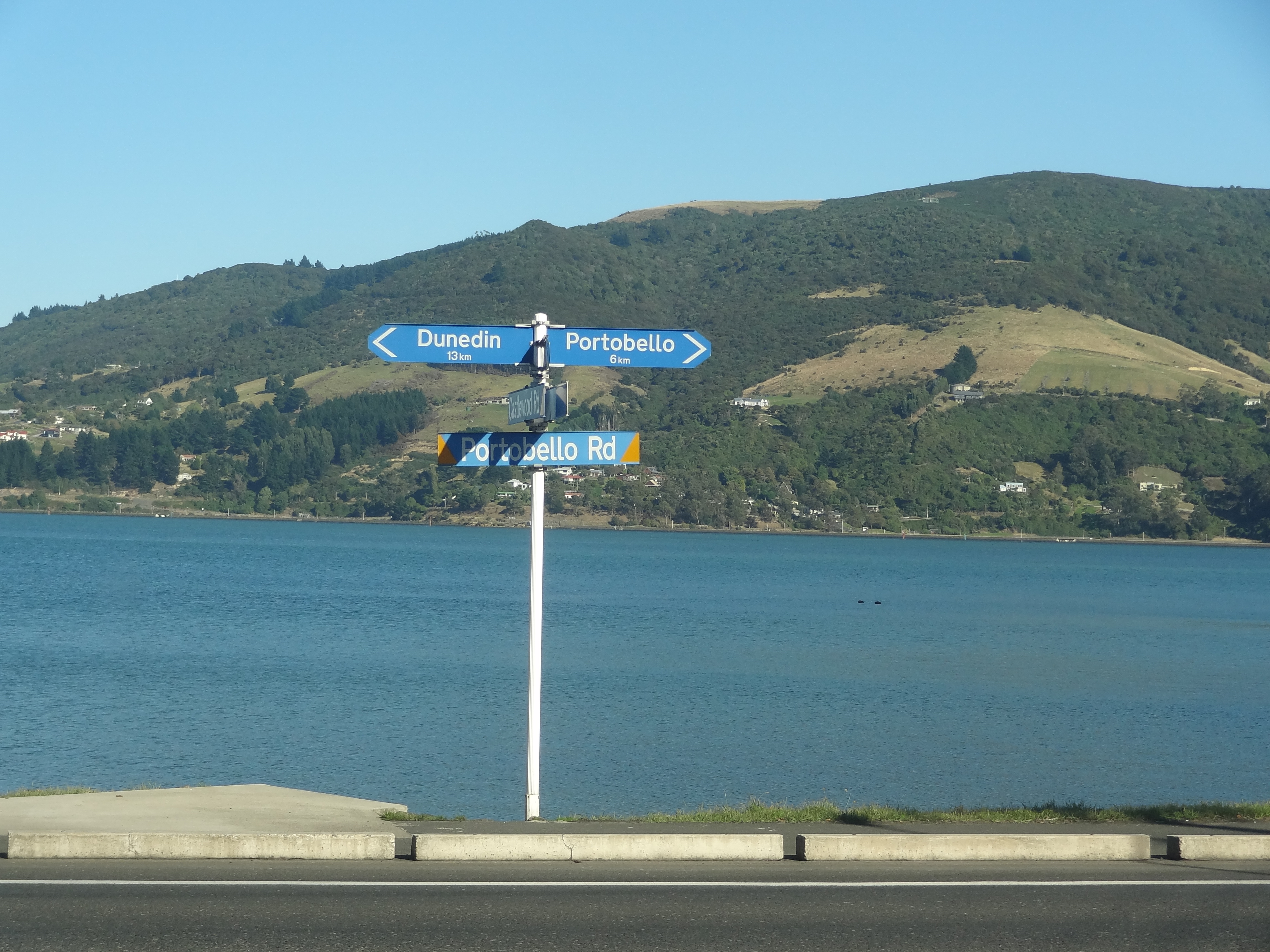
An early start ( for us) the next day saw us onto the Otago Peninsula very quickly. The scenery is truly magnificent. Its a very hilly place and the hills are seriously steep with hairy horseshoe bends one after the other – it does mean that the driver is very much focussed on the road rather than on the scenery but even so it was very enjoyable.
Otago Peninsula near PortabelloOtago Peninsular – stunning countrysideOtago PeninsulaBoat House near Portobello
We decided to give Larnach Castle and the Albatross colony a miss due to lack of time but we saw enough of the place to want us to revisit and stay a few nights to do some walking if ever we get chance.
We left Otago Peninsula not long after noon for our journey to Mt Cook.
Our next port of call was Kaka Point, an out of the way small town on the South East coast and we would follow the Southern Scenic Route to get there. We left Te Anau around 8am on 9th March for the drive South to Invercargill, New Zealand’s most southerly city. Te Anau to Invercargill is around 160 KMs. With an early start and virtually no traffic on the road, we made good time. The weather was fine and the scenery as pleasant as ever with a constantly changing landscape; through forest one minute then hill farms, sheep and cattle and occasionally deer or goats and eventually long straight roads through wide glacial valleys. There are very few settlements on this route but one that we were looking forward to was Tuatapere, Sausage Capital of New Zealand. We hadn’t had a fry-up since we stayed at Shady Rest in Takaka several weeks ago and so the thought of some gourmet sausages was quite appealing. We were quite excited as we came into Tuatepere but sadly our hopes were dashed and our hearts sank when we found the shop closed and no sign of opening hours. Gutted!
Sadly closed when we visited…
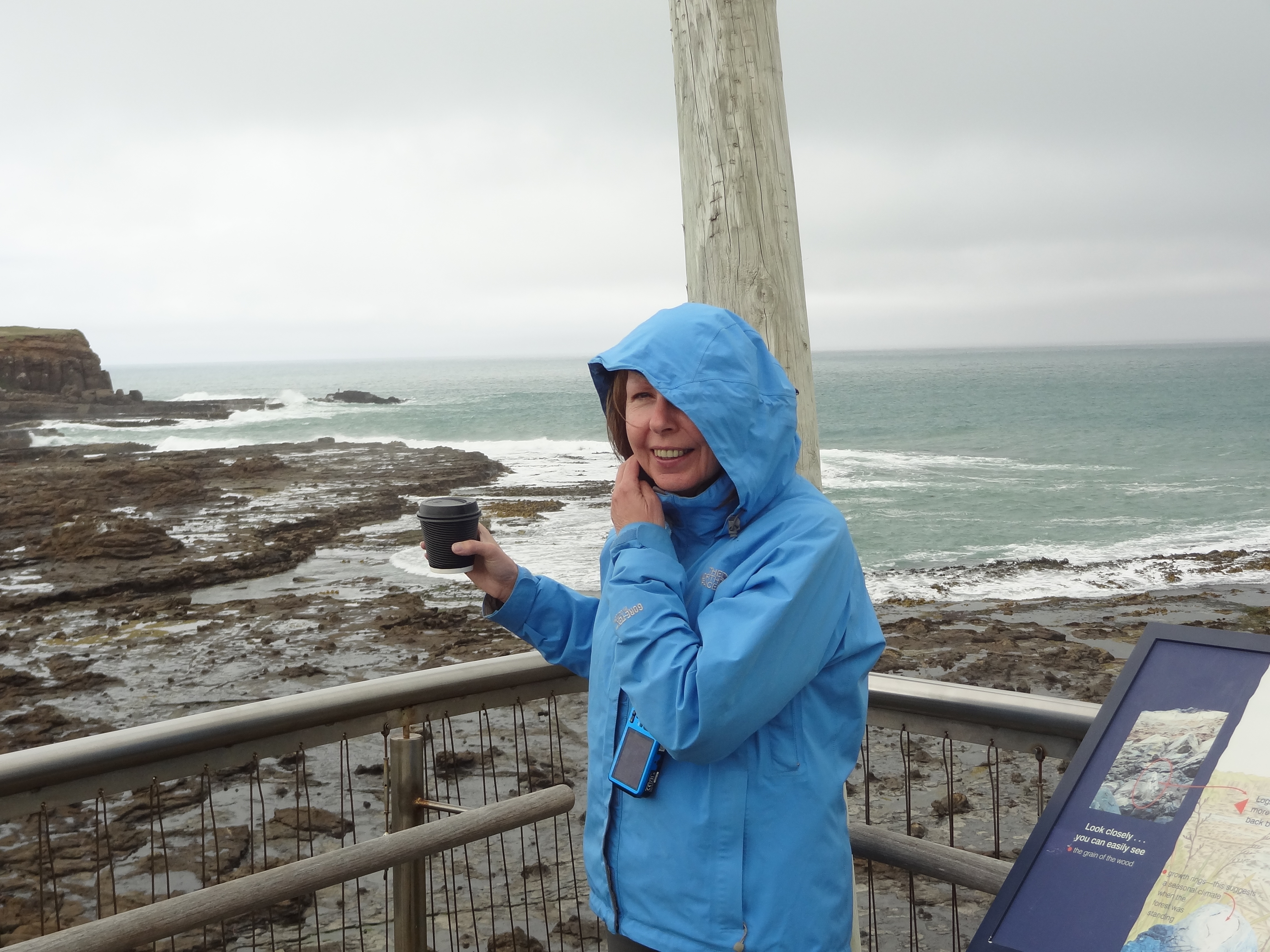
We carried on to Invercargill stopping only for fuel. We had been advised that there would be nothing to keep us in what was a fairly large but uninteresting town and so we went straight through getting to the Catlins around 1pm and ready for some lunch. The Catlins is a largely agricultural area with lovely hilly countryside and lots of rivers. There were a number of small settlements on our route to Kaka Point but most of these settlements comprised a small cluster of houses and nothing else – we couldn’t find a cafe, restaurant or shop anywhere and before we knew it we had arrived at Curio Bay famous for it’s 18 million year old petrified forest. This was one of the places on our “to visit” list. The weather was changing by now and at this point rain had started to fall but we decided to look at the petrified forest rather than make the journey back at some other time. Sadly conditions were not good for photography and also the tide wasn’t fully out which meant that we couldn’t see the old logs at their best – nor did any penguins show up!
Curio Bay – spot the tree….Not the best weather for photography….
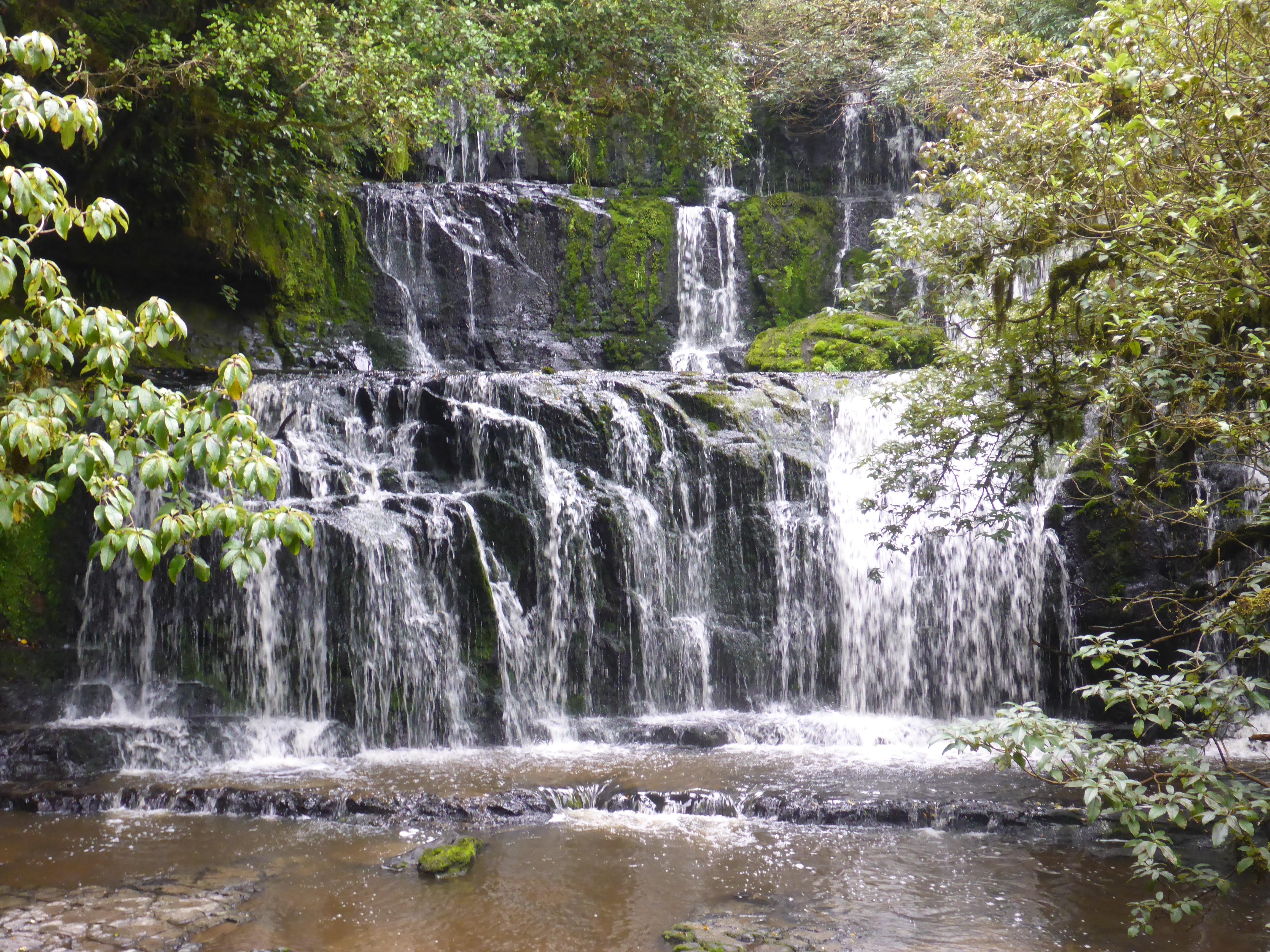
We got back in the car and pressed on. An hour later we still hadn’t found an eatery but found ourselves passing a sign for Purakaunui Falls, another of our “must see” places in the Catlins. The rain had stopped and despite our hunger pains we decided to take a look. Sure enough it’s a lovely spot but not really something to go out of your way for. We were glad to be able to tick this off as done rather than drive back later. After waiting for several minutes whilst a group of Japanese tourists rudely hogged the viewing area and view by posing, re-posing and re-posing, we eventually managed to get a snap.
Purakaunui Falls on the Purakaunui River
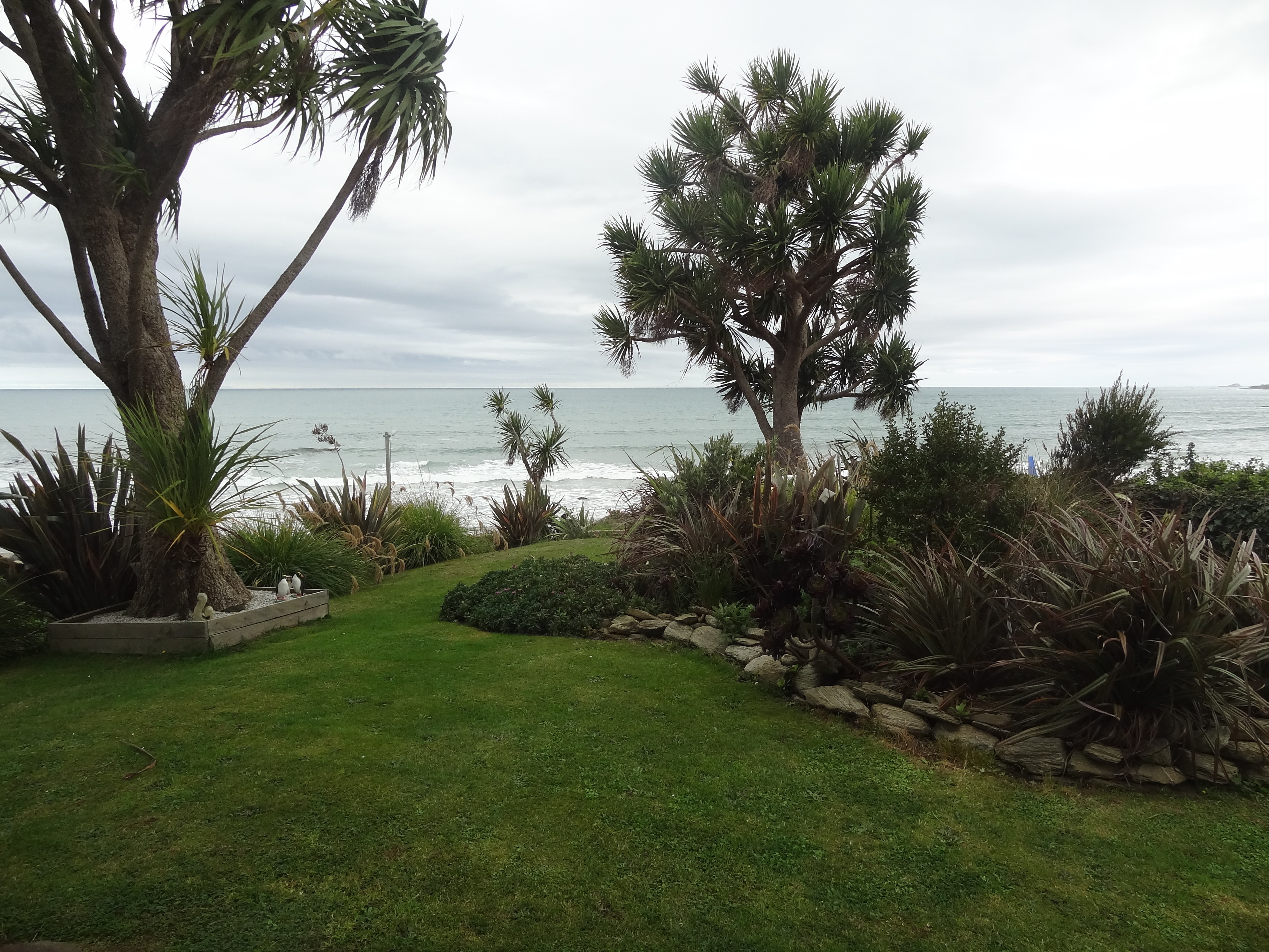
By 2pm we were within a short distance of our destination, Mike and Jenny’s Unit at Kaka Point ahead of schedule, needing an ATM and lunch – we paid a visit to Balclutha where we enjoyed our best curry so far at the Raj Restaurant. Balclutha is the largest town in the Catlins and has nothing out of the ordinary but it is one of the main trout fishing centres in South Island with a number of famous fishing rivers in the area. Unfortunately on this occasion we didn’t have time to cast a fly as we had to get on our way. Replete with our Jalfrezi and Madras, we headed for Kaka Point and Mike and Jenny’s Unit – which in this case was a one bedroom apartment underneath their home. The unit was a tad old fashioned in its furnishings but spotless and very comfortable and Jenny gave us a very warm welcome. I had noticed her vegetable garden and greenhouse as we parked the car at the front of the house but once we got to the back of the house, we were gob smacked by the view – absolutely stunning. As we unloaded the car, Jenny asked if we liked fish. Having confirmed in the affirmative, she offered to cook an evening meal for us which was delivered to us late in the evening. An excellent meal with fish they had caught that morning with potatoes and salad including edible flowers – everything freshly picked from their garden. One of the best meals we had on this trip to date. At the end of our first evening we were already regretting the fact that we hadn’t booked longer than two nights.
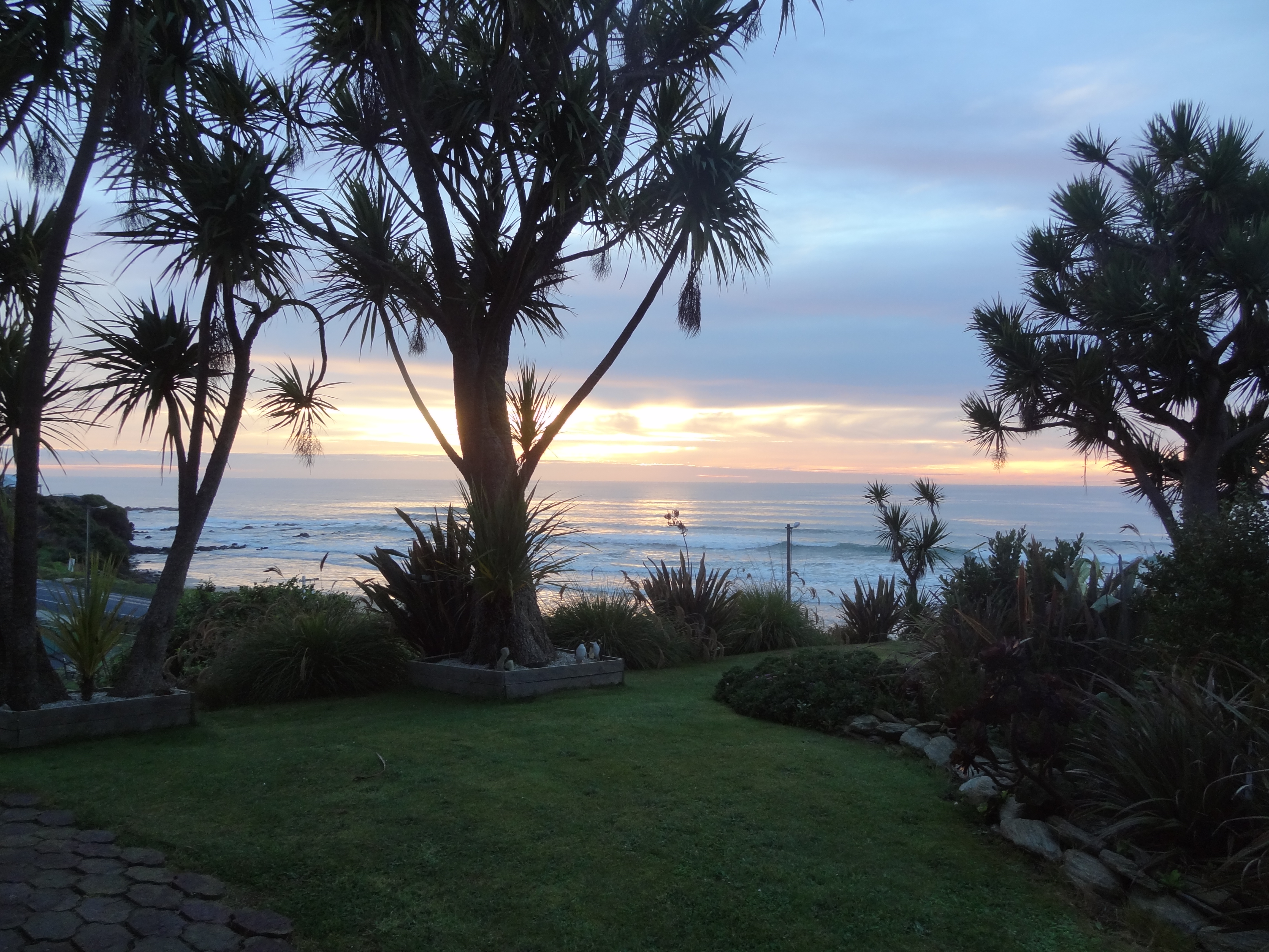
Room with a view…not a perfect day but still a stunning view.and another in the early evening
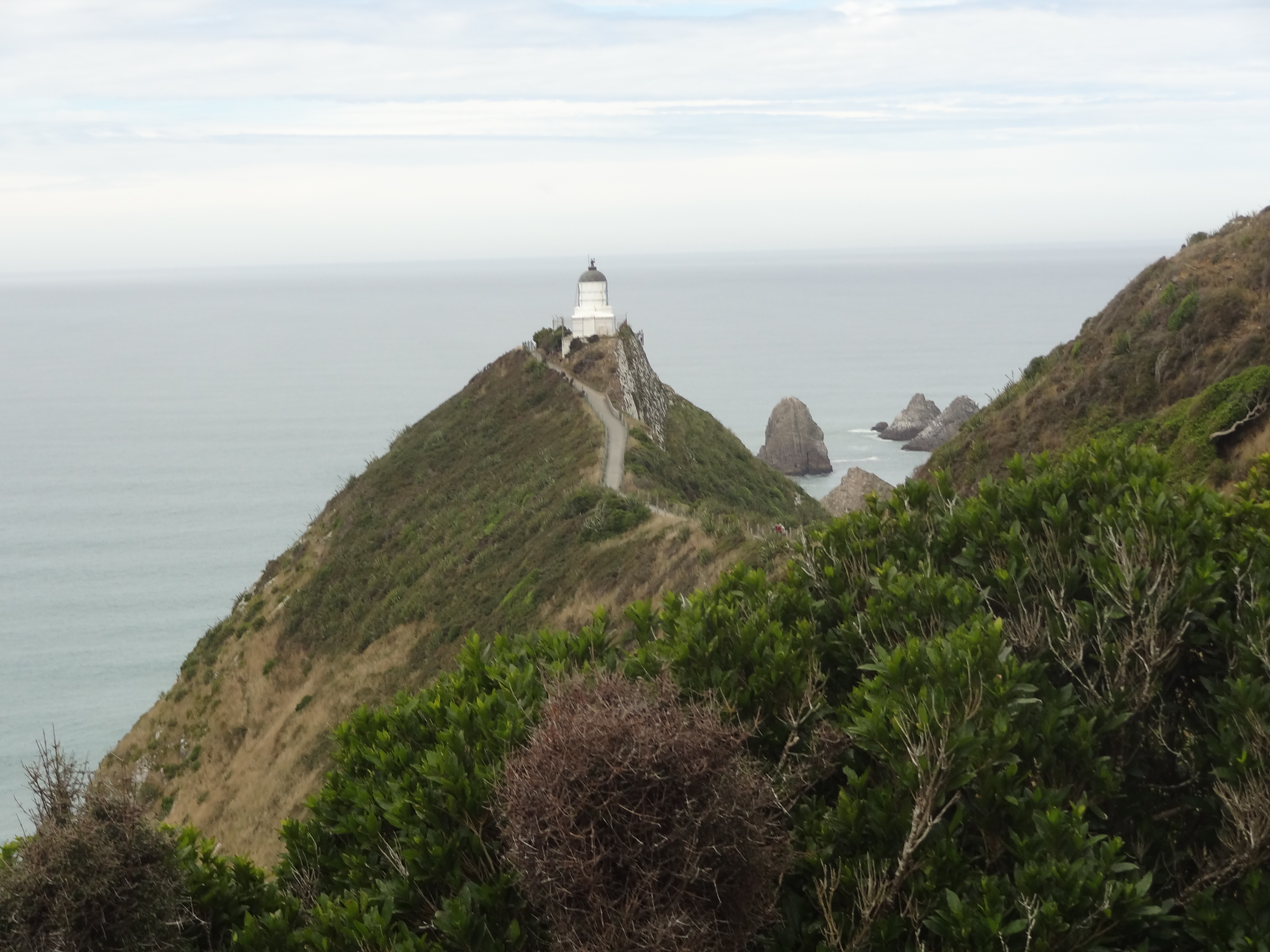
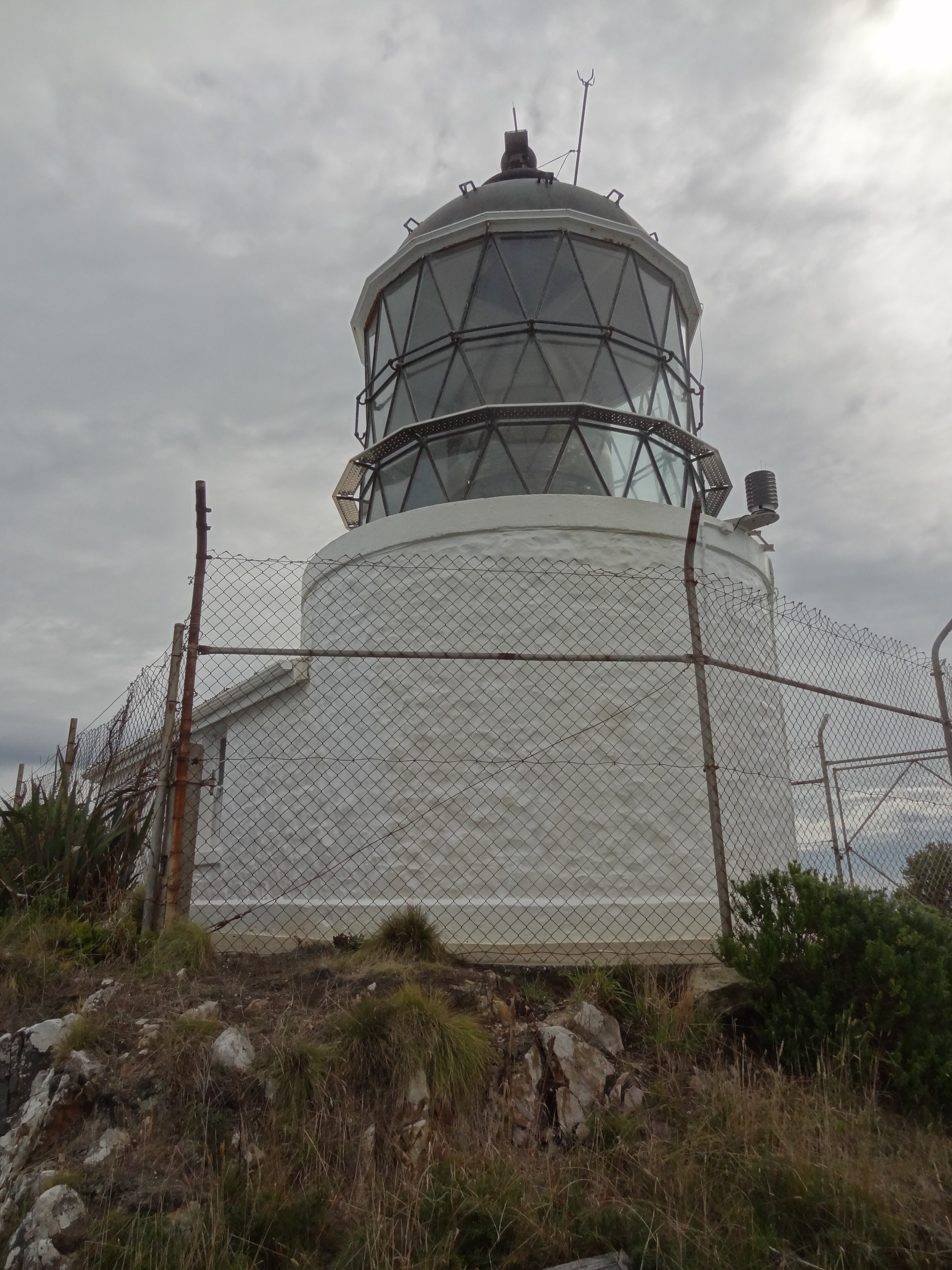
Essentially we had only one full day at Kaka Point and so it was as well that we had managed to see Curio Bay and the waterfall the previous day. The other must see was Nugget Point Lighthouse where penguins can be seen in the early evening as they return from the sea to their nests as night falls. We had already researched this beforehand and decided that we would not drive the dirt track to the lighthouse as a number of reviewers on-line had described this as dangerous. We had decided to walk even though this would mean that we would not get to see the penguins, hey ho…
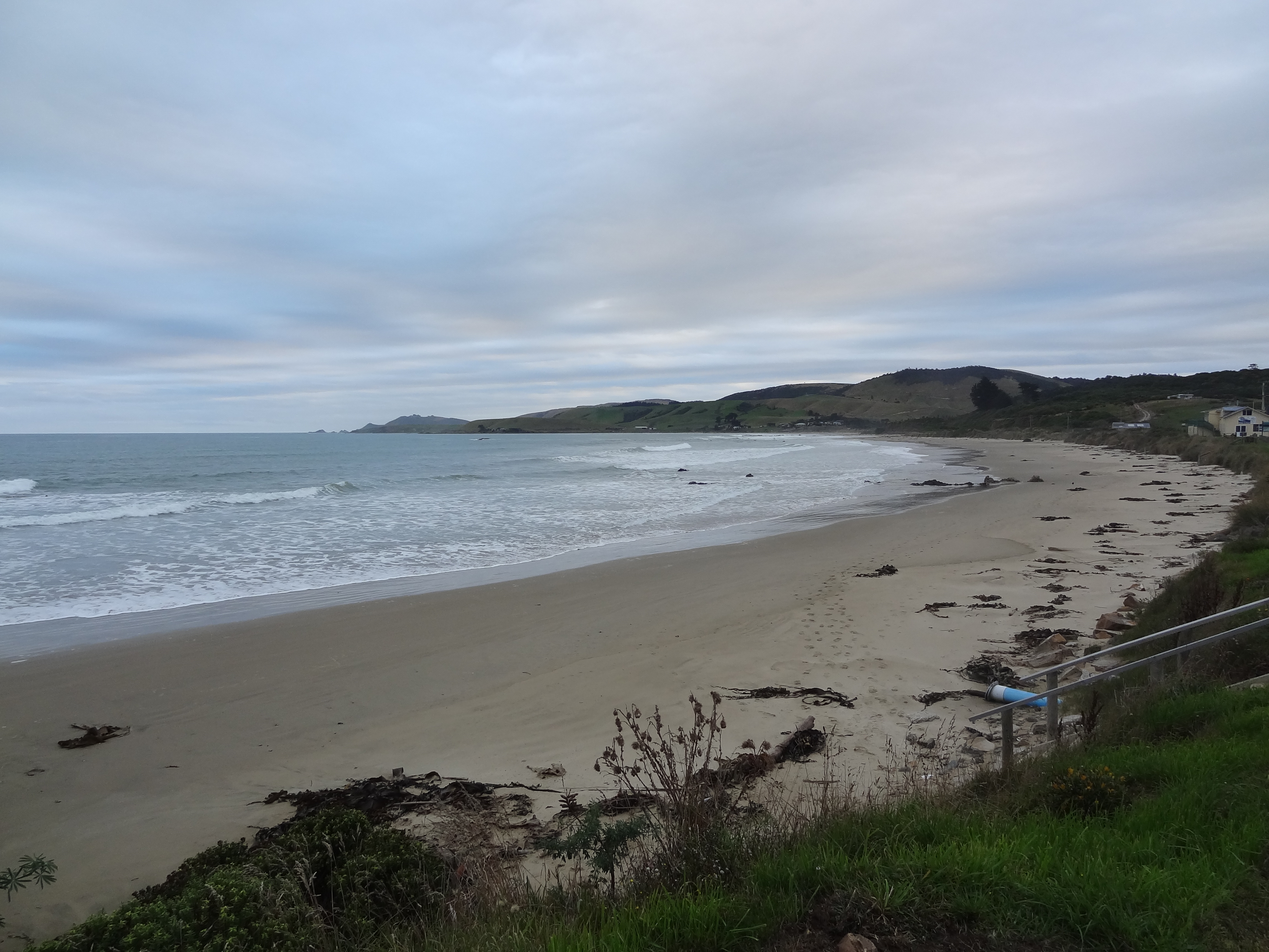
Kaka Bay Beach – view from below Mike and Jenny’s place
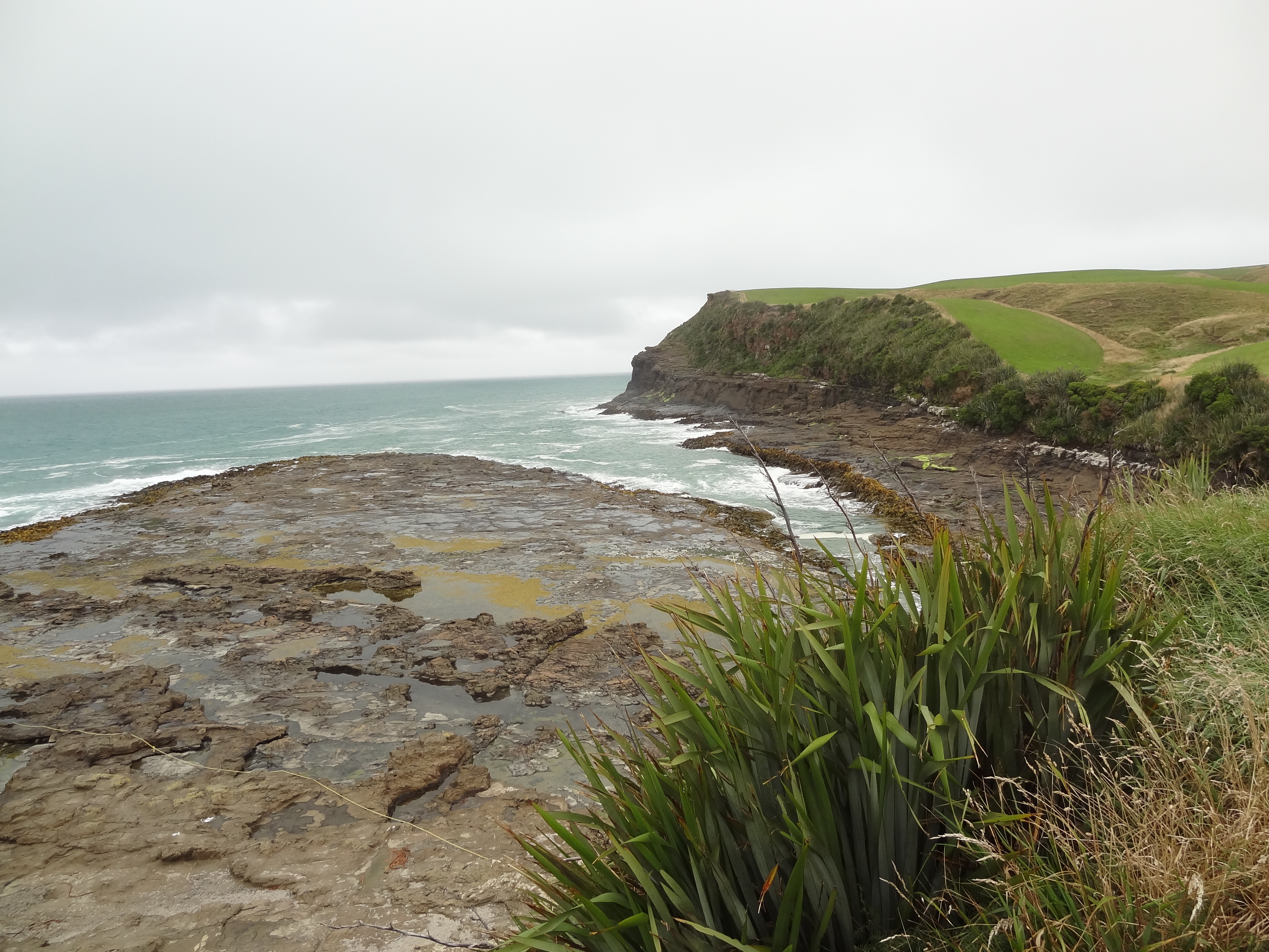
So most of our one day at Kaka Point was spent walking to and from Nugget Point, a total of 16KM. We packed a picnic and were lucky to have a nice day for our walk although it did threaten to rain on and off. We walked almost the entire walk on the beach but in some places where it’s necessary to get up onto the road to continue. On the first of the road stretches we spotted a car that had gone off the road and over a rocky edge onto the beach below. On the next stretch a little further on, a car had also gone off the road and rolled down the beach turning over onto its roof; this had happened within minutes of us reaching the scene and the Japanese family, seemingly all unscathed but very much in shock, were struggling to get their belongings out of the overturned car. The police had been called and a local was looking after them so we continued on our walk thinking we had made the right decision to walk rather than drive.
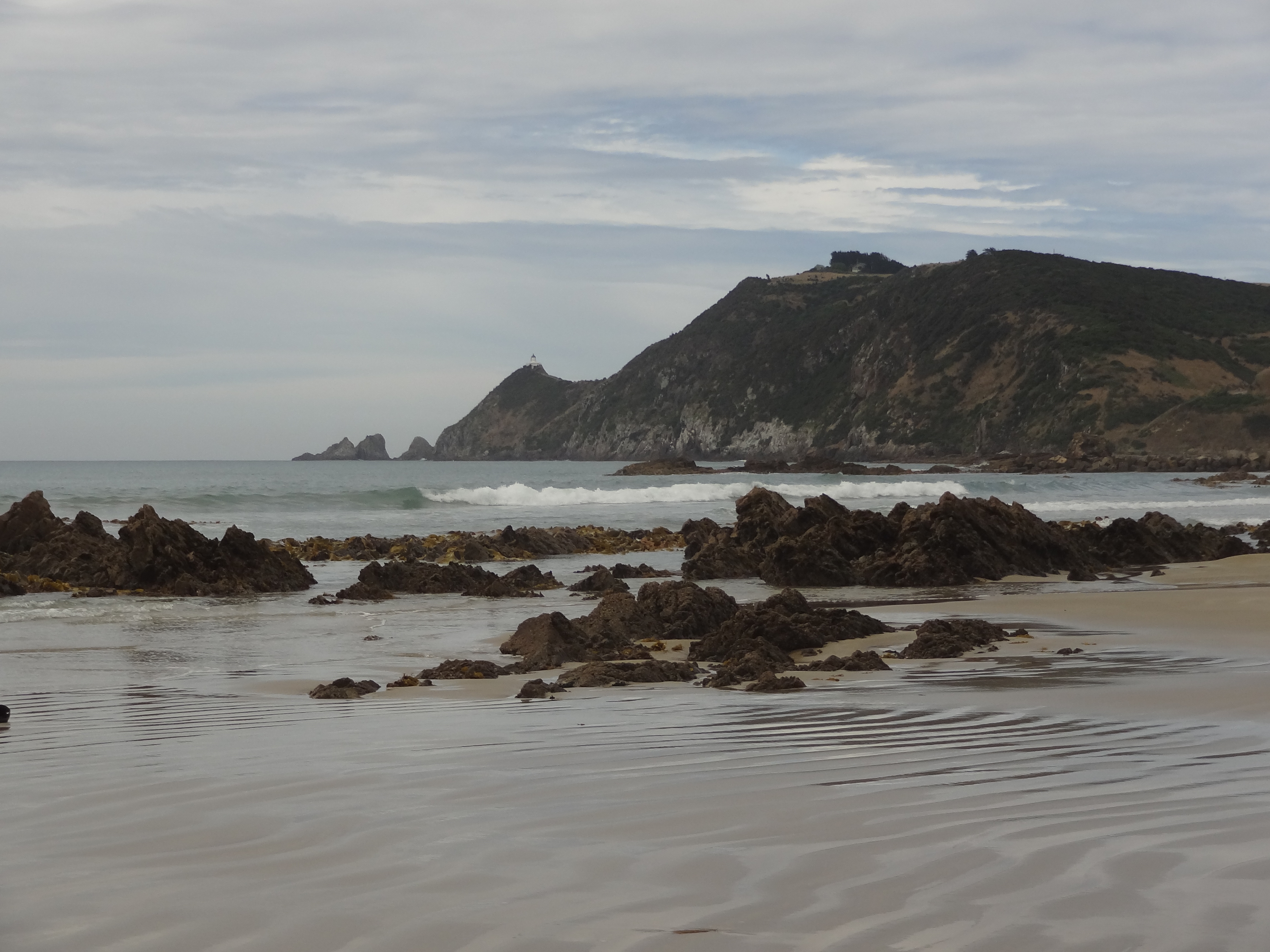
A long walk to Nugget Point Lighthouse
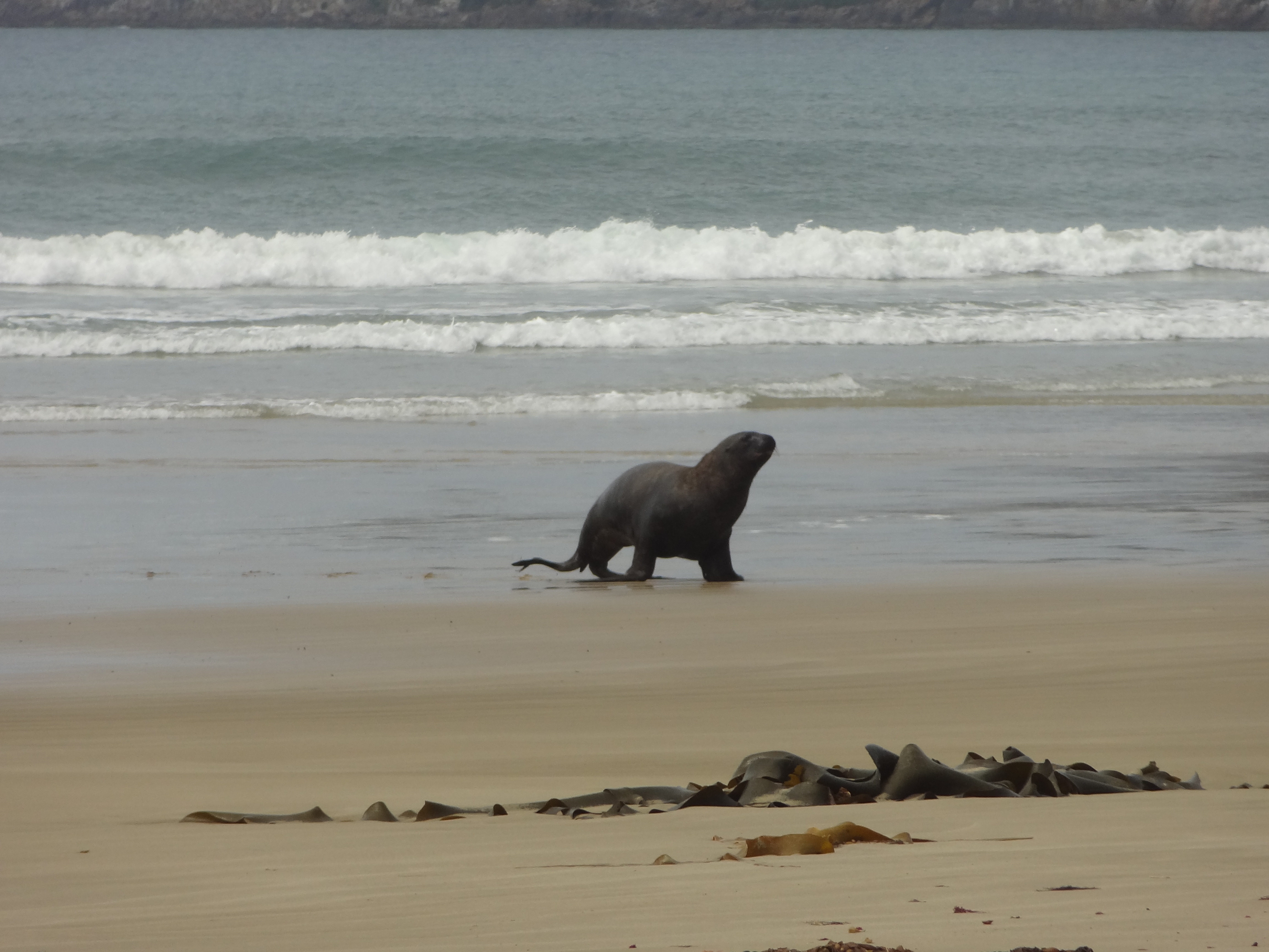
Our walk otherwise was without incident and at different spots we were lucky to see a couple of sea lions that came out of the sea on to the beach as we were walking along – amazing. There is also lots of bird life (mostly unidentified by us) and we saw plenty of fur seals on the rocks far below the lighthouse but alas no penguins…
Sea lion on Kaka Bay BeachNearly there….Nice place for a picnic
We lunched at the lighthouse and walked back to find a vehicle recovery contractor removing one of the wrecked cars from the beach. He had already removed the first one. Seems he is regularly called out. He told us that the Japanese family we had spoken to earlier were already on a bus to Queenstown to continue their holiday! We enjoyed a couple of beers at the pub/restaurant next to the the Unit and retired, knackered, for an early night mindful that we were back on the road the following morning. Next stop Dunedin.
Sea views from the very convenient hostelry next door to Mike and Jenny’s